Puy de Chambourguet and Puy de Champgourdeix

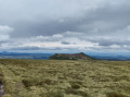
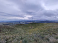
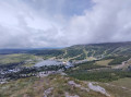
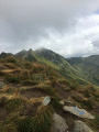
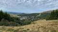
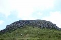
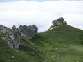
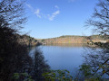
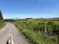
Explore the area around the Super-Besse resort by visiting the Puys de Chambourguet and Champgourdeix. You’ll discover two volcanic peaks with completely different appearances. A leisurely, family-friendly hike along the paths and tracks around the resort.

Details

12622996
Creation:
Last update:
Last review:
  • Walking
    Activity: Walking
  • ↔
    Distance: 5.11 mi
  • ◔
    Average duration: 3h 15 
  • ▲
    Difficulty: Moderate

  • ⚐
    Back to start: No
  • ↗
    Ascent: + 1,047 ft
  • ↘
    Descent: - 1,024 ft

  • ▲
    Highest point: 5,141 ft
  • ▼
    Lowest point: 4,275 ft

Photos

Description of the walk

Park in the designated spaces in the centre of the resort, on Avenue du Sancy.

(S/E) Follow the avenue south-eastwards. Pass the Route du Lac on your right, then Rue Marcel Gauthier on your left, and take the next left (Montée de Chaudefour).

(1) Turn left onto Rue Côte de Durbise. At the junction just after this, continue almost straight ahead to cross the holiday village and join the Piste de Bois Joli.

(2) Turn left and follow the track uphill to the next junction, then turn right onto the Piste de la Bruyère. After about a hundred metres, turn right towards the Puy de Chambourguet.

(3) At the crossroads, head straight ahead to reach the summit.

(4) Walk round the summit to admire the puy and the surrounding landscape, then head back the way you came.

(3) Turn right. Further on, you’ll come out onto a wider path; follow this for about a hundred metres until you reach a junction that’s not very clearly marked on the ground.

(5) Turn left. Keep heading west-north-west until you come to a more clearly marked path. Then turn right, heading north, and you’ll come out onto the path coming from the Chaudefour valley.

(6) Turn right to reach the Puy de Champgourdeix.

(7) Enjoy the view over the Chaudefour Valley, complete a short circular route, then retrace your steps.

(6) Turn left onto the outbound route. Leave the uphill track on your left and continue straight on until you reach the Piste de Bois Joli.

(8) Follow this track, taking a wide bend to the right. Once you reach the edge of the woodland, veer left to skirt it and continue down the track.

(2) Turn right to cross back through the holiday village, then return to the start on Avenue du Sancy (S/E).


Waypoints

  1. S : mi 0 - alt. 4,275 ft - Car park on Avenue du Sancy. Near the - Couze Pavin (rivière) à finaliser
  2. 1 : mi 0.22 - alt. 4,400 ft - Rue Côte de Durbise
  3. 2 : mi 0.49 - alt. 4,567 ft - Bois Joli track, on the left
  4. 3 : mi 0.81 - alt. 4,711 ft - Puy de Chambourguet junction
  5. 4 : mi 1.19 - alt. 4,957 ft - Puy du Chambourguet
  6. 5 : mi 1.89 - alt. 4,905 ft - Path on the left
  7. 6 : mi 2.61 - alt. 5,118 ft - Chaudefour Valley Trail
  8. 7 : mi 3.04 - alt. 5,118 ft - Puy de Champgourdeix
  9. 8 : mi 3.72 - alt. 4,980 ft - Bois Joli Trail
  10. E : mi 5.11 - alt. 4,298 ft - Car park on Avenue du Sancy

Notes

The walk may prove challenging during the climb over the rocks – a safety rope is provided – to reach the Puy de Chambourguet (over a short distance).
There is no water along the route; it can be very windy at the summit of the Puy de Chambourguet.

REGULATIONS: This route passes through the Chaudefour Valley Nature Reserve. Dogs are not permitted on certain sections of this route – they are allowed on a lead only on the signpostedGR®® 30 andGR®® 4 trails. Mountain biking, wild plant picking and camping are prohibited. Please stay on the marked paths. Full details at: ‘Chaudefour Valley Nature Reserve’

This route passes through a protected area, which may be subject to special regulations:

Always be cautious and plan ahead when you're outdoors. Visorando and the author of this route cannot be held responsible for any accidents occurring on this route.

The GR® and PR® markings are the intellectual property of the Fédération Française de Randonnée Pédestre.

Reviews and comments

3.3 / 5
Based on 6 reviews

Reliability of the description
3.2 / 5
Ease of following the route
2.8 / 5
Route interest
3.8 / 5
Stéphane G72
Stéphane G72

Overall rating : 3.7 / 5

Date of your route : Jul 04, 2026
Reliability of the description : ★★★★☆ Good
Ease of following the route : ★★★☆☆ Average
Route interest : ★★★★☆ Good
Very busy route : Yes

We absolutely loved this route. The only downside is the lack of signage in some places indicating whether the route is for pedestrians or mountain bikers. We ended up on a section of the mountain bike route (and they made it very clear to us!!). Conversely, on sections of the route marked ‘pedestrians only’, we were surprised by a group of mountain bikers! A word of advice: be careful!

Machine-translated

tacfox
tacfox

Overall rating : 2 / 5

Date of your route : Jul 09, 2025
Reliability of the description : ★★☆☆☆ Disappointing
Ease of following the route : ★★☆☆☆ Disappointing
Route interest : ★★☆☆☆ Disappointing
Very busy route : No

Hello, a few concerns about this hike:
- It's OK to cross mountain bike trails sometimes, but there are too many risks of getting in the way, especially with your back to the trails on the way back
- The route can only be followed with GPS equipment, as it goes through grass and you end up trampling a lot of fragile plants
The puys are very pretty, but I don't recommend following this route to see them

Machine-translated

SHAPIE23
SHAPIE23

Overall rating : 2.3 / 5

Date of your route : Nov 14, 2024
Reliability of the description : ★☆☆☆☆ Very disappointing
Ease of following the route : ★☆☆☆☆ Very disappointing
Route interest : ★★★★★ Very good
Very busy route : No

Unbelievable but true – I couldn’t make head nor tail of the route descriptions, so I followed the route in real time, and even then I couldn’t make it all the way to Le Puy-Champgourdeix. It was far from warm, and I couldn’t find anyone to guide me. Was I supposed to take a path that doesn’t exist? I don’t know, but in any case, I didn’t find it.
As for water, there is some – if you’ve got a water bottle with a filter.

Machine-translated

Jacques1842
Jacques1842

Overall rating : 4 / 5

Date of your route : Oct 09, 2023
Reliability of the description : ★★★★☆ Good
Ease of following the route : ★★★★☆ Good
Route interest : ★★★★☆ Good
Very busy route : No

I followed the route correctly. I made a few mistakes.
Overall, it went well.

Machine-translated

VIKING5083
VIKING5083

Overall rating : 3.7 / 5

Date of your route : Jul 18, 2023
Reliability of the description : ★★★★☆ Good
Ease of following the route : ★★★☆☆ Average
Route interest : ★★★★☆ Good
Very busy route : Yes

A lovely walk, especially the climb up to the first hilltop, where you can enjoy a magnificent 360° panorama. However, the rest of the route to the second hilltop is less interesting and a bit tedious, as it winds its way through the mountain bike trails. To make up for it, we were able to tuck into some lovely blueberries by the side of the path 😋!

Machine-translated

crismari
crismari

Overall rating : 4 / 5

Date of your route : Feb 07, 2022
Reliability of the description : ★★★★☆ Good
Ease of following the route : ★★★★☆ Good
Route interest : ★★★★☆ Good
Very busy route : No

A clearly marked route with a detailed map; check the estimated time for the walk.

Machine-translated

Other walks in the area

For more walks, use our search engine .

The GPS track and description are the property of this route's author. Please do not copy them without permission.