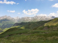
Circular route of Punta del Pacino via Reña Retourno

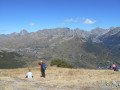
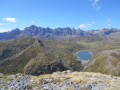
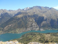
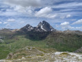
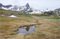
Punta Pacino is a magnificent 360° viewpoint from which you can admire a host of peaks, such as the Pics d’Enfer, Peña Roya, Pico de Anayet, Pic du Midi d’Ossau, Peña Forratata, Lake Lanuza, the village of Sallent de Gallego and many more. Forests and pastures blend together to form a splendid landscape. The route follows a track for a short stretch, but is mostly along paths and trails.

Fiche technique

107239496
Creation:
Last update:
Last review:
  • trace_mode_pedestrian
    Activité: trace_mode_pedestrian
  • ↔
    label_distance: 5.90 mi
  • ◔
    Durée calculée: 4h 20 
  • ▲
    Difficulte: Moyenne

  • ⚐
    Retour point de depart: Oui
  • ↗
    label_elevation_gain: + 1,860 ft
  • ↘
    label_elevation_loss: - 1,847 ft

  • ▲
    label_highest_point: 6,329 ft
  • ▼
    label_lowest_point: 4,583 ft

Photos

Description of the walk

From the border at the Col du Pourtalet, drive along the A136 for 8.8 km and turn right onto a track. For the first 50 metres, the track widens to serve as a car park. Beyond this point, the track is closed to traffic.

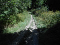
(S/E) Head south along the track closed to traffic (marked with white and yellow signs for the Pacino).

(1) At the second bend, turn left (west) onto a path marked by a cairn, which cuts across the track and rejoins it further up. You’ll soon reach a Fork in the road with a signpost.

(2) Turn left towards the Pacino. Follow the path, which is very well marked and winds several times before reaching the Col de Pacino.

(3) Continue east-southeast and climb to the summit.

(4) Descend via the same path back to the pass.

(3) Then turn left and descend west-south-west along the Selva de Sallent ridge.

(5) At the signpost, turn right and continue down, heading north then north-east (blue and red markings in the forest).

(6) You’ll come out onto a track; follow it as it continues. After several bends, you’ll reach a junction you passed earlier in the walk.

(2) Take the shortcut down the hill that you took on the way up.

(1) Complete the descent along the track to the car park (S/E).

Points de passages

  1. D/A : mi 0 - alt. 4,583 ft - Car park – Track
  2. 1 : mi 0.23 - alt. 4,692 ft - Start of the trail
  3. 2 : mi 0.38 - alt. 4,816 ft - Junction of the circular loop – Signpost
  4. 3 : mi 1.83 - alt. 5,978 ft - Cuello del Pacino (1827 m)
  5. 4 : mi 2.19 - alt. 6,263 ft - Punta del Pacino (1964 m)
  6. 5 : mi 3.37 - alt. 5,915 ft - Signpost
  7. 6 : mi 4.73 - alt. 5,125 ft - Track junction
  8. D/A : mi 5.9 - alt. 4,583 ft - Car park – Track

Other walks in the area

For more walks, use our search engine .

Les descriptions et la trace GPS de ce circuit restent la propriété de leur auteur. Ne pas les copier sans son autorisation.