Sauwartan from Le Petit Dour

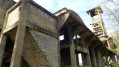
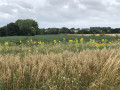
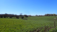
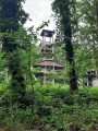
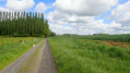
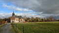
A walk that’s half through woodland and half across open countryside, where you’ll discover the remains of the Sauwartan coal mine and the site of an old watermill, as well as “Nounours” the llama.
The more adventurous can climb to the top of the slag heap.

Details

6956314
Creation:
Last update:
Last review:
  • Walking
    Activity: Walking
  • ↔
    Distance: 2.34 mi
  • ◔
    Average duration: 1h 10 
  • ▲
    Difficulty: Easy

  • ⚐
    Back to start: Yes
  • ↗
    Ascent: + 85 ft
  • ↘
    Descent: - 102 ft

  • ▲
    Highest point: 436 ft
  • ▼
    Lowest point: 328 ft
  • ⚐ Country: Belgium
  • ⚐ City: Dour 
  • ⚑
    Start/End: N 50.383612° / E 3.822027°
  • ❏
    IGN map(s): Ref. 2706OT
  • Hour-by-hour weather

Photos

Description of the walk

Parking available near the cemetery.

(S/E) From the cemetery car park, walk down Rue du Cimetière towards the woods and enter them. Follow the path to the Ruisseau d’Elwasmes.

(1) Follow the path to the left until you reach the remains of the Sauwartan colliery.

(2) Climb the short, steep slope or follow the path to the remains of the Sauwartan coal mine, then head back down the path towards the south (marked route).

(3) Take the path on the right and go straight on at the junction.
Then turn left and follow the path down to Rue Mouligneau.

(4) Turn left onto this street and head towards the site of the old watermill. Walk up the street on the right, then turn left onto Voie de Sars. Turn left onto Rue du Cimetière. Say hello to “Nounours” if he’s there, and make your way back to the car park (S/E)

Waypoints

  1. S/E : mi 0 - alt. 413 ft - Car park near the cemetery
  2. 1 : mi 0.67 - alt. 328 ft - Elwasmes Stream
  3. 2 : mi 0.92 - alt. 397 ft - Former Sauwartan charcoal kiln
  4. 3 : mi 1.05 - alt. 404 ft - Turn right at the fork
  5. 4 : mi 1.53 - alt. 390 ft - Rue Moulingneau
  6. S/E : mi 2.34 - alt. 413 ft - Car park near the cemetery

Notes

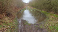
At the entrance to the woods, a spring has appeared on the path, so you’ll need to walk on the right-hand side of the path to avoid the water if you’re not wearing waterproof shoes.

Worth a visit

Reviews and comments

4.7 / 5
Based on 2 reviews

Reliability of the description
5 / 5
Ease of following the route
5 / 5
Route interest
4 / 5
User 30053441

Overall rating : 4.7 / 5

Date of your route : Aug 17, 2026
Reliability of the description : ★★★★★ Very good
Ease of following the route : ★★★★★ Very good
Route interest : ★★★★☆ Good
Very busy route : No

A lovely walk with my dogs – wild and off the beaten track. At this time of year, when there had been some storms, a few trees were blocking certain paths (which didn’t bother me), but it’s not suitable for pushchairs or bikes, as the paths are only accessible on foot.
An unusual walk through the woods with a water source for the dogs

Machine-translated

1U6
1U6

Overall rating : 4.7 / 5

Date of your route : Apr 19, 2021
Reliability of the description : ★★★★★ Very good
Ease of following the route : ★★★★★ Very good
Route interest : ★★★★☆ Good
Very busy route : No

A lovely walk to do with young children, with hardly any elevation gain and a varied route … mostly through the woods and then across the countryside.
The site of the old coal mine is quite spectacular.
We spotted lots of birds and a roe deer crossed the path just a few steps away from our group.

Machine-translated

Other walks in the area

For more walks, use our search engine .

The GPS track and description are the property of this route's author. Please do not copy them without permission.