Country:

 City:


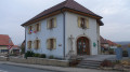
The starting point is at Place de la Libération, opposite the church on Rue des 2 Fontaines. Car park and bus stop.
The route is signposted with a Red Ring.
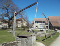
(S/E) On leaving the car park, turn right towards the east. Walk past the drinking fountain, dating from 1760, and the wash house (1852), both fed by the Adour, a pretty little river which rises in the Val de Saint-Dizier-l’Évêque and flows through the village.
When you reach the junction, turn left onto the D50 and continue for about ten metres until you reach the next junction.
(1) Turn right onto Rue du Coteau Français. Walk past the school, with its bell tower, then the town hall. Continue along this street. Shortly after the last houses, enter the forest via the hamlet known as ‘la Vie de Porrentruy’, which takes its name from Roman times.
Take the path on the left, next to a platform used for storing logs during timber felling. Follow the signposts carefully to find the path that branches off to the left at a 90° angle.
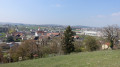
(2) Follow it. At the edge of the forest, you’ll emerge at the hamlet known as ‘les Cratrays’. A very lovely viewpoint. In the foreground on the right, the towns of Boncourt and Delle. Ahead of you: the ‘Queue aux loups’ and its Technoparc, as well as the junction with the N1019, which leads to the customs post, the border crossing with our Swiss neighbours. Join another marked route with a Green Disc (the ‘Three Valleys Circular Route’). Leave the forest and take the Chemin des Cratrays for about 400 metres until you reach a path branching off to the right.
(3) Ignore the Green Disc, which continues straight on, and follow the Red Ring markings. After about 300 metres, turn sharply left. If, by mistake, you were to go straight on, you would arrive at the Stegmann farm and find yourself in Switzerland.
At the end of this country lane, which leads to the hamlet known as ‘Le Mont’ – with the Salle des Trois Fontaines on your left – admire an oak tree that is well over three hundred years old. Keep an eye out for the signposting to find the hairpin bend that follows.
(4) Take the sharp left turn onto the path that winds round the small copse and descends towards the village. Through the hedgerows, the western slope of the village comes into view.
Another 500 metres and your visit to Lebetain will come to an end, but first pass by the school, which dates from 1835. The construction of the retaining walls in 1936 and 1938 led to the discovery of a sarcophagus and graves containing human remains, dating approximately from the Celtic period. This sarcophagus is currently believed to be housed in the Belfort Museum.
(1) Reach the crossroads and return to the car park where you started, following the same route you took on the way there. (S/E)

 Visorando Member
 Difficult

 Moderate