Country:

 City:
City:


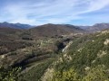
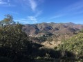
Park opposite the tree-lined park at the Neyrac-les-Bains thermal baths.
(S) Walk down the small road crossing the Ardèche to reach the N102. Turn right onto it for about ten metres, then cross the road to join a small path to the left of the stream.
(1) Follow the stream to the Roman bridge and the Via Domitia. Do not cross the bridge (this will be the return route), but turn left until you reach a small road; follow this northwards for about 1 km, leading to the hamlet of Le Crouset.
(2) Do not enter the hamlet, but turn right at the junction. Barely 50 metres further on, just past the small wayside cross, head up the path to the left, shaded by holm oaks. Shortly afterwards, the path begins a very pleasant descent towards the hamlet of Le Maillet. Cross the hamlet and two small roads, continuing downhill (there are steps), to reach the beautiful, characterful village of Meyras.
(3) In the village, leave the church on your right to reach Rue des Tisserands; turn left onto this street and follow it for 100 metres, then head down the tiny Rue du Lavoir on your right to reach the D26. Cross the road and head up the path opposite, which is lined with a low stone wall. As it begins to descend, the path turns into a track until it joins the D536.
(4) Turn right onto Rue des Mésanges to come out onto the D536, which you follow to the right. 200 metres further on, cross the bridge over the Fontolière.
(5) Just after the entrance to the Écomusée du Moulinage, at the “Pont de Veyrières” signpost, head steeply uphill to the left. Follow the signposting carefully. Cross a road and continue straight ahead.
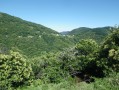
(6) At the “Le Gontier” signpost, turn left towards Saint-Pierre-de-Colombier and continue due west, following the contour line; this path offers lovely views of the Fontolière valley below, then that of the Bourges – two magnificent rivers. After passing through several hamlets, the signposts will lead you to the “hiking information” point at Saint-Pierre-de-Colombier.
(7) Stay on the left bank of the Bourges, taking the small road on the right between the “hiking information” point and the boules court. Head due north along this route which runs alongside the river, through meadows. At the Moulin du Prat junction, take the steep climb to the right towards “Le Prat” or “Celas”.
(8) Pass through the hamlet of “Le Prat”; follow the clearly marked signposts to tackle the day’s toughest stretch: a steep climb towards the Col de Moucheyre. Reach the hamlet of Celas and pass through it.
(9) The only thing to watch out for on this path is that, as you leave the hamlet, there is a junction of paths: make sure you stay on the one on the right and continue to the Col de Moucheyre.
(10) Leave the Bourges valley and head over towards Besorgues; there are lovely views on both sides. This is also the junction with theGRP® de la Haute Cévenne d’Ardèche, marked in yellow and red. Head down the road towards the east for about ten metres, then turn right onto thisGRP® path which descends through the chestnut trees; it passes through the hamlet of Moucheyre to join the D243.
(11) Leave theGRP® and any other signposting. Turn left onto this departmental road for 50 metres, then turn right onto a small road and follow it straight on until you are forced to turn right when you reach the river.
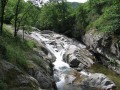
(12) If you have time, you can make a round trip to a lovely spot for a swim in the cool waters of the Besorgues; to do this, continue straight on for 100 metres and head down the path on the left towards the river.
(13) Relax, have a swim, enjoy the natural water currents and natural slides. Return to the previous junction via the same path.
(12) On your return, continue left, heading due south, go round the cemetery, cross the D254 and take the path leading down opposite, rejoining theGRP® further on. Follow it due east along a small road that turns into a path, leading to the ‘l’Abro’ signpost.
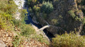
(14) Leave theGRP® for good, heading down to the left to reach the ‘delicate’ bridge spanning the Besorgues. Follow this path, which passes at the foot of a large building overlooking the river and leads you to a truly beautiful structure, the Pont de Gamarnés.
(15) Do not cross the bridge, but head up to the left. Join the road and follow it to the right for a few metres, then immediately rejoin the path climbing to the left until you reach Chastagner Gourd. At this point, you’ll come out onto a tarmac road; take it to the right for 500 metres and, after a hairpin bend going downhill, take the path climbing to the left, then continue more or less following the contour line.
(16) At the crossroads of paths, head down to the right towards the Col d’Aizac (S/E).



 Tourism professional
 Difficult
  Visorando Member