From the top of the ramparts at La Petite Mer de Gâvres to Port-Louis

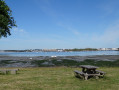
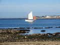
Surrounded by the sea on three sides, the maritime town of Port-Louis is also steeped in history, as evidenced by its ramparts and the Citadel… Let yourself be enchanted by its rich heritage, its beaches and small coves, set against a backdrop of breathtaking views of the Lorient Harbour and the Petite Mer de Gâvres.

Details

57639724
Creation:
Last update:
Last review:
  • Walking
    Activity: Walking
  • ↔
    Distance: 4.55 mi
  • ◔
    Average duration: 2h 05 
  • ▲
    Difficulty: Easy

  • ⚐
    Back to start: Yes
  • ↗
    Ascent: + 33 ft
  • ↘
    Descent: - 33 ft

  • ▲
    Highest point: 43 ft
  • ▼
    Lowest point: 7 ft
  • ⚐ Country: France
  • ⚐ City: Port-Louis (56290)
  • ⚑
    Start/End: N 47.711612° / W 3.356287°
  • ❏
    IGN map(s): Ref. 0720ET
  • Hour-by-hour weather

Photos

Description of the walk

Parking is available along the marina. Water buses can take you to the starting point from Lorient (see link under ‘Practical information’).

The route starts at Quai de la Pointe

(S/E) Walk up the quay, then along Rue de la Pointe past the Tour Carrée.

(1) Continue along this street to the right. Take the steps on the right and follow the path alongside the low wall to the memorial, either by climbing up onto the ramparts on the right or by following the path below. From the memorial, continue left along the path that crosses the meadow and a street, then, after the skatepark, cross the avenue and head back to the ramparts. Carry on left along the path to the Tour des Prisonniers.

(2) A gap in the ramparts on the right allows you to walk along the Promenade du Lohic towards the sea. Keep going straight on. After the Bastion du Papegaut, take the path on the right and continue to the right along the pavement of Rue de Locmalo. Turn right onto Rue Leraw, then head up to the left and follow Rue du Bastion and Rue de la Résistance 39–45 to the right. Walk along Côte Rouge Beach and Locmalo Bay.

(3) Cross the road after the roundabout and take the path on the right into the field. After the car park, carry on straight ahead along the dirt track. Turn left onto Rue de la France Libre, then right onto Rue Joachim Uhel.

(4) Take the second dirt track on the left, at the bend in the Route de Kerlugery. Walk along the field on your left, then take the path on the right which passes between two houses. Turn left, then cross the Route de Port-Louis at the roundabout and follow it to the right for 60 metres (departmental road).

(5) Continue straight on along the departmental road and take the second track on the left. Keep going straight on, then turn left to reach the shore. Follow the coastal path to the left. Continue left along the path that runs alongside the breeze block wall. After the council works department, turn right onto Rue Jean-Baptiste Guiheneuc and keep to the right on the path closest to the water to reach Pointe de Kerzo.

(6) Carry on along the path to the right which goes round the park and continue along the coastal path, ignoring the paths to the left. Once past the cemetery, turn right onto the footpath and carry on straight ahead. At the road, turn right towards the ramparts. Carry on straight ahead, then, at Boulevard de la Compagnie des Indes, turn right towards Quai de la Pointe to return to your starting point (S/E).

Waypoints

  1. S/E : mi 0 - alt. 10 ft - Quai de la Pointe
  2. 1 : mi 0.06 - alt. 13 ft - Tour Carrée
  3. 2 : mi 0.86 - alt. 30 ft - Prisoners’ Tower
  4. 3 : mi 1.76 - alt. 13 ft - Locmalo Bay
  5. 4 : mi 2.23 - alt. 36 ft - Junction with Rue Joachim Ihuel
  6. 5 : mi 2.54 - alt. 16 ft - Route de Port-Louis
  7. 6 : mi 3.62 - alt. 26 ft - Pointe de Kerzo
  8. S/E : mi 4.55 - alt. 10 ft - Quai de la Pointe

Notes

- More information on the water buses here

This route is included in the Morbihan Departmental Plan for Walking and Hiking Routes and has been accredited by the French Hiking Federation. You can follow the yellow signposts. There is an information board with a map and details of heritage sites at the start.

Worth a visit

This route is organised by Lorient Agglomération. Find out more: https://www.lorient-agglo.bzh/a-vivre/to...

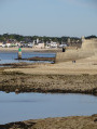
- Tour Carrée: part of the town walls (1649–1653), later the fishing port’s ice house (1947), now home to the Yacht Club.
- Memorial: 69 members of the Resistance, martyrs of the Citadel.
- Port-Louis Citadel (16th century, altered in the17th century): Museum of the Compagnie des Indes and National Maritime Museum.
- Grande Plage des Pâtis: the first seaside bathing resort, established in 1837.
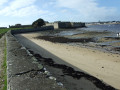
- City walls (1649–1653).
- Grande Poudrière (1750–1752): ammunition depots. A venue for creative works and exhibitions.
- Lavoir des Poullo and Fontaine des Récollets (17th century).
- Cannonball ramp (1840).
- Prisoners’ Tower.
- Promenade du Lohic
- Saint-François Tower: a half-tower topped by a19th-century watchtower; home to artists-in-residence and exhibitions.
- Papegaut Bastion (1649–1653): used to monitor Locmalo Bay and the Gâvres Peninsula.
- Locmalo: former sardine-fishing village (19th century). Fish market (1889), now home to the village hall.
- Château and Pointe de Kerzo: a holiday residence (1878). Birdwatching spot.
- Le Driasker: in Breton, ‘the village below’, a former quarter of caulkers and shipwrights.
- Port de la Pointe (1618).

Reviews and comments

4.1 / 5
Based on 3 reviews

Reliability of the description
4 / 5
Ease of following the route
4.3 / 5
Route interest
4 / 5
kartavan
kartavan

Overall rating : 4.3 / 5

Date of your route : Aug 09, 2026
Reliability of the description : ★★★★☆ Good
Ease of following the route : ★★★★☆ Good
Route interest : ★★★★★ Very good
Very busy route : No

A pleasant little walk taking in the ramparts, the citadel and the view over the ‘Little Sea’ of Gâvres.
The second part of the route is less appealing, as is often the case with circular walks.

Machine-translated

User 28954724

Overall rating : 3.3 / 5

Date of your route : Jun 22, 2026
Reliability of the description : ★★★☆☆ Average
Ease of following the route : ★★★★☆ Good
Route interest : ★★★☆☆ Average
Very busy route : No

A short walk on the mother’s side is pleasant; on the town side, much less so

Machine-translated

REQUILLARD
REQUILLARD

Overall rating : 4.7 / 5

Date of your route : Apr 07, 2025
Reliability of the description : ★★★★★ Very good
Ease of following the route : ★★★★★ Very good
Route interest : ★★★★☆ Good
Very busy route : Yes

A great, well-signposted and enjoyable walk

Machine-translated

Other walks in the area

For more walks, use our search engine .

The GPS track and description are the property of this route's author. Please do not copy them without permission.