


Refine your search for walks in Pont Romain sur l'Ubaye.
Pont Romain sur l'Ubaye. walks


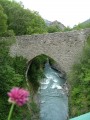
 The Costeplane Waterfalls
 Visorando Member
 3.73 mi
 +1,017 ft
 -1,010 ft
 2h 35
 Moderate
 Departure from Le Lauzet-Ubaye (Alpes-de-Haute-Provence)
Site classified by decree of 9 January 1939.Facing the Pas-de-la-Tour ravine, in the heart of a magnificent mountain environment, this natural curiosity is clearly visible from the road at the bottom of the valley. These waterfalls are a popular spot for panoramic views. They can also be explored from the village of Lauzet, along pleasant country trails.
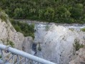
From Lauzet to Roche Rousse through the tunnels, following the railway line
 9.33 mi
+2,700 ft
-2,680 ft
6h 40
Moderate
Departure from Le Lauzet-Ubaye (Alpes-de-Haute-Provence)
The unfinished railway project at the beginning of the 20th century left behind some beautiful viaducts and tunnels that are ideal for an unusual hike. The return journey can be made via theGRP® Tour du Lac de Serre-Ponçon. This is an original hike that winds its way through hamlets and abandoned farms, ending in the inhabited hamlets of the commune of Lauzet. Finally, you cross the famous Roman bridge over the Ubaye Gorges.
Walks near Pont Romain sur l'Ubaye.
The Pierre Arnoux Belvedere
 3.72 mi
+1,601 ft
-1,552 ft
3h 05
 Easy
Departure from Savines-le-Lac (Hautes-Alpes)
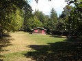
The walk begins with a stroll through a beautiful forest and ends with a splendid view of Lake Serre Ponçon.
Lac Sainte-Marguerite and Source de Jérusalem
 5.97 mi
+1,903 ft
-2,156 ft
4h 25
Moderate
Departure from Les Orres (Hautes-Alpes)
A very pleasant circular above Les Orres resort, allowing you to discover a beautiful lake, Sainte-Marguerite, and the springs that feed Les Orres, named Jerusalem.
In the cool shade of the larch trees at Les Orres
 Tourist office
 2.96 mi
+246 ft
-2,123 ft
1h 35
Easy
Departure from Les Orres (Hautes-Alpes)
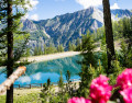
A long, cool downhill walk through the larch forest, passing through Grand-Clos, where the water reservoir transforms into a mirror-like lake.
This walk is a downhill route from the top of the Pic Vert chairlift to the 1650 resort (L’Épervière car park).
From Pra Loup 1600 via Coste Belle to La Dalle en Pente
2.45 mi
+1,594 ft
-430 ft
2h 30
Moderate
Departure from Uvernet-Fours (Alpes-de-Haute-Provence)
A good walk to work up an appetite! Set off from Pra Loup to the La Dalle en Pente restaurant and return via the Chappe chairlift.
The Aiguilles de Chabrières, starting from the chairlifts
3.95 mi
+883 ft
-2,188 ft
2h 35
 Difficult
Departure from Réallon (Hautes-Alpes)
The Aiguilles de Chabrières are majestic but you have to earn them.
To walk there , you mustn’t be afraid of heights or of using your hands to hold on.
It’s a fun and magnificent playground.
Taking the chairlifts (July and August only) saves you a 600-metre climb.
Refuge de l’Estrop – La Foux d’Allos
 7.71 mi
+3,517 ft
-4,452 ft
7 hrs
 Very difficult
Departure from Prads-Haute-Bléone (Alpes-de-Haute-Provence)
Day2 of this route takes you to the summit of the Estrop, then back down to the Foux d’Allos resort via the Baisse de l’Aiguille. A very technical hike, featuring extensive and exposed scree slopes. The view from the summit is fantastic, taking in the whole of the Champsaur Range, the Écrins, the Queyras and the Mercantour. You’re sure to spot chamois, ibex and marmots. This stage requires sure-footedness.
Allos Mountain Hut – Petit Col du Talon – Bayasse
 15.80 mi
+3,504 ft
-4,836 ft
10 hrs
Very difficult
Departure from Uvernet-Fours (Alpes-de-Haute-Provence)
The third stage is very difficult due to its length of nearly 26 km, with a few technical sections – particularly when carrying a rucksack – which will put your body to the test. This is why I have classified this stage as ‘very difficult’. However, this stage is one of the most beautiful on this route: wild, technical, with stunning panoramic views.
You’ll cross pastures, wooded areas, mountain pastures and very rocky high-mountain sections between the two highest peaks of the Mercantour: Mont Pelat (3,051 m) and Le Cimet (3,020 m).
You’ll be crossing the northern part of the Mercantour National Park.
Allow between 8 and 10 hours for this challenging stage.
Route from Val d'Allos la Foux to Val d'Allos le Seignus
 9.34 mi
+1,611 ft
-2,385 ft
5h 40
Moderate
Departure from Allos (Alpes-de-Haute-Provence)
A forest trail that will take you to the Val d’Allos Le Seignus ski resort.
La Foux D’Allos – Refuge de l’Estrop
 4.20 mi
+2,215 ft
-1,276 ft
3h 50
Moderate
Departure from Allos (Alpes-de-Haute-Provence)
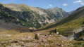
Thefirst stage of this two-day route. An easy day’s walk to get you properly warmed up for the next day’s stage. The ascent of the Baisse de l’Auriac is gentle. At the pass, there’s a magnificent view of the Tête de l’Auriac, the Bléone valley and the Mercantour.