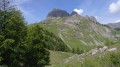
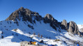
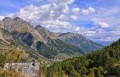
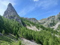
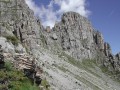
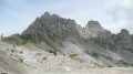
The Aiguilles de Chabrières, starting from the chairlifts

The Aiguilles de Chabrières are majestic but you have to earn them.
To walk there , you mustn’t be afraid of heights or of using your hands to hold on.
It’s a fun and magnificent playground.
Taking the chairlifts (July and August only) saves you a 600-metre climb.

Details

n°12781717
Creation:
Last update:
Last review:
  • Walking
    Activity: Walking
  • ↔
    Distance: 3.95 mi
  • ◔
    Average duration: 2h 35 
  • ▲
    Difficulty: Difficult

  • ⚐
    Back to start: No
  • ↗
    Ascent: + 883 ft
  • ↘
    Descent: - 2,188 ft

  • ▲
    Highest point: 7,753 ft
  • ▼
    Lowest point: 5,633 ft
  • ⚐ Country: France
  • ⚐
    Areas: Alps, Dauphiné
  • ⚐ City: Réallon (05160)
  • ⚑
    Start: N 44.576568° / E 6.339805°
  • ⚑
    End: N 44.580831° / E 6.352793°
  • ❏
    IGN map(s): Ref. 3438ET, 3438ETR
  • Hour-by-hour weather

Description of the walk

Park your car at the Réallon Ski Resort.
Take the two chairlifts leading to Les Aiguilles. This covers a 600-metre ascent. The chairlifts operate in July and August on certain days and at specific times; please check in advance.

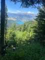
(S) At the chairlift exit, take the ascending path which leads to a magnificent viewpoint over the valley. Views of Gap, Chorges, Lake Serre-Ponçon and Lake St Apollinaire.
The path starts off as a balcony trail, then climbs between two rock spires to reach a beautiful pass offering panoramic views to the north: La Coupa and Le Barle.

(1) To reach the peak (optional and not recommended for those with a fear of heights), turn left onto a path running along a ledge, then left again (cairn) towards a narrow passage in the rocks: ‘la boîte à lettres’. After a bit of scrambling and a few thrills, you’ll reach the summit.

(2) From the summit, you’ll be treated to a 360° panorama over the Drac valley, Les Orres, Serre-Ponçon, Gap, Bure and the old Chaillol… absolutely breathtaking!
Turn back, descending via the same route. Do not head for the fork you passed on the way up, but carry on straight ahead (west).

(3) Then turn left to rejoin a more even path. Below, you can see karst formations (limestone eroded by rainwater). In the distance, below the shepherd’s hut, the Serrière de la Fourche path stands out; follow this to make your way back down.

(4) Turn right onto the path, heading towards the shepherd’s hut.
Please respect the site, the shepherd’s work, his flock and his dogs. Do not approach his hut. Thank you.
The path continues across the meadow, then winds its way up a steeper slope before entering a beautiful forest.

(5) Turn right to head back down towards the resort.

(6) Carry on to the left, straight ahead, then turn left at the water retention basin to reach the top of the Clos des Aurans chairlift.

The chairlift takes you down to the car park. The ride down is free.
It is also possible to walk to the car park (E).

Waypoints

  1. S : mi 0 - alt. 6,946 ft - Top of the chairlift
  2. 1 : mi 0.71 - alt. 7,618 ft - Pass between the peaks
  3. 2 : mi 0.78 - alt. 7,753 ft - Summit - Aiguilles de Chabrières
  4. 3 : mi 0.88 - alt. 7,556 ft - Return to the path - Lac de Serre-Ponçon
  5. 4 : mi 1.35 - alt. 7,208 ft - Turn right via Serrière de la Fourche
  6. 5 : mi 2.78 - alt. 5,863 ft - Turn right towards the resort
  7. 6 : mi 3.32 - alt. 5,791 ft - To the left
  8. E : mi 3.95 - alt. 5,633 ft - Top station of the first chairlift section

Notes

(1) You may choose not to climb to the summit (a technical and challenging section). Continue on to (3).
A rope may be required to belay a person.
Plenty of water (no water along the route).
Hike classified as difficult due to exposed sections and the route to the summit (2)

Reviews and comments

4.7 / 5
Based on 1 review

Reliability of the description
4 / 5
Ease of following the route
5 / 5
Route interest
5 / 5
jeanmariedegap
jeanmariedegap

Overall rating : 4.7 / 5

Date of your route : Aug 03, 2023
Reliability of the description : ★★★★☆ Good
Ease of following the route : ★★★★★ Very good
Route interest : ★★★★★ Very good
Very busy route : No

Hello,

We went there on 3 August 2023. For your information, the previously tricky section beneath the summit of the Aiguilles has been widened and fitted with three metal handrails, which makes access to the summit much easier. That said, you’d best not be afraid of heights!

Machine-translated

Other walks in the area

For more walks, use our search engine .

The GPS track and description are the property of this route's author. Please do not copy them without permission.