


Refine your search for walks in Pont du sergent Jean Tane
Pont du sergent Jean Tane walks


 Circular route between Roubion and Plampinet via the Route Forestière du Bois Noir
 Visorando Member
 3.26 mi
 +335 ft
 -364 ft
 1h 50
1h 50
 Easy
Easy
 Departure from Névache (Hautes-Alpes)
A lovely, easy walk, mostly through a larch forest and, for a short stretch, along the Clarée. In summer, you can enjoy the magnificent alpine flora that accompanies you along the entire route.
Pamplinet - Refuge du Chardonnet
8.03 mi
+2,546 ft
-135 ft
5h 55
 Difficult
Departure from Névache (Hautes-Alpes)
Difficult
Departure from Névache (Hautes-Alpes)
This section corresponds to the second stage of the crossing of France, following the 45th parallel. This stage is magnificent and can be a hike in its own right. You follow the Clarée valley and discover beautiful waterfalls before climbing up to the Refuge du Chardonnet.
Walks near Pont du sergent Jean Tane
Névache – Refuge des Drayeres
 10.88 mi
+3,451 ft
-1,512 ft
8h 00
Difficult
Departure from Névache (Hautes-Alpes)
10.88 mi
+3,451 ft
-1,512 ft
8h 00
Difficult
Departure from Névache (Hautes-Alpes)
This is the fourth stage of the route, taking you from the village of Névache to the Drayéres mountain hut at the head of the Clarée Valley. The route follows the path known as the Chemin de Ronde, part of theGRP® Tour du Thabor trail. You’ll complete a circular route around Lake Laramon. Alternatively, from this lake you can also reach Lake aux Serpents.
The view over the valley from the top of the Chemin de Ronde is simply stunning.
When you reach the Refuge de la Terrasse, take a moment to admire the mountainous landscape of this valley.
 Buffère Mountain Hut
2.98 mi
+1,627 ft
-98 ft
3 hrs
 Moderate
Departure from Névache (Hautes-Alpes)
Moderate
Departure from Névache (Hautes-Alpes)
You’ll gradually discover the Clarée valley. As you gain altitude, your view will widen. It’ll soon become truly extraordinary!
La Clarée right bank: from Névache to the Laval car park
 6.13 mi
+1,444 ft
-49 ft
4h 05
Moderate
Departure from Névache (Hautes-Alpes)
6.13 mi
+1,444 ft
-49 ft
4h 05
Moderate
Departure from Névache (Hautes-Alpes)
Between forest, mountain pastures and the banks of the Clarée, this walk takes you gently from Névache to the upper Clarée valley. It is also an opportunity to discover the hamlets and isolated chalets scattered throughout the valley. Don't forget to admire the pretty Fontcouverte waterfall on the way!
Please note that if you do this hike outside the shuttle bus operating period (information available from the tourist office), you will have to walk back to the starting point along the same route!
Névache - Briançon
15.15 mi
+4,222 ft
-5,141 ft
10h 40
Difficult
Departure from Névache (Hautes-Alpes)
Étape de la Grande Traversée des Alpes de Névache dans la vallée de la Clarée à Briançon (plus haute ville de France) par la porte de Cristol.
Terzo Alpini Mountain Hut – Névache
 8.80 mi
+2,884 ft
-3,455 ft
6h 35
Difficult
Departure from Névache (Hautes-Alpes)
8.80 mi
+2,884 ft
-3,455 ft
6h 35
Difficult
Departure from Névache (Hautes-Alpes)
This third stage of the route will take you to the village of Névache via the Col du Vallon, once again following theGRP® “Tour du Thabor”. The climb to the pass is difficult, particularly the section through the scree slope, a former glacier. Due to its exposure, the gully leading up to the pass is prone to snowfields.
The scenery is fabulous. The descent towards Névache is superb, through a lush green valley, alongside a torrent and past a beautiful chapel.
The Clarée lakes route: Laramon, Serpent, Les Gardioles, Blanc
 8.96 mi
+3,579 ft
-4,459 ft
7h 15
Difficult
Departure from Névache (Hautes-Alpes)
8.96 mi
+3,579 ft
-4,459 ft
7h 15
Difficult
Departure from Névache (Hautes-Alpes)
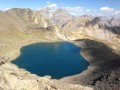
This hike is certainly long, but it will allow you to discover one of the major areas of the wonderful Clarée Valley.
Lac de la Cula via the circular trail
4.95 mi
+2,001 ft
-1,463 ft
4h 00
Moderate
Departure from Névache (Hautes-Alpes)
A beautiful hike with magnificent scenery. The climb to the Ricou refuge is a little steep but not particularly difficult. Once you reach the circular path, the route is very easy, almost flat until you reach the Torrent de la Cula. The view over the entire valley is truly superb. From the lake, the trail descends to Laval.
Fontcouverte Campsite - Lac de la Ponsonnière
 7.08 mi
+3,691 ft
-1,391 ft
6h 30
Difficult
Departure from Névache (Hautes-Alpes)
7.08 mi
+3,691 ft
-1,391 ft
6h 30
Difficult
Departure from Névache (Hautes-Alpes)
For this first three-day stage, the route offers magnificent views of the Écrins Massif at the Col du Chardonnet and then of the Grand Lac. We have chosen to camp at Lac de la Ponsonnière, but it is entirely possible to camp on the heights of the Grand Lac, near the pastoral house. This allows you to shorten the duration of this first day slightly and, above all, reduce the elevation gain by around 200m.
Refuge du Chardonnet - Arsine
11.94 mi
+2,608 ft
-4,436 ft
7h 45
Difficult
Departure from Névache (Hautes-Alpes)
This third stage of the crossing of France, following the 45th parallel as closely as possible, is long and difficult but absolutely magnificent. You will discover or rediscover the two jewels that are the Écrins and Meije massifs. Most of the route is on the GR® 50 and GR® 57. The paths are well marked and well maintained.
This stage can be divided into four sections: 1) an ascent to the Col du Chardonnet; 2) the descent to Lauzet; 3) the ascent to the Col du Lautaret; 4) the descent to Arsine.
Lac Lavoir - Laval car park via the Pic du Lac Blanc
 8.57 mi
+2,746 ft
-3,556 ft
8 hrs
8.57 mi
+2,746 ft
-3,556 ft
8 hrs
 Very difficult
Departure from Névache (Hautes-Alpes)
Very difficult
Departure from Névache (Hautes-Alpes)
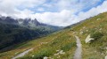
Last day of the circular, returning to the Laval car park via the Col du Vallon and the Pic du Lac Blanc, from where you can see the route of the previous three days.