Pointe de Pécé

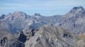
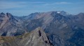
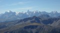
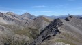
A hike to one of the dominant peaks of the Clarée Valley, offering panoramic views of the Écrins, Cerces and Queyras massifs, as well as some Italian peaks.

Details

280915
Creation:
Last update:
Last review:
  • Walking
    Activity: Walking
  • ↔
    Distance: 9.14 mi
  • ◔
    Average duration: 7h 45 
  • ▲
    Difficulty: Difficult

  • ⚐
    Back to start: Yes
  • ↗
    Ascent: + 4,094 ft
  • ↘
    Descent: - 4,094 ft

  • ▲
    Highest point: 8,944 ft
  • ▼
    Lowest point: 4,849 ft

Photos

Description of the walk

From Briançon, take the road to the Col de Montgenèvre and turn off at the hamlet of La Vachette to take the road to the Névache Valley on the left.
Pass Val-des-Prés and continue to the bridge over the Torrent des Acles, situated just before the entrance to the village of Plampinet. Park near the bridge at the side of the road.

(S/E) From the bridge over the Acles torrent, follow the road towards Plampinet for about thirty metres, then at the sign for ‘Montée de la gorge’, take the path on the right towards the Pointe de Pécé.
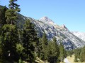
This path crosses the Acles torrent before climbing gently up the south-south-eastern slope through a dense larch forest.
You are now on a ridge path linking the villages of Plampinet and Val-des-Prés.
This path passes beneath imposing cliffs of excellent rock, much loved by climbers.
After a straight climb for 2 km, the path winds its way upwards in hairpin bends.

(1) At the crossroads of paths, leave the balcony path on your right and turn left towards our summit. After a few hairpin bends, the path heads northwards across the slope before emerging at an altitude of around 2,040 metres onto a plateau, which it crosses in a north-easterly direction.

(2) At an altitude of 2,075 metres, by the signpost, turn right towards the Pointe de Pécé.

(3) At the second signpost, 50 metres further on, turn right again towards the summit.
The path climbs as it heads south, emerges from the forest and turns south-east.
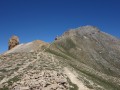
It then climbs diagonally eastwards, winding its way up in a series of hairpin bends, and joins the ridge line near a Hertzian relay station.
Climb along the ridge to the north, then head for the summit, marked by a cairn.

(4) Return in the opposite direction via the same route to your car park (S/E).

Waypoints

  1. S/E : mi 0 - alt. 4,849 ft - Car park near the - Clarée (rivière)
  2. 1 : mi 1.68 - alt. 5,971 ft - Marked trail junction
  3. 2 : mi 2.84 - alt. 6,785 ft - Marked trail junction
  4. 3 : mi 2.89 - alt. 6,827 ft - Marked trail junction
  5. 4 : mi 4.58 - alt. 8,944 ft - Summit of the - Pointe de Pécé (2733m)
  6. S/E : mi 9.14 - alt. 4,849 ft - Car park

Notes

There was a landslide in 2021 affecting a stretch of a few metres, as often happens in the mountains after heavy rain. The Névache tourist office has informed me that the path was re-routed following repair work in 2022.
You can now hike up to this magnificent summit.

I’ve made a video, complete with the names of the peaks, which shows the route and the atmosphere of this walk.

What can I say about this route?

It’s a hike that follows paths throughout, though it may be daunting for some walkers who are prone to vertigo.
Indeed, the path, which winds along the mountainside, cuts across steep slopes in several places.

Reviews and comments

3.9 / 5
Based on 3 reviews

Reliability of the description
4 / 5
Ease of following the route
4 / 5
Route interest
3.7 / 5
Chauvelinus
Chauvelinus

Overall rating : 4.7 / 5

Date of your route : Jul 28, 2025
Reliability of the description : ★★★★★ Very good
Ease of following the route : ★★★★★ Very good
Route interest : ★★★★☆ Good
Very busy route : No

The footbridge (over the Acles torrent) has disappeared at the start of the walk, but the torrent can easily be crossed by wading.
A little further up, the crossing at the second point where the stream (which is dry at this time of year, outside the rainy season) flows down from the Pointe de Pécé has been slightly modified, but may be a little difficult for some to negotiate.
For your information, trail runners currently make regular trips to the Pointe.
This walk is not recommended for young children.

Machine-translated

Britanicus100
Britanicus100

The Névache tourist office has informed me that the trail was re-routed following works carried out in 2022.
You can now therefore hike up to this beautiful peak.

Machine-translated

Britanicus100
Britanicus100

I’ve just been in touch with the Névache tourist office. There have indeed been several mudslides in that area.
It is therefore no longer possible to walk this route for the time being, and certainly not this summer.
We’ll have to wait until the path has been repaired.
Of course, as you point out – and I thank you for that – this in no way detracts from the work that has been done: the description, the reliability of the route and its interest.

Machine-translated

Microbe123
Microbe123
• Edited:

Overall rating : 2 / 5

Date of your route : Jun 27, 2021
Reliability of the description : ★★☆☆☆ Disappointing
Ease of following the route : ★★☆☆☆ Disappointing
Route interest : ★★☆☆☆ Disappointing
Very busy route : No

I set off on this hike, really inspired by the video and the beautiful panoramic views, but quite soon after the ‘Gorge Ascent’ sign, I came across a significant landslide; as a result, I found myself completely unable to continue the hike: that’s why I’ve rated it as ‘disappointing’.
I’m really disappointed that I couldn’t make it all the way to the top!

Machine-translated

VCANET
VCANET

Overall rating : 5 / 5

Date of your route : Oct 18, 2020
Reliability of the description : ★★★★★ Very good
Ease of following the route : ★★★★★ Very good
Route interest : ★★★★★ Very good
Very busy route : No

-

Machine-translated

Other walks in the area

For more walks, use our search engine .

The GPS track and description are the property of this route's author. Please do not copy them without permission.