Country:

 City:


(S/E) Leave the refuge heading towards Lac Long, walk alongside it and tackle the steep climb leading to the Seuil de l’Ouille: the path is very easy to spot and follow.
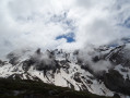
(1) You will then reach the moraines of the Grande Casse Glacier, following the cairns as far as possible. Stay on the moraine on the right, then begin to traverse diagonally until you reach the foot of the Col des Schistes.
(2) Head left, towards the west, following no real path. The route is quite difficult, but it is possible to cross by climbing over the large boulders whilst taking care to maintain the same direction. Once you reach the grassy area, you’ll find a proper path; follow this to the pass.
(3) Head to the right, due north, to begin the ascent of the ridge: cairns consistently indicate the way; the routes are sometimes easier than those marked, but to avoid getting lost it is best to follow the cairns. You will often need to use your hands on this section. Although the ridge is wide, both sides remain quite exposed, so you must climb in the middle. Cross a small step secured with a chain and a fixed rope, which is easy to climb: the rock is very sound and hardly ever crumbles, and there are no technical difficulties provided you take the correct route. This will take you to the end of the ridge, where you’ll emerge onto the South Glacier of La Glacière.
(4) Cross along the upper section without getting too close to the rocks above. This traverse is manageable in hiking boots, but crampons may be useful; the glacier isn’t very steep, so there’s no need to worry about that. Towards the end of the glacier, crevasses have formed, but they are very visible and easy to avoid. At the end of the glacier, you’ll reach a patch of orange, very slippery ground; climb up it as best you can until you reach the fixed rope visible a few metres higher up. Use the rope to reach the pass.
(5) Here’s the technical section! A rope may be useful for securing yourself as there are bolts in place:take a moment to admire the Petite Glière on your right – lower but more challenging. Climb up to the left along the ridge, which, at first glance, looks impressive. There are plenty of cairns, though some routes may cross as there are several possible paths.
As on the first ridge, the rock is excellent; all the handholds are very deep and stable. Make your way through the large boulders by following the cairns or passing between them, taking your time to find the best route. Two fixed ropes have been installed to aid the climb, although at times the rock itself is easier to use.
There are three technical sections to negotiate. The first is marked by a green rope, but with a bit of exploration, you’ll realise that the rock itself is more useful than the rope. The second is a three- to four-metre chimney on the left-hand side of the ridge, but once again, it offers very good holds. The last section is equipped with another rope, which is useful this time. The final stretch is easier, leading to the summit of the Pointe de la Grande Glière (3,392 m). Take in the impressive views of the Aiguille de l’Épéna and the Aiguille de la Vanoise.
(6) Follow the same route back , taking particular care at the tricky descent sections before the Glacier Sud de la Glière. Then continue along the ascent route in the opposite direction to return to the Refuge du Col de la Canoise (S/E).
 Visorando Member

 Very difficult

 Moderate
 Difficult
 Association / Club / Walk leader