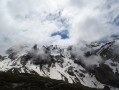
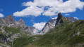
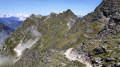
The Tour de l’Aiguille de la Vanoise via the lakes and the Col du Moriond

This hike requires a bit of fitness but is accessible. To make it easier, it’s best to do it in the opposite direction; however, with our children aged 8 and 12, we prefer the route described below.
Mountain trolls and marmots are sure to be spotted. If you’re lucky, you might even spot some chamois.

Details

57479410
Creation:
Last update:
Last review:
  • Walking
    Activity: Walking
  • ↔
    Distance: 8.03 mi
  • ◔
    Average duration: 6h 30 
  • ▲
    Difficulty: Difficult

  • ⚐
    Back to start: Yes
  • ↗
    Ascent: + 3,222 ft
  • ↘
    Descent: - 3,222 ft

  • ▲
    Highest point: 8,268 ft
  • ▼
    Lowest point: 5,433 ft

Description of the walk

Park in the Fontanettes car park at the lower chairlift stations.

(S/E) Take the GR® 55 and follow the red and white markings to the Refuge des Barmettes.

(1) Cross the Pont de la Glière, continue along the left bank of the torrent, and you’ll soon reach a crossroads of paths.

(2) Carry on straight ahead along theGR®55, cross the Pont du Chanton and reach the Lac des Vaches.

(3) Cross the lake by walking from stone to stone. Continue along theGR® and, after a few hairpin bends, reach Lac Long.

(4) Walk alongside the lake, then complete the ascent to the Refuge du Col de la Vanoise.

(5) Leave theGR® here by taking the path on the right, leading to Lac des Assiettes.

(6) Continue the descent along the left bank of the Ruisseau de l’Arcelin, joining the stream at the end of the descent.

(7) Cross the stream and then begin an easy climb up to the Col du Moriond.

(8) Resume the descent and, via a few widely spaced hairpin bends, reach the crossroads where the paths meet, which you passed on the way out.

(2) Turn left and, following theGR®55in the opposite direction, head for the Chalet des Barmettes and then the Fontanettes car park (S/E).

Waypoints

  1. S/E : mi 0 - alt. 5,433 ft - Fontanettes car park
  2. 1 : mi 1.19 - alt. 6,598 ft - Refuge des Barmettes (2012m)
  3. 2 : mi 1.5 - alt. 6,732 ft - Crossroads of the circular loop
  4. 3 : mi 2.63 - alt. 7,605 ft - Lac des Vaches
  5. 4 : mi 3.51 - alt. 8,130 ft - Lac Long (Vanoise)
  6. 5 : mi 4 - alt. 8,258 ft - Refuge du Col de la Vanoise
  7. 6 : mi 4.23 - alt. 8,222 ft - Lac des Assiettes
  8. 7 : mi 5.54 - alt. 7,054 ft - Arcelin stream - Chalet inférieur de l'Arcellin
  9. 8 : mi 5.91 - alt. 7,372 ft - Col du Moriond
  10. S/E : mi 8.03 - alt. 5,433 ft - Fontanettes car park

Notes

This hike starts on theGR®55, which is a real ‘motorway’, so you can’t go wrong until you reach the refuge. You’ll just need to leave it behind after the Col de la Vanoise refuge; otherwise, you’ll end up straight in Tignes, but that’s another story.
Wildlife: plenty of marmots and a few chamois on the climb up to the pass.
Flora: still very diverse.

Worth a visit

Always be cautious and plan ahead when you're outdoors. Visorando and the author of this route cannot be held responsible for any accidents occurring on this route.

The GR® and PR® markings are the intellectual property of the Fédération Française de Randonnée Pédestre.

Reviews and comments

4.8 / 5
Based on 2 reviews

Reliability of the description
4.5 / 5
Ease of following the route
5 / 5
Route interest
5 / 5
Totofvalrando
Totofvalrando

Overall rating : 5 / 5

Date of your route : Nov 04, 2024
Reliability of the description : ★★★★★ Very good
Ease of following the route : ★★★★★ Very good
Route interest : ★★★★★ Very good
Very busy route : No

A superb walk taken in the direction indicated, with few other walkers at this time of year. Exceptional views of the glaciers and lakes – unfortunately, Lac des Assiettes has completely dried up.

Machine-translated

ggdu38890
ggdu38890

Overall rating : 4.7 / 5

Date of your route : Aug 20, 2024
Reliability of the description : ★★★★☆ Good
Ease of following the route : ★★★★★ Very good
Route interest : ★★★★★ Very good
Very busy route : Yes

A very lovely route, with no particular difficulties in terms of navigation. We did it in the direction indicated with two teenagers. The ascent from Les Fontanettes is gradual and pleasant, through woodland as far as Les Barmettes. After that, it’s a landscape of rocky outcrops and mountain pastures.
Once you reach the Col de la Vanoise mountain hut, it’s worth exploring the lakes (Lac Rond, Lac du Col de la Vanoise) before heading back down. As we spent the night at the hut, we were lucky enough to spot a herd of ibex and watch marmots near the paths.
The descent via the Arcellin valley is the most interesting option. The valley is wilder, and the slope, which is more uneven with numerous rocky sections, is better suited to descending than ascending. The climb back up to the Col du Moriond is straightforward along a well-maintained and pleasant path, as is the descent back down to the Barmette.
The only drawback of this route is how busy it gets, particularly between the top of the chairlift and Lac des Vaches. It can also be difficult to find a space in the Fontanettes car park.

Machine-translated

Other walks in the area

For more walks, use our search engine .

The GPS track and description are the property of this route's author. Please do not copy them without permission.