Tro Sant Per from Plogonnec

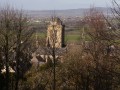
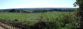
A countryside walk taking in the Saint-Pierre Chapel, the edge of the Bois du Névet and the hills overlooking Locronan.

Details

21634
Creation:
Last update:
Last review:
  • Walking
    Activity: Walking
  • ↔
    Distance: 6.41 mi
  • ◔
    Average duration: 3h 30 
  • ▲
    Difficulty: Moderate

  • ⚐
    Back to start: Yes
  • ↗
    Ascent: + 679 ft
  • ↘
    Descent: - 663 ft

  • ▲
    Highest point: 725 ft
  • ▼
    Lowest point: 171 ft
  • ⚐ Country: France
  • ⚐ City: Plogonnec (29180)
  • ⚑
    Start/End: N 48.0778° / W 4.191025°
  • ❏
    IGN map(s): Ref. 0518OT
  • Hour-by-hour weather

Photos

Description of the walk

Car park by the post office in Plogonnec.

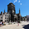
(S/E) Walk past the post office and take the small flight of steps leading round to the gable end of the town hall. You’ll emerge opposite the church; turn left into the street. Take the first street on the right, Rue du Placître, and walk past the media library. Take the pedestrian crossing on the left, which leads onto Rue des Fleurs and then the Route de Kerheun. Follow the yellow markings (Tro Sant Per) towards Kergroez

(1) At the first three-way junction, carry on straight ahead; then, when you reach a stream, turn left onto a wide path and follow it to the next road. Turn right, pass a cross on your right-hand side, then the hamlet of Kergroëz,

(2) Turn left at a 90° angle, pass the hamlet of Pennévet and continue to the next road.

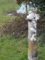
(3) At the Kergoat Nevet signpost, turn left onto the road towards Roz ar Veil. Go round the farm on the left and follow the wide, stony path leading to the Chapel of Saint-Pierre.

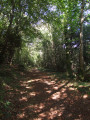
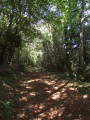
(4) Cross the fenced area of land, follow a path that crosses the Ruisseau le Névet via a footbridge and join a wide path which climbs to the right, heading north along the edge of the Bois de Névet. Follow this ascending path which runs alongside a small stream on your right. At the top of the woodland, follow a wire fence on your right and pass through the gap in the fence to reach a small road.

YellowPR® signposts

(5) At the junction with a road, turn right and follow it straight on.

(6) At the first junction, turn right onto Chemin de Park Tri Horn. At the end, veer left to join the D63 Plogonnec–Locronan.

(7) Follow it for 100m to the right (take care), cross it to join a stony path on the left, and head straight up to the next road.

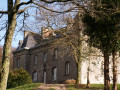
(8) Turn left, passing the Manoir de Kerguénolé (view of Douarnenez Bay).

(9) At the exit, turn right and follow the ascending stony path which goes round the campsite to join the road leading down from Locronan hill.

'Off the marked trail'

(10) Turn right and continue along this road to Croaz Keben, where there is indeed a cross, a waypoint on the Troménie route.

(11) Turn left and head down the road leading to the roundabout at the entrance to Plogonnec.

(12) Take the small road on the right that passes in front of the care home to reach the church and the post office car park (S/E).

Waypoints

  1. S/E : mi 0 - alt. 407 ft - Car park by the post office in Plogonnec
  2. 1 : mi 0.53 - alt. 400 ft - Go straight ahead at the three-way junction
  3. 2 : mi 1.21 - alt. 443 ft - Turn left at a 90° angle
  4. 3 : mi 1.55 - alt. 407 ft - Kergoat Nevet sign
  5. 4 : mi 2.17 - alt. 210 ft - Saint-Pierre Chapel
  6. 5 : mi 3.17 - alt. 482 ft - Road junction
  7. 6 : mi 3.52 - alt. 515 ft - Park Tri Horn path
  8. 7 : mi 3.89 - alt. 525 ft - Junction with the D63
  9. 8 : mi 4.2 - alt. 633 ft - Junction before the Manoir de Kerguénolé
  10. 9 : mi 4.5 - alt. 594 ft - On the right, exit from the manor house
  11. 10 : mi 4.92 - alt. 702 ft - Junction with the Route de la Montagne de Locronan
  12. 11 : mi 5.22 - alt. 663 ft - Croaz Kében
  13. 12 : mi 5.9 - alt. 427 ft - Return route via Plogonnec
  14. S/E : mi 6.41 - alt. 407 ft - Car park by the post office in Plogonnec

Notes

Public toilets at the car park at the start.
Simple walking shoes.
Partly marked with yellow signposts andthe GR®38between (9) and (10).

Worth a visit

Always be cautious and plan ahead when you're outdoors. Visorando and the author of this route cannot be held responsible for any accidents occurring on this route.

The GR® and PR® markings are the intellectual property of the Fédération Française de Randonnée Pédestre.

Reviews and comments

4 / 5
Based on 3 reviews

Reliability of the description
4 / 5
Ease of following the route
4 / 5
Route interest
4 / 5
lecamremi29
lecamremi29

Overall rating : 4 / 5

Date of your route : Mar 18, 2025
Reliability of the description : ★★★★☆ Good
Ease of following the route : ★★★★☆ Good
Route interest : ★★★★☆ Good
Very busy route : No

A lovely route that allowed us to explore other parts of Plogonnec. The stretch along the edge of the Bois du Névet and the sunken lanes near Locronan are very pleasant; it’s certainly a bit of a climb, but there are beautiful views of Locronan and Douarnenez Bay.

Machine-translated

marche quimper
marche quimper

Overall rating : 4.7 / 5

Date of your route : Aug 16, 2021
Reliability of the description : ★★★★★ Very good
Ease of following the route : ★★★★★ Very good
Route interest : ★★★★☆ Good
Very busy route : No

A nice walk… Quite easy…

Machine-translated

FLOCH
FLOCH ★

Thank you for your comment.
This was my first suggested walk on Visorando.

I’ll see how I can make it more precise.

Kind regards.

FLOCH

Machine-translated

tara29
tara29

Overall rating : 3.3 / 5

Date of your route : Sep 14, 2016
Reliability of the description : ★★★☆☆ Average
Ease of following the route : ★★★☆☆ Average
Route interest : ★★★★☆ Good

An interesting route, but there are no signposts at the exit from the Névez wood.

Machine-translated

Other walks in the area

For more walks, use our search engine .

The GPS track and description are the property of this route's author. Please do not copy them without permission.