Locronan Mountain Route

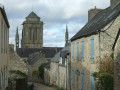
Let's climb Locronan Mountain, where we will have a view of the Porzay basin and Douarnenez Bay. Along the way, we can admire the Saint-Théleau Chapel and the Kerguénolé Manor and its grounds overlooking the village of Locronan.

Details

98088
Creation:
Last update:
Last review:
  • Walking
    Activity: Walking
  • ↔
    Distance: 6.67 mi
  • ◔
    Average duration: 3h 40 
  • ▲
    Difficulty: Moderate

  • ⚐
    Back to start: Yes
  • ↗
    Ascent: + 725 ft
  • ↘
    Descent: - 709 ft

  • ▲
    Highest point: 919 ft
  • ▼
    Lowest point: 344 ft
  • ⚐ Country: France
  • ⚐ City: Plogonnec (29180)
  • ⚑
    Start/End: N 48.077986° / W 4.190852°
  • ❏
    IGN map(s): Ref. 0518OT
  • Hour-by-hour weather

Photos

Description of the walk

Start: Place de la Poste in Plogonnec.

(S/E) From the car park, head towards the main street, Rue Saint-Thélau. Turn right towards Saint-Albin, crossing the bridge over the D63.

(1) At the end of the bridge, take a discreet path on the left which overlooks the departmental road. Continue straight on along the edge of the meadow, then turn right to reach the Fontaine Saint-Thurien, after which the church in Plogonnec is named. Follow the stream upstream to reach a well-restored wash house.

(2) At the road, turn left to reach the hamlet of Maner Beuliec. Just before the ‘private property’ sign, look out for a small blue arrow on the right indicating the path that allows you to go round the buildings and continue along the road.

GR®38: red and white markings

(3) Pass Penker Farm on your right and turn left onto the wide, signposted mountain-bike track which climbs in wide, circular loops.
Follow it until you reach a road at Parkou Ménez. Ignore the road that climbs to the left

No markings

(4) Turn left onto the track leading to the Saint-Théleau Chapel, whose bell tower is already visible. Pass the Route de la Boissière on your right and, shortly after a transformer, you’ll find the entrance to the chapel grounds on your left.
A pleasant spot for a short break whilst exploring the building and its history.

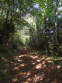
(5) Go round the chapel on the left and follow a narrow path that climbs through the woods. This is the steepest section. Carry on until you reach a road at the top. You’ll see a large pylon as a landmark.

(6) Turn left to reach the Ar Sonj Chapel on your right (the site of the annual Troménie procession (1)). From there, you’ll have a view of Douarnenez Bay.
As you leave the enclosure, begin the descent to the right. Pass the road on your right-hand side which leads directly down to Locronan. Continue towards Coat Beuliec and its small wayside cross.

GR®38: red and white markings

(7) Turn right onto a path that forms a wide circular loop. Pass the first path leading down to the campsite; when you reach another path, turn right (at the fallen tree) and continue the descent. You’ll be looking down on the Locronan campsite.

(8) When you reach a road, turn left to enter the grounds of the Manoir de Kerguénolé, from where you’ll have a breathtaking view of Locronan. Cross this communal land and, at the exit, take the small road on the left that leads uphill.

(9) Turn onto the first stony track on the right which leads down towards the D63; ignore the other paths branching off to the right.

Unmarked

When you reach the road, cross it carefully and follow it to the right for a few dozen metres before taking the first path on the left.

(10) Turn left again and follow the wide path that winds through the fields to join a road at Pennévet. Continue along this road to the left, then turn right towards Keravec.

(11) At Kervec, by the cross, follow the road to the left which leads to the village of Plogonnec. You’ll soon have the church spire in sight. Walk through a housing estate and continue along Rue des Fleurs, which leads onto a path through a small park.
On the street opposite the church, turn right, pass the media centre (a beautiful, renovated building) and cross the church grounds. As you pass, take a moment to admire the carved door of the south porch. You’ll come to the car park on your right (S/E).


Waypoints

  1. S/E : mi 0 - alt. 410 ft - Place de la Poste in Plogonnec
  2. 1 : mi 0.08 - alt. 400 ft - Junction with a little-used path
  3. 2 : mi 0.3 - alt. 371 ft - Washing house
  4. 3 : mi 0.68 - alt. 394 ft - Mountain bike trail.
  5. 4 : mi 1.69 - alt. 515 ft - Route de Saint-Thélau
  6. 5 : mi 2.01 - alt. 577 ft - Entrance to the enclosure of the Saint-Thélau Chapel
  7. 6 : mi 2.62 - alt. 915 ft - Summit.
  8. 7 : mi 3.3 - alt. 741 ft - Coat Beuliec Calvary
  9. 8 : mi 4 - alt. 594 ft - Entrance to the grounds of the Manoir de Kerguénolé.
  10. 9 : mi 4.3 - alt. 633 ft - Gravel path towards the D63.
  11. 10 : mi 4.67 - alt. 535 ft - Path through the fields.
  12. 11 : mi 5.78 - alt. 344 ft - Keravec Cross.
  13. S/E : mi 6.67 - alt. 410 ft - Place de la Poste in Plogonnec

Notes

Please wear walking boots and bring walking poles if you are used to using them.
Toilets are available at the start car park.
Refreshments available in Plogonnec.

Worth a visit

(1) La Troménie: ‘Tro Minihi’ means ‘the tour of the monastic estate’. The Grande Troménie is one of Brittany’s most important ‘pardons’. It takes place every six years, covering a 12km route. The next Grande Troménie will take place on Sunday 14 July 2019. The Petite Troménie is a 6km route held every year between each Grande Troménie.
http://www.infobretagne.com/locronan-tro...

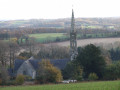
The15th-century Saint-Thurien Churchin Plogonnec.
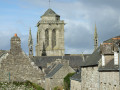
The 16th-century Saint-Théleau Chapel at the foot of Locronan Mountain.
Ar Sonjdominant Chapel, overlooking the Porzay basin from a height of 289 metres.

Kerguénolé Manor: Formerly owned by Mr Charles Daniélou, mayor of Locronan from 1912 to 1944, then by the sculptor Job Le Gall; acquired by the municipality of Locronan in 1985 with the support of the Finistère department and the Brittany Region.

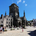
After your walk, you can head to Locronan, 5 km from Plogonnec: Listed as a Historic Monument since 1924, Locronan is one of Brittany’s most prestigious sites, thanks to its architectural quality.

Always be cautious and plan ahead when you're outdoors. Visorando and the author of this route cannot be held responsible for any accidents occurring on this route.

The GR® and PR® markings are the intellectual property of the Fédération Française de Randonnée Pédestre.

Reviews and comments

4.5 / 5
Based on 16 reviews

Reliability of the description
4.5 / 5
Ease of following the route
4.4 / 5
Route interest
4.4 / 5
Canif grognon
Canif grognon
• Edited:

Overall rating : 4.7 / 5

Date of your route : Sep 26, 2024
Reliability of the description : ★★★★☆ Good
Ease of following the route : ★★★★★ Very good
Route interest : ★★★★★ Very good
Very busy route : No

The description was a bit vague at times, but I really enjoyed the route.

Machine-translated

koulouba
koulouba

Overall rating : 4.3 / 5

Date of your route : Aug 05, 2024
Reliability of the description : ★★★★★ Very good
Ease of following the route : ★★★★☆ Good
Route interest : ★★★★☆ Good
Very busy route : No

a pleasant and varied hike with some superb views and two beautiful chapels along the way. The roads used are not busy with cars

Machine-translated

la petite renarde
la petite renarde

Overall rating : 4.3 / 5

Date of your route : Aug 06, 2023
Reliability of the description : ★★★★☆ Good
Ease of following the route : ★★★★☆ Good
Route interest : ★★★★★ Very good
Very busy route : No

Beautiful climb through woods, beautiful view of Douarnenez Bay.

Machine-translated

Cat29
Cat29

Overall rating : 5 / 5

Date of your route : Nov 20, 2021
Reliability of the description : Not used / Not applicable
Ease of following the route : ★★★★★ Very good
Route interest : ★★★★★ Very good
Very busy route : No

A surprising hike in the fog, which gave nature the feel of a horror film set.
We'll do it again in summer to enjoy the view of Douarnenez Bay.
A beautiful route, with a little bit of tarmac on the last few kilometres.

Machine-translated

Chantal&Olivier
Chantal&Olivier

Overall rating : 4 / 5

Date of your route : Jun 22, 2021
Reliability of the description : ★★★★★ Very good
Ease of following the route : ★★★★★ Very good
Route interest : ★★☆☆☆ Disappointing
Very busy route : No

Too much asphalt

Machine-translated

tess29000
tess29000

Overall rating : 4.3 / 5

Date of your route : Mar 25, 2021
Reliability of the description : ★★★★☆ Good
Ease of following the route : ★★★★☆ Good
Route interest : ★★★★★ Very good
Very busy route : No

A wonderful discovery of the area and Douarnenez Bay. Highly recommended
Thank you for the work of the visorandonneur.

Machine-translated

marcheurs07
marcheurs07

Overall rating : 4.7 / 5

Date of your route : Sep 11, 2020
Reliability of the description : ★★★★★ Very good
Ease of following the route : ★★★★★ Very good
Route interest : ★★★★☆ Good
Very busy route : No

Nice walk, beautiful wash house, beautiful chapel

Machine-translated

FLOCH
FLOCH ★

Thank you, bpja, for clarifying that.
I didn't know about this fountain.
I went to check it out and will be able to mention it in the description.

Best regards

Machine-translated

bpja
bpja

Overall rating : 4.7 / 5

Date of your route : Sep 14, 2018
Reliability of the description : ★★★★★ Very good
Ease of following the route : ★★★★☆ Good
Route interest : ★★★★★ Very good

Superb hike, beautiful view of the bay, discovery of chapels.
On the road leading to Maner Beuliec, there is a wash house and, 50 metres further along the river, a restored fountain.
To reach the summit of Mount LOCRONAN, follow the path uphill.
Thank you for this route.

Machine-translated

gronan 29
gronan 29

Overall rating : 4 / 5

Date of your route : Sep 10, 2018
Reliability of the description : ★★★★☆ Good
Ease of following the route : ★★★★☆ Good
Route interest : ★★★★☆ Good

A pleasant hike that can be done at a leisurely pace within the given time frame.
We had a few minor doubts at times, which could have been avoided if distance indicators had been provided at certain points. But with a bit of logic and the help of the map, everything went smoothly.

Machine-translated

regibertrand@orange.fr

Overall rating : 4.3 / 5

Date of your route : Aug 20, 2018
Reliability of the description : ★★★★★ Very good
Ease of following the route : ★★★★☆ Good
Route interest : ★★★★☆ Good

Machine-translated

emmalouboutin
emmalouboutin

Overall rating : 5 / 5

Date of your route : Jul 23, 2018
Reliability of the description : ★★★★★ Very good
Ease of following the route : ★★★★★ Very good
Route interest : ★★★★★ Very good

A superb hike with the discovery of Saint Thélo Chapel. It was a very powerful moment.
With the IGN map, it is very easy for beginners to find their way around. Then, at the end of the route, discovering Locronan and Douarnenez Bay – you couldn't hope for anything more beautiful.
Thank you so much for this route, which allowed me to treat my friends.
A wonderful day.

Machine-translated

jlucquimper
jlucquimper

Overall rating : 5 / 5

Date of your route : Apr 23, 2018
Reliability of the description : ★★★★★ Very good
Ease of following the route : ★★★★★ Very good
Route interest : ★★★★★ Very good

A very pleasant walk to discover Locronan.

Machine-translated

hascoet
hascoet

Overall rating : 4.3 / 5

Date of your route : Dec 20, 2016
Reliability of the description : ★★★★☆ Good
Ease of following the route : ★★★★☆ Good
Route interest : ★★★★★ Very good

a beautiful hike in lovely dry weather.
we discovered old paths and enjoyed panoramic views of Doarnenez Bay from the AR SONj chapel. We also visited Locronan and its Christmas market, illuminations, nativity scenes
...and mulled wine

best regards

Machine-translated

FLOCH
FLOCH ★

Thank you for your comment.
At this time of year, it's a good idea to combine your visit with a trip to Locronan at night.
However, remember to plan your return for nightfall.
Best regards

FLOCH

Machine-translated

Other walks in the area

For more walks, use our search engine .

The GPS track and description are the property of this route's author. Please do not copy them without permission.