Country:
 City:
City:


Car park: Espace Ti Lokorn
(S/E) On leaving the car park, turn right into Rue du Four, walk past the Espace Ti Lokorn, then the library and the former glassworks. Walk past the town hall car park and take the path between the church and the houses.
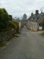
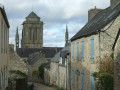
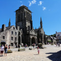
Turn left, walk past the beautiful porch of Saint-Ronan’s Church (which you can visit – the church is usually open) and head into Rue Saint-Maurice, which climbs steadily.
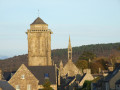
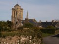
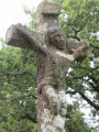
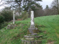
Pass the ALSH (day-care centre) on your right, then a little further up, on your left, two crosses, one of which is missing its top. As you climb, look back regularly to see Locronan Church and the Porzay landscape appearing in the background. You’ll reach the entrance to the Manoir de Kerguénolé.
GR®38signposting: White and Red
(1) Turn left to enter the manor’s grounds and continue along this wide path. Note, on your left, the ‘Chêne du Névet’ (Névet Oak), planted by schoolchildren from Locronan in 2007 to mark the forum on deforestation. (Beautiful view over Douarnenez Bay).
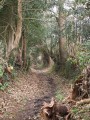
At the top, ignore the road leading down to the left and continue along a sunken track. Pass under a fallen tree and ignore a path on the right.
(2) At the next three-way junction, turn left following the signposting, leaving the path on the right. Continue along this track at the edge of the woods, overlooking the campsite below on your left.
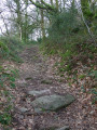
At the next fork, turn right, ignoring the path that climbs up from the left, coming from the campsite. Continue along this rutted track until you reach the junction with a small road at a place called Coat Beuliec, marked by a small wayside cross.
Unmarked section
Turn left onto this small road, which climbs straight up towards the summit of the Locronan mountain. At the junction with the road leading off to the left (sign for the campsite, 300 m), take the hairpin bend (offering sweeping views over Douarnenez Bay and Ménez Hom). Follow this small road downhill and pass the sign marking the entrance to Locronan (water reservoir on the left).
(3) Turn right onto an inconspicuous path marked for mountain bikes. At the Fork in the road that appears immediately, veer left and follow a single track that descends, at times steeply, as it winds round the ‘Camp des Salles’ site, a Carolingian fortification surrounded by embankments and stones. The site has now been reclaimed by vegetation following the last excavations in 1989. Only a section of wall has been uncovered by the team that mapped out this route. Follow this path along the earthen embankment as it zigzags between the trees.
At the bottom, with the sports ground visible on the left, turn right, following the track which climbs slightly before descending again into a coniferous woodland. Continue down through the deciduous trees and find a gap in the embankment to reach a wide path overlooking the D7.
⚠️This part of the route does not appear on any map (newly cleared land) and the route is not a GPS track. I found it difficult to stick as closely as possible to the mountain bike trail.
(4) Turn right onto this wide track and, after about 100 m, keep left onto a faint path that leads into an area of coniferous trees (do not continue along the wide track, which climbs steadily). Carry on straight ahead between the trees overlooking the road and follow this track as it veers left to descend towards the D7.
Cross the departmental road with care; on the left, follow the sign for Route du Créach, which turns right (large ‘wintering’ sign), and you’ll reach Kervavarn Farm (a large stone house).
YellowPR® markings in the opposite direction to the route and few in number.
Just before the farm, turn left into a sunken lane, continue straight on and you’ll reach a major crossroads. Turn right (look out for a small stone wall) and follow this path, which leads to a small road. Opposite the ‘Le Styvel’ sign, turn right and you’ll reach a three-way junction.
(5) Take a hairpin bend to pass close to Le Styvel farm (beautiful stone buildings) and continue along the same path which climbs back up towards the D7 (a stone marking the end of the path).
Cross the D7 again with care and head uphill opposite along a path called Chemin du Styvel to reach a street in a residential area.
No signposting
(6) At the junction, carry straight on along a path lined with hydrangeas, ignore the Venelle des Charrettes on the right and emerge onto Rue des Charrettes.
Cross it and take the path (with a barrier) leading uphill opposite, running alongside the town hall car park.
At Rue du Four, turn left towards the Espace Ti Lokorn, where the car park is located (S/E).



 Visorando Member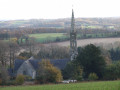

 Easy
Easy