The Molière and Sornin plateaus

A walk between two limestone plateaus in the Northern Vercors, passing close to the Gouffre Berger and the sharp limestone pavement.
Can be done on snowshoes in winter.

Details

43759
Creation:
Last update:
Last review:
  • Walking
    Activity: Walking
  • ↔
    Distance: 14.06 mi
  • ◔
    Average duration: 9h 20 
  • ▲
    Difficulty: Difficult

  • ⚐
    Back to start: Yes
  • ↗
    Ascent: + 3,337 ft
  • ↘
    Descent: - 3,323 ft

  • ▲
    Highest point: 5,597 ft
  • ▼
    Lowest point: 4,009 ft

Description of the walk

Park at Les Merciers (above Lans via Les Egaux) or in the valley, 300m before (by the roadside on a wide bend).

(S/E) Take the yellow-green marked path which climbs up to Les Merciers.

(1) Take the path on the left to reach a T-junction.

(2) Turn right onto a steep track running alongside a meadow to reach the woodland. Join a ridge path. Go round a rocky valley and climb through the woods before emerging onto the plateau. Head due west (to the left) to reach the Refuge des Molières.

(3) Turn right and follow an almost flat path to reach the Plateau de la Molière orientation table.

(4) Continue straight ahead along the Sentier des Génisses. At the edge of the forest, you’ll reach a crossroads of paths.

(5) Turn right and carry on until you reach the junction with theGR®9.

(6) Turn right onto it for a few metres, then leave it and head off to the left. Follow this path downwards to reach the cliff edge at the Dent du Loup.

(7) Return along the same route to theGR® junction.

(6) Turn right here and follow the red-and-white markings. Follow the almost flat path to reach the Plénouze junction.

(8) Leave theGR® here and turn left, passing Plénouze and its fountain, and shortly afterwards you’ll reach the crossroads you passed on the way out.

(5) Continue straight ahead to return to the Table d’Orientation junction.

(4) Turn right onto the ridge path, which leads to the summit of Charande.

(9) Continue along this pleasant ridge path, passing the Pas de l’Ours and then reaching the Pas de Bellecombe.

(10) Head down to the right to reach the plateau. Turn right onto the wide track and head towards the livestock watering holes. Leave the track and take the signposted path on the left. You’ll reach the summit of the Montagne de la Graille.

(11) Take the signposted path on the right to reach the road. Follow the road uphill to the left to return to the Merciers car park (S/E).


Waypoints

  1. S/E : mi 0 - alt. 4,009 ft - Les Merciers car park
  2. 1 : mi 0.16 - alt. 4,068 ft - Les Merciers
  3. 2 : mi 0.55 - alt. 4,360 ft - Elevation 1329
  4. 3 : mi 1.4 - alt. 5,105 ft - La Molière Alpine Lodge (1,565 m)
  5. 4 : mi 2.78 - alt. 5,358 ft - Orientation table
  6. 5 : mi 3.34 - alt. 5,305 ft - Crossroads
  7. 6 : mi 4.36 - alt. 5,020 ft - GR9
  8. 7 : mi 5.89 - alt. 4,537 ft - Dent du Loup
  9. 8 : mi 8.32 - alt. 5,164 ft - Crossroads
  10. 9 : mi 10.69 - alt. 5,597 ft - Charande 1709m
  11. 10 : mi 11.93 - alt. 5,318 ft - Pas de Bellecombe
  12. 11 : mi 13.14 - alt. 4,682 ft - Montagne de la Graille
  13. S/E : mi 14.06 - alt. 4,012 ft - Les Merciers car park

Notes

A long walk with no major difficulties. Water available only at the Molières refuge.
Sturdy walking boots and a map are essential.

This route passes through a protected area, which may be subject to special regulations:

Worth a visit

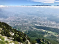
Large grassy plateaus with flowers in June. Stunning views of the Alps. Between the two plateaus, the sharp limestone pavement and the Gouffre Berger (30 mins return).

Always be cautious and plan ahead when you're outdoors. Visorando and the author of this route cannot be held responsible for any accidents occurring on this route.

The GR® and PR® markings are the intellectual property of the Fédération Française de Randonnée Pédestre.

Reviews and comments

4.2 / 5
Based on 3 reviews

Reliability of the description
4.3 / 5
Ease of following the route
4 / 5
Route interest
4.3 / 5
grossif
grossif

Overall rating : 5 / 5

Date of your route : Aug 22, 2022
Reliability of the description : ★★★★★ Very good
Ease of following the route : ★★★★★ Very good
Route interest : ★★★★★ Very good
Very busy route : No

Not very busy because of the rain; otherwise, it’s a nightmare.

Machine-translated

AL1COTT
AL1COTT

Overall rating : 3 / 5

Date of your route : May 23, 2021
Reliability of the description : ★★★☆☆ Average
Ease of following the route : ★★☆☆☆ Disappointing
Route interest : ★★★★☆ Good
Very busy route : Yes

This hike offers a stunning panoramic view of the surrounding mountain ranges; the route along the ridge to the Pas de Bellecombe is really lovely and provides a magnificent view.
A detour to see the Gouffre Berger, the first ‘-1000’, is a bonus.
We returned via Sornin from the Dent du Loup to avoid a round trip and to top up our water supplies.
The area is very popular as the road access to La Molière from Autrans makes it a very family-friendly walk.
The presence of water sources along the route provides a very welcome opportunity to top up your water supplies on a hike in hot weather: the Lodge de la Molière, two springs between points 3 and 4, a spring in Sornin, and a water source at an altitude of 1,531 metres at the fork before point 12.
The route description is rather ‘minimalist’ and could do with being expanded, as not all water points are shown on the map.
The GPS track is ‘approximate’ in several sections of the route, particularly between points 2 and 3 at an altitude of 1,476 metres, where you must carefully follow the path that takes the ridge on the left after the end of the climb up the meadow.
At point 12, it is possible to avoid returning via the road by turning left to rejoin point 2.
Nevertheless, it’s a lovely route that we thoroughly enjoyed.

Machine-translated

casillas
casillas

Overall rating : 4.7 / 5

Date of your route : Jan 31, 2020
Reliability of the description : ★★★★★ Very good
Ease of following the route : ★★★★★ Very good
Route interest : ★★★★☆ Good

A lovely walk, but we set off too late to complete the circular route; the climb was very steep for 2 km. We stopped at the plateau at 4.30 pm and returned via the same route. A shame – one to do again.

Machine-translated

Other walks in the area

For more walks, use our search engine .

The GPS track and description are the property of this route's author. Please do not copy them without permission.