The Pas de la Corne and Pas du Curé circular loop

A shaded walk with a few views, starting from Les Jaux d’Engins. A direct ascent to the Pas de la Corne, then on via the Goulet des Moulins and beneath the cliff. The descent takes you through the Défilé du Coulou and the classic Pas du Curé, returning to Les Jaux d’Engins via the dam.

Details

25021866
Creation:
Last update:
Last review:
  • Walking
    Activity: Walking
  • ↔
    Distance: 2.14 mi
  • ◔
    Average duration: 2h 00 
  • ▲
    Difficulty: Moderate

  • ⚐
    Back to start: Yes
  • ↗
    Ascent: + 1,129 ft
  • ↘
    Descent: - 1,152 ft

  • ▲
    Highest point: 3,593 ft
  • ▼
    Lowest point: 2,726 ft

Description of the walk

Park at the Engins car-share car park on the D531 heading towards Grenoble. A second small car park is available further down, next to the dam. It’s better to park there than on the road leading up to the Ferme des Rapilles.

(S/E) Follow the road carefully as far as the hamlet of Les Jaux.

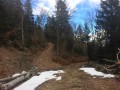
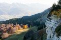
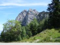
(1) Turn left onto theGR® (marked in white and red), passing between two houses. The path crosses the Furon via a small bridge before beginning the climb up to the Pas de la Corne. The climb includes a few steps to get past some rocks and, towards the end, even a handrail. Just before the Pas de la Corne, you’ll find a beautiful viewpoint over the Furon valley. Continue along the path, which remains at a constant altitude, to reach the Goulet des Moulins.

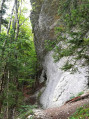
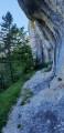
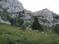
(2) Head down to the left: follow the yellow and green markings. Pass beneath the cliff to reach the highest point of the walk.

(3) Take the second path on the right, leaving the first one which heads back up to Saint-Nizier via Corba. The descent is pleasant and steady, leading down to the Défilé du Coulou. Then follow the gorge to the left to reach the famous Pas du Curé with its steps and ramp. Continue along the path which runs alongside the hamlet of Batardière before joining the road.

(4) Follow the road to the left, cross the dam – where you’ll find some interesting information – and join the D531. Turn left again and walk carefully alongside the D531 until you reach the car-sharing area (S/E).

Waypoints

  1. S/E : mi 0 - alt. 2,769 ft - Engins Car-sharing Car Park
  2. 1 : mi 0.2 - alt. 2,802 ft - Start of the GR°°®°°
  3. 2 : mi 0.71 - alt. 3,556 ft - Goulet des Moulins junction
  4. 3 : mi 1.11 - alt. 3,465 ft - High point, junction
  5. 4 : mi 1.76 - alt. 2,831 ft - Batardière, path/road junction
  6. S/E : mi 2.14 - alt. 2,769 ft - Engins Car-sharing Car Park

Notes

The walk is shaded all the way.
Do remember to take walking poles for the climb.
Do not attempt this walk in wet weather: several sections are rocky and can become very slippery.

Allow 2 hours 30 minutes without any specific breaks. Visorando’s estimate of 1 hour 30 minutes is a bit optimistic.

Worth a visit

After the walk, do pop into the Ferme des Rapilles to try some cheese made right there on the farm.

Always be cautious and plan ahead when you're outdoors. Visorando and the author of this route cannot be held responsible for any accidents occurring on this route.

The GR® and PR® markings are the intellectual property of the Fédération Française de Randonnée Pédestre.

Reviews and comments

4.2 / 5
Based on 3 reviews

Reliability of the description
4 / 5
Ease of following the route
4.7 / 5
Route interest
4 / 5
pelerin77b
pelerin77b

Hello Ange
This was my first walk that I’d picked out from a hiking website. Usually I plot my own route on the map, and if I get it wrong when reading it, I’ve only myself to blame. I was interested in this one, but the dotted lines on the map worried me a bit. So I wanted to put my mind at rest. I’d read the description of the Pas de la Corme and the Curé carefully, and I knew it wouldn’t be easy; that’s partly why I went there – to test myself and check the posts. Based on the description, I thought the difficulties would be in the Coulou Gorges; there’s nothing mentioned about the Pas de la Corme, or perhaps I hadn’t looked into it thoroughly enough. In fact, there is a warning about technical sections. According to one post, the Pas de la Corme section was closed. Hence my route was the reverse of the description – I figured I’d go via the Pas du Curé and complete a circular route via the plateau.
My rating isn’t down to disappointment with the route itself, although… It’s down to the difficulty of the terrain.
I’ve also read the reviews
Given my age, I’ve clocked up quite a few kilometres on flat ground and in low-altitude mountains (I don’t do high-altitude hiking), and when I read a post recommending this to beginners, I think it can’t be that difficult. Yet there’s certainly enough here to put them off mountain walking for good. It’s a challenging walk.
You have to admit that throughout the walk, we’re walking through the forest; even at the edge of the cliff we’re in the woods, and thankfully that spares us from seeing the 200-metre drop. It has to be said that the descent from the Pas de la Corme is, how shall I put it… a slide; it really deserves a ‘no entry’ sign whilst the path is being repaired and the ground stabilised. And it was dry. I think it was the third day without rain. On certain sections, it was just as well I was planting my walking stick into the ground to steady my footing; and thankfully – even though environmentalists are against it – I hadn’t put the spike covers on, because there’s no longer a proper path; it’s just a gully. I’m actually surprised they’re letting the terrain deteriorate like this. And unfortunately, it’s not just here. You’re simply looking for a spot where your footing will be stable. I’d gone too far to turn back, but at one point I seriously considered turning back. The climb up via the Pas du Curé, on the other hand, seemed a bit easier to me…
I therefore agree with the comment posted on 29 April 2024: a difficult, even dangerous walk with children. You’ll have to manage the child’s descent as well as your own. A fall is guaranteed. It’s no joy at all to emerge at a spectacular site such as a cirque, a monument or a 360° viewpoint.
As the post from 29 April 2024 suggests, it can only satisfy trekkers or hikers seeking challenges and thrills. For the hiker looking for something else, this isn’t for them, and they need to be told so.

Machine-translated

Ange Heureux
Ange Heureux
• Edited:

Hello pelerin77b,
I’m sorry to hear that you were disappointed with this walk. But did you read the description before choosing it? Because the text addresses the points you’ve raised right from the introduction and in the practical information section… So you were bound to be disappointed.
Happy hiking
Ange

Machine-translated

pelerin77b
pelerin77b

Overall rating : 2.7 / 5

Date of your route : Jun 15, 2024
Reliability of the description : ★★☆☆☆ Disappointing
Ease of following the route : ★★★★☆ Good
Route interest : ★★☆☆☆ Disappointing
Very busy route : No

Hello, I’m just passing through to have a rest after crossing the Chartreuse via the Entremont Valley. I set off on the adventure of the Pas de la Corne and the Curé. In a few reviews, I’d read about how challenging the terrain was. Indeed, there are ramps to help you get over the cliffs, but even so, it’s not easy. The path is never wide, and the descent from the Pas de la Corne is still very technical on slippery ground. The slope is steep – very steep – the path barely visible, with hikers having to find their own way. This is not a walk for beginners; you need proper footwear, and walking poles are essential for support or to plant your feet firmly on the descent where the path has been washed away by erosion. It’s absolutely essential to do this in good weather. I realised it was a GR route, but I couldn’t see myself descending the Pas de la Corne with a 12 kg rucksack. Do not attempt this with children or dogs. On the Via Vercors map, the route is shown passing through the Charvet plateau, and the two sites mentioned above are classified as dangerous. The Via Vercors is a gentle route crossing the Vercors. Some might say that at my age – 67 – I’ve only got the gentle trails left to explore. I found the route rather disappointing; only the upper section at the foot of the rock – provided you’re not afraid of walking along a 40-cm-wide path – is of any interest. The rest takes place in the forest with no views, or else you’re just watching where you put your feet.

Machine-translated

Atoutcorde
Atoutcorde

Overall rating : 5 / 5

Date of your route : May 06, 2024
Reliability of the description : ★★★★★ Very good
Ease of following the route : ★★★★★ Very good
Route interest : ★★★★★ Very good
Very busy route : No

A lovely walk.

Machine-translated

Guiliz
Guiliz
• Edited:

A rather uninteresting walk,
Dangerous, especially for children, with a section alongside very steep embankments,
Just one lovely view; the rest of the route is through the forest.
Very steep at the start; in fact, most of the elevation gain is covered in 30 minutes.
I wouldn’t recommend it, except for trail runners

Machine-translated

Otsoa
Otsoa

Overall rating : 5 / 5

Date of your route : Jun 24, 2023
Reliability of the description : ★★★★★ Very good
Ease of following the route : ★★★★★ Very good
Route interest : ★★★★★ Very good
Very busy route : No

A lovely walking route; it took us about 2 hours and 10 minutes to complete the circular route. The start is quite steep but is manageable with a few breaks. The rest of the walk is very pleasant, mainly in the shade, at the foot of some beautiful cliffs.
I highly recommend this walk, especially to beginners or anyone looking for a pleasant, not-too-long stroll!

Be careful in summer – there may be a few ticks about towards the end of the walk, but nothing too serious.

Machine-translated

Other walks in the area

For more walks, use our search engine .

The GPS track and description are the property of this route's author. Please do not copy them without permission.