The Val d’Aube

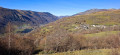
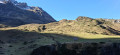
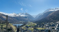
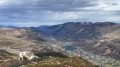
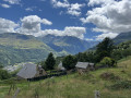
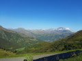
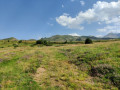
Explore the upper Louron Valley, amongst barns, high-altitude fir forests and terraced pastures.

Details

67130009
Creation:
Last update:
Last review:
  • Walking
    Activity: Walking
  • ↔
    Distance: 8.23 mi
  • ◔
    Average duration: 6h 00 
  • ▲
    Difficulty: Moderate

  • ⚐
    Back to start: Yes
  • ↗
    Ascent: + 2,520 ft
  • ↘
    Descent: - 2,592 ft

  • ▲
    Highest point: 5,476 ft
  • ▼
    Lowest point: 3,251 ft

Photos

Description of the walk

Head to Loudenvielle via the D25 from Arreau. Car park opposite the mini-golf course, Place des Badalans.

(S/E) From the car park, turn right onto the Chemin des Badalans, then take the Chemin de Clarabide heading due south. Continue until you reach a crossroads.

(1) Turn right onto the Chemin d’Artiguelongue and follow it to the hydroelectric power station.

(2) Cross the D725 with care and continue straight ahead along an old track. Cross the road again and you’ll reach a wider track which runs parallel to the road before veering off to the right. Cross the Ruisseau d’Aube and climb the steep slope up to the road.

(3) Cross the road carefully and follow the path opposite which climbs to a hilltop: the Spios viewpoint. Descend and walk alongside the road for about 100 metres.

(4) After passing the metal barrier, take the wide path on the right which climbs steeply. Walk past the small hydroelectric power station and reach the Pont de Hournets.

(5) Without crossing the bridge, continue along the path to the right and keep climbing on the left bank of the Ruisseau d’Aube. Cross a clearing, then take a path that climbs through the fir forest.

.(6) Carry on straight ahead along the small reservoir and reach the Cabane d’Ourtiga (alt. 1,620 m).

(7) Carry on for about a hundred metres. Cross the Ruisseau d’Aube, choosing the most accessible routes between the rocks, and climb up the opposite side to rejoin the well-markedGR®10, which will take you left, on a gentle descent, to Germ.

(8) You may wish to take a short break to admire the pretty houses and the church. Continue along theGR®10down a steeper slope to Loudenvielle, which you’ll reach at the Chemin des Edelweiss. Turn right and head for the town hall square and its small car park.

(9) Walk past the church and follow the Chemin de la Bayle. Turn right onto the Chemin de l’Églantine, then left to join the Chemin de Clarabide. Cross over and take the Chemin des Badalans opposite, which leads back to the starting car park (S/E).


Waypoints

  1. S/E : mi 0 - alt. 3,337 ft - Place des Badalans car park
  2. 1 : mi 0.25 - alt. 3,333 ft - Artiguelongue Path
  3. 2 : mi 0.82 - alt. 3,409 ft - Hydroelectric power station - Neste du Lourou (rivière) - Affluent de la Neste
  4. 3 : mi 1.49 - alt. 3,816 ft - Cross the road
  5. 4 : mi 1.61 - alt. 3,835 ft - Path on the right
  6. 5 : mi 2.14 - alt. 4,357 ft - Hournets Bridge
  7. 6 : mi 3.16 - alt. 5,102 ft - Reservoir, dam
  8. 7 : mi 3.74 - alt. 5,463 ft - Ourtiga Hut
  9. 8 : mi 6.9 - alt. 4,554 ft - Germ
  10. 9 : mi 7.83 - alt. 3,360 ft - Loudenvielle, Chemin des Edelweiss
  11. S/E : mi 8.23 - alt. 3,261 ft - Place des Badalans car park

Worth a visit

Loudenvielle: museum complex, Balnéa thermal leisure centre, Lake Génos-Loudenvielle.
Germ: Church of the Invention of Saint Stephen (16th century).
Saoussas Mill.

Always be cautious and plan ahead when you're outdoors. Visorando and the author of this route cannot be held responsible for any accidents occurring on this route.

The GR® and PR® markings are the intellectual property of the Fédération Française de Randonnée Pédestre.

Reviews and comments

4.3 / 5
Based on 3 reviews

Reliability of the description
4 / 5
Ease of following the route
4.3 / 5
Route interest
4.7 / 5
bichouck34
bichouck34

Overall rating : 4.3 / 5

Date of your route : Aug 10, 2026
Reliability of the description : ★★★★☆ Good
Ease of following the route : ★★★★☆ Good
Route interest : ★★★★★ Very good
Very busy route : Yes

A lovely walk to go on
You walk along the river for much of the route (so there’s no need to carry a spare water bottle – you can top up from the river)
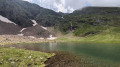
The arrival at the Cabane d’Ourtiga is very pretty, overlooking the cirque formed by the huge mountains all around. I’d recommend it without hesitation

Machine-translated

User 22941287

Overall rating : 4.3 / 5

Date of your route : Nov 03, 2025
Reliability of the description : ★★★★☆ Good
Ease of following the route : ★★★★☆ Good
Route interest : ★★★★★ Very good
Very busy route : No

Good app, but I don't see the difference between the free and paid versions. We took a wrong turn and the app took too long to tell us we'd made a mistake. A few synchronisation issues, but otherwise a very good app.

Machine-translated

Patrick_Cde31
Patrick_Cde31

Overall rating : 4.3 / 5

Date of your route : Feb 14, 2025
Reliability of the description : ★★★★☆ Good
Ease of following the route : ★★★★★ Very good
Route interest : ★★★★☆ Good
Very busy route : No

The route was covered in snow at higher altitudes, so it was very tricky to complete… but we managed to reach the hut at the highest point of the route.
The first section features very open countryside, but this quickly gives way to more enclosed terrain as you head towards the hut
There are also some very steep and long climbs before the Pont de la Chèvre

Machine-translated

Other walks in the area

For more walks, use our search engine .

The GPS track and description are the property of this route's author. Please do not copy them without permission.