Pic de Néouvielle via the Refuge de la Glère

A 9-hour hike of high difficulty. Wilder, longer and less frequented than the ascent from Lac d’Aubert (which it joins for the final 300 metres of ascent), it passes numerous lakes and torrents.
It combines many different types of terrain: from tracks suitable for vehicles to sections where you’ll need to use your hands, as well as scree slopes of all sizes and snowfields.
A challenging mountain hike requiring physical stamina and a good sense of direction.
You will be entering the Néouvielle National Nature Reserve, which is protected by regulations. Please respect these regulations (see practical information).

Details

n°1319055
Creation:
Last update:
Last review:
  • Walking
    Activity: Walking
  • ↔
    Distance: 9.73 mi
  • ◔
    Duration according to the author: 10 hrs 
  • ▲
    Difficulty: Very difficult

  • ⚐
    Back to start: Yes
  • ↗
    Ascent: + 5,056 ft
  • ↘
    Descent: - 5,056 ft

  • ▲
    Highest point: 10,023 ft
  • ▼
    Lowest point: 5,509 ft

Photos

Description of the walk

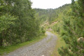
(DA) The start is at the bottom of the Glère valley. The path is very stony, but passable with all-terrain tyres.
You can choose between the yellow-marked path or the track suitable for vehicles.

(1) After about an hour’s walk along the track, you’ll reach the Refuge de la Glère.
To avoid having to walk a few dozen metres further up to the refuge, it’s best to finish on the footpath.

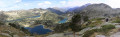
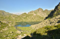
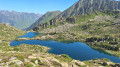
(2) The path skirts around Lac de la Glère on the left. You’ll need to walk right alongside the water to avoid the large rockfall.
Beyond the first ledge, the path continues along a virtually flat section to Lac de Mounicot. You then reach the stream, which you follow to Lac de la Mourèle.

(3) You then walk until you come to a concrete culvert. Follow it along to the sluice gate

(4) Continue along the stream. This section is quite pleasant but very long.

(5) Once you reach the first large scree slope, things get trickier. Follow the cairns and keep to the left where the boulders are slightly smaller.

(6) Danger! The scree slope turns into a loose rock field where all the stones are very unstable. Keep as far to the outside as possible to avoid the risk of being hit by a falling stone.
Note: Keep an eye on those above you and warn those following behind. It’s best to be on your own on this section, which is about a hundred metres long.
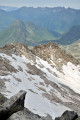
Once past the first ledge, the rocks are stable. Put on your crampons to cross the snowfields.

(7) About thirty metres from the Chausenque gap, the terrain becomes less stable again.
Once past the breach, if the snow is good, you can carefully traverse the snow slope with crampons. The slope is steep, but this avoids having to descend too far to rejoin the Aubert route

(8). Then ascend in zigzags on the snow as far as possible.

(9) Finish with a section where you’ll need to use your hands.
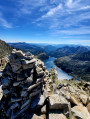
You can then enjoy the view from the summit, which isn’t quite a full 360° due to the presence of the Pic des Trois Conseillers. To the north, you can see the Pic du Midi de Bigorre. To its right, clearly visible, is the Arbizon. Further to its right, above Lac de Cap de Long, in the distance (>30 km), is the Posets. Continuing beyond the Trois Conseillers, you can see the Taillon. Then, in the distance, the Vignemale with its glacier. And the Balaïtous just to its right, in the distance.
The return journey follows the same route back to the grassy car park by the stream (S/E).

Waypoints

  1. S/E : mi 0 - alt. 5,509 ft - Grass car park by the stream
  2. 1 : mi 1.96 - alt. 7,037 ft - Refuge de la Glère (2153m)
  3. 2 : mi 2.06 - alt. 6,906 ft - Lac de la Glère
  4. 3 : mi 2.86 - alt. 7,543 ft - Lac de La Mourèle
  5. 4 : mi 3.16 - alt. 7,700 ft - Water source.
  6. 5 : mi 3.68 - alt. 8,120 ft - Large scree slope
  7. 6 : mi 3.92 - alt. 8,494 ft - Caution: area of unstable ground
  8. 7 : mi 4.22 - alt. 9,147 ft - Brèche de Chausenque (2790m)
  9. 8 : mi 4.35 - alt. 9,058 ft - Junction with the Aubert route
  10. 9 : mi 4.95 - alt. 9,970 ft - A section where you’ll need to use your hands to climb. Near the - Pic de Néouvielle ou d'Aubery (3091m)
  11. S/E : mi 9.73 - alt. 5,509 ft - Grass car park by the stream

Notes

Regulations concerning the Néouvielle National Nature Reserve:
• Dogs are not permitted in the core zone of the Pyrenees National Park, even when kept on a lead
• Dog boarding facilities – enquiries at Aragnouet Town Hall – Tel: 05 62 39 62 63
• No fires, to prevent wildfires and soil damage
• Please keep quiet to preserve the peace and tranquillity of the area
• Please bring bin bags with you to carry your rubbish back down
• No picking or collecting of plants, minerals or fossils is permitted
• Capturing animals is prohibited
• Regulated camping is permitted more than an hour’s walk from a road access point, between 7.00 pm and 9.00 am
• No camping or motorhome parking overnight to preserve the beauty of the sites and prevent pollution
• Hunting and fishing are prohibited

  • Crampons are essential. If you don’t have any, a large sports shop on the main square in Luz-Saint-Sauveur has them for hire.
  • Numerous sections over scree and snowfields require good, waterproof hiking boots with a stiff, grippy sole (such as Vibram).
  • Do not underestimate the amount of water you need to take with you: 2.5 litres seems to be the minimum. The Refuge de la Glère has a water supply in case of need.
  • Waterproof or water-repellent trousers (and/or gaiters) are useful on snow.

This route passes through multiple protected areas, which may be subject to special regulations:

Reviews and comments

4 / 5
Based on 2 reviews

Reliability of the description
4.5 / 5
Ease of following the route
3.5 / 5
Route interest
4 / 5
lila3113
lila3113

Overall rating : 4 / 5

Date of your route : Jul 19, 2024
Reliability of the description : ★★★★★ Very good
Ease of following the route : ★★★☆☆ Average
Route interest : ★★★★☆ Good
Very busy route : No

These are indeed very technical sections
We did it the other way round and I wouldn’t recommend it
The descent from the pass was very chaotic
The markings are only there so you can see them when going the other way
The descent over the boulders, each one as unstable as the next, gave us quite a fright

Between Aubert and the pass, it’s brilliant – tough but doable
But on the other side, all the way to Glere, it was very tricky

It took us 10 hours from Aubert to Glere via the pass

Machine-translated

MAGET Jacques
MAGET Jacques

Overall rating : 4 / 5

Date of your route : Aug 20, 2023
Reliability of the description : ★★★★☆ Good
Ease of following the route : ★★★★☆ Good
Route interest : ★★★★☆ Good
Very busy route : No

I did this route in September 2023; I didn’t do a round trip: I climbed the Néouvielle from the Glére refuge via the Brèche de Chaussenque, then descended to Lac d’Aumard

I found it difficult. Lots of stones – big stones. Whilst the distance of 11.44 km isn’t particularly long, the elevation gain is significant at 1,481 m. It took me 9 hours, including breaks.

A wild area with magnificent scenery,

Machine-translated

Other walks in the area

For more walks, use our search engine .

The GPS track and description are the property of this route's author. Please do not copy them without permission.