


ocarton

 Visorando Member
 Premium user
 - Gender: man
Sign up:
Published route(s)
 Lac dets Coubous, Lac de la Jonquère and Lac de Tracens
 7.08 mi
 +2,398 ft
 -2,398 ft
 5h 20
5h 20
 Moderate
 Departure from Barèges (Hautes-Pyrénées)
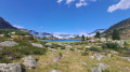
This is a very accessible walk. After following a valley where irises bloom in late July, it climbs up to the Lac de Barrage dets Coubous. It then winds its way from lake to lake, across the meadows of a high-altitude cirque.
Pic de Néouvielle via the Refuge de la Glère
 9.73 mi
+5,056 ft
-5,056 ft
10 hrs
9.73 mi
+5,056 ft
-5,056 ft
10 hrs
 Very difficult
Departure from Barèges (Hautes-Pyrénées)
Very difficult
Departure from Barèges (Hautes-Pyrénées)
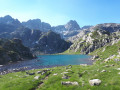
A 9-hour hike of high difficulty. Wilder, longer and less frequented than the ascent from Lac d’Aubert (which it joins for the final 300 metres of ascent), it passes numerous lakes and torrents.
It combines many different types of terrain: from tracks suitable for vehicles to sections where you’ll need to use your hands, as well as scree slopes of all sizes and snowfields.
A challenging mountain hike requiring physical stamina and a good sense of direction.
You will be entering the Néouvielle National Nature Reserve, which is protected by regulations. Please respect these regulations (see practical information).
Pic de Baxouillade
 8.44 mi
+3,005 ft
-3,005 ft
6h 30
8.44 mi
+3,005 ft
-3,005 ft
6h 30
 Difficult
Departure from Fontrabiouse (Pyrénées-Orientales)
Difficult
Departure from Fontrabiouse (Pyrénées-Orientales)
The Pic de Baxouillade dominates the Galbe, Laurenti and Orlu valleys. The access path through the Galbe valley, which is fairly quiet, climbs gradually through wide mountain pastures and passes close to two lakes, including the Portella d'Orlu.
The only difficulty on the hike is a steep section in a couloir at 2,450 metres, where you will need to use your hands on the rock to help you climb, but it is not rock climbing.
Pic de Portarras via the Campana du Cloutou refuge
 11.48 mi
+4,403 ft
-4,400 ft
9h 05
Difficult
Departure from Campan (Hautes-Pyrénées)
11.48 mi
+4,403 ft
-4,400 ft
9h 05
Difficult
Departure from Campan (Hautes-Pyrénées)
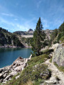
Between the mountain pastures of the upper Campan valley, where cows and sheep graze, and the towering peaks of Bastan and Portarras, this hike runs alongside a dozen or so bodies of water of all sizes and colours, ranging from forest green to deep blue.
This hike (difficult+) requires a minimum of preparation: steep slopes, significant elevation gain, rocky terrain, scree, high mountains.