Pic de la Journalade via a circular loop from the Col de Port

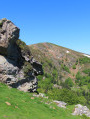
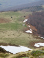
The Pic de la Journalade, visible from afar due to its jagged contours, is reserved for fit and experienced walkers. The first section is very accessible. The second section, between points (3) and (4), involves a lot of scrambling to cross three very steep rocky outcrops, requiring you to use your hands and stow away your walking sticks. The final ascent to the Journalade is very steep but not dangerous. The descent is tricky as there is no path and there are many hazards: a slippery slope and rocky outcrops to negotiate before reaching a proper path.

Details

106942280
Creation:
Last update:
Last review:
  • Walking
    Activity: Walking
  • ↔
    Distance: 8.60 mi
  • ◔
    Average duration: 6h 45 
  • ▲
    Difficulty: Very difficult

  • ⚐
    Back to start: Yes
  • ↗
    Ascent: + 3,222 ft
  • ↘
    Descent: - 3,205 ft

  • ▲
    Highest point: 6,348 ft
  • ▼
    Lowest point: 4,098 ft

Photos

Description of the walk

Head up to the Col de Port from Tarascon-sur-Ariège or Massat: large car park.

(S/E) Take the path heading south-south-west, then, near the bend in the track, take the path leading up to the left, due south, along the edge of the forest. After a lovely, steady climb, you’ll reach the Pic d’Estibat: 360° panoramic views.

(1) Head south-east, to the left, following the fence to reach the large rocks of the Sommet des Griets.

(2) Turn right, heading south, whilst continuing to follow the fence. You’ll reach the Col de l’Estagnou.

(3) Continue straight on towards the south up a very steep slope leading to the foot of the rocky outcrops. Cross the fence to the left about 200 m before the start of the climb. Put your walking poles away and cross three rocky outcrops, taking great care. Do not attempt this in rainy or even damp weather, as it could be extremely dangerous. After a final very steep climb, you’ll reach the Pic de la Journalade at 1,945 m: another 360° panorama.

(4) At this point, there are two options:
_ either turn back and descend the three rocky outcrops,
_ or carry on to complete a circular route. The downside: there is no path for 2 to 3 km over rough and treacherous terrain (choose your route carefully). Descend south-eastwards, heading for the Cap de la Dosse. Halfway down, turn left, heading due east, to descend into the valley.

(5) Choose your turning point according to the terrain to bypass the impassable rocky outcrops on the left. Descend north, north-east, navigating the terrain as best you can to rejoin the path coming from Saurat.

(6) Turn left onto this path, which joins and generally follows the Ruisseau de Loulmet – at least at the start – before veering off to the left to join a forest track in the Forêt de Sauzet, leading to a forester’s cottage.

(7) Carry straight on along the track through the woods. You will then emerge from the woodland to reach the Cabane d’Estibat.

(8) Go round the hut and continue along the path which climbs north-westwards to reach the ridge and join the ascent path. Descend to the Col de Port and the car park (S/E).

Waypoints

  1. S/E : mi 0 - alt. 4,098 ft - Car park - Col de Port
  2. 1 : mi 1.04 - alt. 5,446 ft - Pic d'Estibat (1663)
  3. 2 : mi 1.79 - alt. 5,292 ft - Sommet des Griets (1621 m)
  4. 3 : mi 2.51 - alt. 5,233 ft - Col de l'Estagnou (1592 m)
  5. 4 : mi 3.38 - alt. 6,348 ft - Pic de la Journalade (1945 m)
  6. 5 : mi 3.91 - alt. 5,801 ft - Junction
  7. 6 : mi 4.65 - alt. 4,954 ft - Crossroads – Rocky outcrops
  8. 7 : mi 6.92 - alt. 4,199 ft - Forest house
  9. 8 : mi 7.53 - alt. 4,357 ft - Estibat Hut
  10. S/E : mi 8.6 - alt. 4,098 ft - Col de Port car park

Notes

From (S/E) to (3): a slightly steep section in places but not a problem.

From (3) to (4): a tricky section; not recommended in wet weather or for less experienced walkers.

From (5) to (6): a treacherous and rather unpleasant descent.

Worth a visit

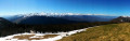
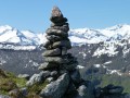
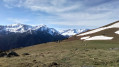
(1) Beautiful 360° view: to the north, the Prat d’Albis ridge stretching as far as Cap de Carmil. To the west, the Vallier and perhaps the Pic du Midi de Bigorre, weather permitting. To the south, the Rouch, the Pique Rouge de Bassiès, the Pic des Trois Seigneurs, the Journalade of course, and the Cap de la Dosse. To the east, the Tarbésou, the Soularac and the Saint-Barthélémy, and the Fourcat.

(4) The same view as from the Pic d’Estibat but closer to the Pic des Trois Seigneurs.

(7) A lovely coniferous forest crossed by a forest track – a welcome sight at the end of the walk!

Other walks in the area

For more walks, use our search engine .

The GPS track and description are the property of this route's author. Please do not copy them without permission.