


Refine your search for walks in Col de Port
Col de Port walks


 Pic d'Estibat from the Col de Port
 Visorando Member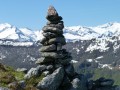
 6.04 mi
 +1,857 ft
 -1,857 ft
 4h 25
4h 25
 Moderate
 Departure from Boussenac (Ariège)
A pleasant, easy hike from the Col de Port, in a magnificent setting combining forest, stream, picnic area and views of the Pyrenees. Not very busy except at the pass.
Pic de Razels from Col de Port
 4.18 mi
+1,647 ft
-1,647 ft
3h 20
Moderate
Departure from Boussenac (Ariège)
4.18 mi
+1,647 ft
-1,647 ft
3h 20
Moderate
Departure from Boussenac (Ariège)
A short, easy Sunday hike (500 m elevation gain) leading to Pic de Razels (1,600 m) with a magnificent 360° view. After a winding climb, you reach the ridge, which you follow to the left through a pretty wood to the peak. Lovely views all along the way.
Col de Mazel and Pech de Therme from Col de Port
 8.50 mi
+2,628 ft
-2,589 ft
6h 10
Moderate
Departure from Boussenac (Ariège)
8.50 mi
+2,628 ft
-2,589 ft
6h 10
Moderate
Departure from Boussenac (Ariège)
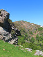
A beautiful hike with lovely views of the town of Foix and its castle, as well as the Pyrenees mountain range.
A very quiet hike, with unspoilt nature, shaded sections in the forest and sections exposed to the sun.
 Pic d'Estibat and Sommet des Griets circular from the Col de Port
 5.52 mi
+1,896 ft
-1,873 ft
6 hrs
Moderate
Departure from Boussenac (Ariège)
5.52 mi
+1,896 ft
-1,873 ft
6 hrs
Moderate
Departure from Boussenac (Ariège)
This is a beautiful hike accessible from the Col de Port, offering magnificent views of the Pyrenees mountain range, from Saint-Barthélémy in the east to Mont Valier and beyond in the west. After a fairly short climb to Pic d'Estibat, the hardest part is over, as the rest of the route continues in a circular fashion along a beautiful ridge before descending through woods and returning on the north side via a pretty valley past the Estibat hut.
Please take note of the comments in the practical information section.
From Prat d’Albis to the Pic de Razels via the Rocher de Batail
 14.04 mi
+2,969 ft
-2,956 ft
9h 00
14.04 mi
+2,969 ft
-2,956 ft
9h 00
 Very difficult
Departure from Ganac (Ariège)
Very difficult
Departure from Ganac (Ariège)
A very beautiful ridge walk, without any difficulty, suitable for both summer and winter, with quick access from Foix.
From Col de Port to Cap de Carmil
 7.06 mi
+2,480 ft
-2,480 ft
5h 25
Moderate
Departure from Boussenac (Ariège)
7.06 mi
+2,480 ft
-2,480 ft
5h 25
Moderate
Departure from Boussenac (Ariège)
A lovely walk starting from the Col de Port, with stunning views of the Pyrenees range: Mont Fourcat, Saint-Barthélémy, Montcalm, Pic d’Estats, Trois Seigneurs, Mont Vallier and, on a clear day, sometimes the Pic du Midi de Bigorre. The walk can be halved by turning back at the Pic de Razels.
Pic de la Journalade via a circular loop from the Col de Port
 8.60 mi
+3,222 ft
-3,205 ft
6h 45
Very difficult
Departure from Boussenac (Ariège)
8.60 mi
+3,222 ft
-3,205 ft
6h 45
Very difficult
Departure from Boussenac (Ariège)
The Pic de la Journalade, visible from afar due to its jagged contours, is reserved for fit and experienced walkers. The first section is very accessible. The second section, between points (3) and (4), involves a lot of scrambling to cross three very steep rocky outcrops, requiring you to use your hands and stow away your walking sticks. The final ascent to the Journalade is very steep but not dangerous. The descent is tricky as there is no path and there are many hazards: a slippery slope and rocky outcrops to negotiate before reaching a proper path.