Country:

 City:


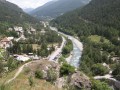
The walk starts from Meyries, a small hamlet on the hills above Château-Queyras. Access is via a narrow country lane. A car park with around ten spaces is situated in the heart of the hamlet.
(S/E) From the car park, head due west for barely 100 metres until you reach the edge of the hamlet, at the information sign and the crossroads.
(1) At the signpost, head towards Col de la Crèche, taking the track that branches off to the right above the village. Follow this track for about 500 m until you reach the bend just before a large mast.
(2) At the ‘Le Puy’ signpost, leave the track and take the path which climbs to the left, still heading towards Col de la Crèche. Climb through the woodland, crossing a track several times, until you reach the ‘Platenq, La Charpennelle’ signpost.
(3) Leave the track and take the path branching off to the left, north-west, into a pine forest, still heading towards the Col de la Crèche.
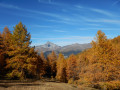
When the vegetation thins out and larch trees replace the pines, you’ll cross a cow pasture. Make sure you close the gate properly!
Once you’ve left the forest, the pass isn’t far away! (15 to 20 mins).
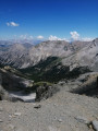
(4) The section from the Col de la Crèche to the Pic de l’Agrenier is not signposted, but the route is not particularly difficult until you reach the ruins of the old signal station.
Head right, north-east, along the Crête de Croix la Crêche via the fairly well-marked path.
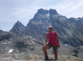
(5) The final part of the ascent requires a bit of care and attention. Follow the numerous cairns which lead first to two crosses (the old one and the new one from 2022 stand side by side) and then to the Pic de l’Agrenier a few metres further on . This section is not recommended for those prone to vertigo.
(6) “From this well-deserved summit, enjoy the extraordinary view.” Turn back towards the Col de la Crèche.
(4) Cross over to the other side of the mountain, heading north-west, facing the Pic de Rochebrune, until you reach the edge of the woodland.
(7) Then look out for the path branching off to the right, heading due north. Descend through this larch forest, heading south-west then north-west, until you reach a sheep paddock and the Bergerie de Péas.
(8) Turn left towards Rouet and Meyriès, following theGR®58andGRP® signposts. The return journey is mainly along a dirt track. Head for Rouet.
(9) In Rouet, I recommend a short detour to the Saint-Charles chapel, surrounded by its cemetery. Take the street that leads down past the fountain, then head back up to the village’s main road and continue towards Les Meyries to reach the car park in the centre of the hamlet (S/E).


 Visorando Member
 Moderate

 Easy