Country:
 City:
City:


(S/E) Leaving the centre via Rue du Moulin, turn right and immediately follow Rue du Baillois to the right, which continues as the Sentier Passiche. Before the road, turn right, staying on the Sentier du Baillois, which continues as the Chemin du Belloy. This leads to the Route du Ry-Beau-Ry; turn left at the Jean Milo roundabout and continue along the first street on the left, Rue Mahiermont (steep climb for 260 m). Follow this until number 80 on the left.
(1) Turn left, staying on Rue Mahiermont, which becomes a path until the junction with the Tout-Laid Trail 12. Continue straight ahead onto the Chemin du Gros Chêne aux Renards. Follow it to the end and turn right onto Route de Renipont. Take the first road on the left: Sentier de l’Hayette. Go straight on to cross Chemin d’Odrimont, follow the path as it curves to the left and then runs alongside the woods of a castle.
(2) Turn right onto Ruelle Maho, then right again onto Moulin d'Ohain. Turn left and continue left onto Rue de l'Église Saint-Étienne. Turn left onto Route de la Marache. At the junction after the two ponds, turn left onto Rue d'Aguinot, which crosses the River Smohain and ends at Rue de Genleau.
(3) Follow it to the left. Turn left at the first junction onto Chemin des Hayes. At the roundabout, follow it to the right and continue straight ahead onto Chemin de Dadelane. At the T-junction, take the left-hand branch.
(4) After the bridge over the Smohain, take the path on the right, Chemin de la Chapelle, which joins Chemin du Moulin. Follow it to the left for about fifty metres before turning right onto Sentier des Bruyères, leading to Chemin de Chaubrire. Turn left, then right onto the second street: Rue de Smohain. First turn right then left onto the Sentier de Haute Brire, which crosses the Clos de la Brire and leads to the Chemin de la Brire; follow this to the right.
(5) Ignore a turn-off to the left, then two more to the right, and continue along Avenue de la Pinède. Continue left onto Avenue des Perdrix and rejoin Route de Renipont, which you should follow to the right. After passing a street on your left, continue along Rue du Pont and pass “La Guinguette” on your right. At the T-junction, take the left-hand branch onto Chaussée de Lasne, then, after number 12 on the right, turn right onto Rue du Baillois. The road takes a sharp right-hand bend and runs alongside the houses of Le Baillois on your right.
(6) After number 28, turn right into Rue Lambermont and follow it to the junction with the Sentier Dyna Beumer, which you take on the right. Continue left and cross Rue Saint-Roch. Place Quai du Tram. Cross the square to Rue Haute.
(7) Cross Rue Haute. Straight ahead, slightly to your left, follow the Val Héron path. This path leads to the roundabout with the cinema, the Intermarché and the Q8 petrol station. Cross at the pedestrian crossing on your left. Turn right and cross the pedestrian crossing straight ahead, opposite the brasserie on the corner of Avenue F. Roosevelt and Avenue de Mérode.
(8) Take Avenue de Mérode, passing the cinema, until you reach the first street on the left leading to the town hall, which is still Avenue de Mérode. Take this street and enter Rixensart’s municipal park. After the car park behind the town hall, take the path that leads into the woods. The police station is on your left. Cross the woods/park, keeping to the left. First follow the ‘library’ sign, walk round the back of this building (which is on your left), and then follow the ‘Rixensart station’ sign.
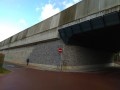
(9) When you reach the railway line, turn briefly left and then go under the bridge on the right. After the bridge, at the crossroads, do not take Avenue Monseigneur, but the street on your right, Rue du Patch. After about a hundred metres, on your left, take the Sentier Marguerite, which leads to Rue de l’Institut.
(10) Turn slightly left onto Rue de l’Institut. Cross Rue de l’Institut. Straight ahead, Sentier Marguerite continues and leads to Rue A. de Hautefenne. On this street, turn left onto the Cimetière path. Follow the path to Rue du Plagniau. Turn left, then take the street on the right: Avenue Général Naessens de Loncin until you reach the T-junction.
(11) Turn left onto Avenue de la Rochefoucauld until you reach the roundabout. At the next roundabout, turn right onto Rue de l’Institut. Continue to the next roundabout. Turn leftonto Rue de la Hulpe. Follow this street to the roundabout with the Café du Lac;cross Rue de Genval. Turn left onto Zilverbeekdreef. You will arrive at Lake Genval.
(12) Go round the lakeon the right-hand side, i.e. the Overijse shore, following Meerlaan. Continue to the end of the lake and Meerlaan, which becomes Avenue du Lac in Genval. Continue along Avenue du Lac, passing the Château du Lac, then take the path on the left that runs alongside the lake and is closed to traffic: Promenade Paul Harris. At the end of this path, take the second right, which climbs steeply: Avenue du Théâtre.
(13) At the end of Avenue du Théâtre, turn right onto Avenue des Cormiers until you reach the roundabout. Go straight through the roundabout. At the next roundabout, go straight on and follow the route past Place des Martyrs and the railway tracks (on your right). At the Schtroumpf roundabout, turn right onto Rue de Rosières, go straight across the junction with Avenue Albert 1er and turn left onto Rue de la Station, which continues as Avenue des Combattants. Follow it for about 1 km (on the left-hand pavement).
(14) Pass the Drève du Val Saint-Pierre on your left. Pass the Marcel Ladrière path (between houses numbered 106 and 104), which is still on your left. Take the Françoise Humblet-Vieujean path on the left (just before number 52), which leads to the Le Carpu Nature Reserve. On the right, the Sentier du Carpu leads to Rue du Moulin. The starting point is fifty metres to the right (S/E).
 Visorando Member
 Easy
Easy 
 Moderate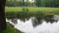
 Association / Club / Walk leader