Short walk around the Cirque d’Orvaz

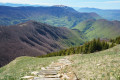
A relatively short route designed to take you round the Cirque d’Orvaz. Along the way, you can enjoy some lovely views.

The walk has been classified as ‘difficult’ due to a few steep sections and some areas potentially exposed to rockfalls.

Details

n°7340927
Creation:
Last update:
Last review:
  • Walking
    Activity: Walking
  • ↔
    Distance: 4.96 mi
  • ◔
    Average duration: 3h 45 
  • ▲
    Difficulty: Difficult

  • ⚐
    Back to start: Yes
  • ↗
    Ascent: + 1,680 ft
  • ↘
    Descent: - 1,683 ft

  • ▲
    Highest point: 3,944 ft
  • ▼
    Lowest point: 2,369 ft

Photos

Description of the walk

Start from the road leading to the hamlets of Orvaz (in the municipality of Belleydoux) at a junction (where there are a few recycling bins).

(S/E) Follow the road uphill for about 700 m.

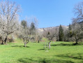
(1) Just before reaching the hamlet, carry on along the small road on the left and, after crossing the bridge, walk past a wash house and head up the grassy path on the left. After first turning left then right, you’ll arrive at a sloping meadow.

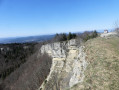
(2) Pass a spring and head right across the meadow, then quite quickly left, heading uphill. The path leading into the forest is not very clearly visible at first, but soon becomes more obvious. The going is a little steep in places; the regular markings (pink circles) help you find your way. A little further up,take care on a few sections crossing scree slopes overhanging ravines and potentially exposed to rockfalls. After skirting the top of a small cliff (lovely view), head left up a somewhat steep slope

(3) Follow the path to the left. The route is easy to follow with no significant change in altitude (follow the yellow markings). Ignore two paths on the right and join a small tarmac road (a place called Le Montelet, according to the signpost).

(4) Turn slightly left onto the small road.

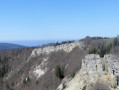
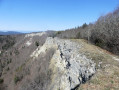
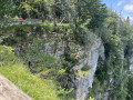
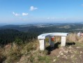
(5) Not far on, take a path on the left (follow the yellow markings). Head west-north-west along the edge of a ravine, then, shortly afterwards, you’ll reach a remarkable viewpoint. Walk along the top of the cliffs (take care) for a short while until you reach a fork in the path.

(6) Take the path on the left towards Orvaz. Just before reaching a pasture, walk along its left-hand side and join a path on the left leading into the forest (a route known as the ‘Postman’s Path’). Descend a few steep slopes (marked with yellow signs), then come out onto a track which you follow to the right.

(7) After about a hundred metres, turn left (Chemin du Soufflet). Head first north-north-east, then south-south-east. The descent is gentle at first, becoming steeper further on. After a short while, you’ll reach a pasture, then quite quickly rejoin the route you previously followed near the hamlet of Orvaz. Turn right onto the small road.

(1) Continue to the right, then return to the starting point (S/E).

Waypoints

  1. S/E : mi 0 - alt. 2,372 ft - Route d’Orvaz – Junction
  2. 1 : mi 0.43 - alt. 2,497 ft - Orvaz
  3. 2 : mi 0.58 - alt. 2,625 ft - Water source
  4. 3 : mi 1.4 - alt. 3,743 ft - Path junction
  5. 4 : mi 2.09 - alt. 3,937 ft - Small road
  6. 5 : mi 2.21 - alt. 3,907 ft - Start of the trail on the left
  7. 6 : mi 2.94 - alt. 3,825 ft - Junction
  8. 7 : mi 3.46 - alt. 3,205 ft - Chemin du Soufflet
  9. S/E : mi 4.96 - alt. 2,372 ft - Route d’Orvaz – Junction

Notes

Good walking boots and walking poles are recommended.
In wet weather, be careful as the ground can be slippery.

Nature doesn’t appreciate your rubbish. Please take it away with you!

It is not possible to park in the hamlet of Orvaz.

The route is generally in good condition:
- From (S/E) to (2): a very easy walk along a small road.
- From (2) to (4): a slightly steep path. A few pink markings help you find your way
- From (4) to (6): an easy route with no significant elevation gain. Follow the yellow markings.

Take care near the cliffs around the Roches d’Orvaz.
If you cannot find the path after (4), you can also continue along the road to reach (6) (Roches d’Orvaz).
The start of the Sentier du Facteur is moderately easy to spot.

From (6) to (7): A well-marked trail (yellow markings) with a few fairly steep sections at times.

From (7) to (S/E): the route is fairly easy along a good path marked in yellow. Along the way, there are a few steep sections.

The route described here partly follows another route in the same area: ‘Around the Combe d’Orvaz’, which offers an alternative, easier and shorter route to the Roches d’Orvaz via a circular route.

This route passes through a protected area, which may be subject to special regulations:

Worth a visit

Reviews and comments

4 / 5
Based on 2 reviews

Reliability of the description
4.5 / 5
Ease of following the route
3.5 / 5
Route interest
4 / 5
Attila 27
Attila 27

Overall rating : 4 / 5

Date of your route : Jul 08, 2024
Reliability of the description : ★★★★★ Very good
Ease of following the route : ★★★★☆ Good
Route interest : ★★★☆☆ Average
Very busy route : No

A lovely walk at the start of summer; no particular problems along the way; spotted a chamois on the way down…

Machine-translated

marion.claude
marion.claude

Overall rating : 4 / 5

Date of your route : Feb 05, 2024
Reliability of the description : ★★★★☆ Good
Ease of following the route : ★★★☆☆ Average
Route interest : ★★★★★ Very good
Very busy route : No

A lovely walk in the Giron area, offering views of the Jura’s distinctive landscape.
The only drawback is the difficulty in finding the correct start point over the first 200 metres or so, until you come across the first pink marker, which is a bit of a hit-and-miss affair. Once you’ve found the first marker, it’s plain sailing (a big thank you to whoever took their little spray can for a spin). I’m not a fan of GPS-guided walks and think it’s better to rely on the description, written in proper French, and the use of maps.
In conclusion, thank you for this lovely walk.
We combined it with walk 814929, Belleydoux–Orvaz, which allows you to avoid a steep descent at the cost of a few extra kilometres – which were very pleasant!

Machine-translated

Other walks in the area

For more walks, use our search engine .

The GPS track and description are the property of this route's author. Please do not copy them without permission.