The Pic du Perthus Oriental via the Ravin du Gratadis and the Roussivau

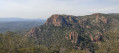
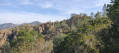
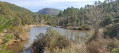
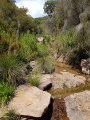
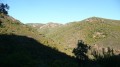
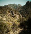
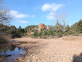
You walk along the ridge beside the Ruisseau du Perthus, then through the Ravin du Gratadis with its pretty little lake. From Col Aubert, you reach Col du Baladou and then Col du Perthus. You descend to Col du Mistral and reach the Sigallon bridge, passing beneath the Pic du Perthus Occidental and the Barre de Roussivau. Finally, we follow the Vallon de la Cabre. The vegetation is abundant: cork oaks, downy oaks and a few eucalyptus trees. Lavender, rosemary and heather offer a whirlwind of pleasant scents.

Details

31295810
Creation:
Last update:
Last review:
  • Walking
    Activity: Walking
  • ↔
    Distance: 7.96 mi
  • ◔
    Average duration: 4h 50 
  • ▲
    Difficulty: Moderate

  • ⚐
    Back to start: Yes
  • ↗
    Ascent: + 1,391 ft
  • ↘
    Descent: - 1,381 ft

  • ▲
    Highest point: 804 ft
  • ▼
    Lowest point: 39 ft

Photos

Description of the walk

In Agay, head up Avenue du Gratadis, then take Route Roussivaou on the right. Pass the Esterel Caravaning campsite and head down to the Gué de la Font du Pommier car park.

(S/E) Cross the Ruisseau du Perthus and join a path in the woods opposite. Follow this path uphill to the left, keeping to the stream. At the fork, go straight on.

(1) Cross the Ravin du Bagnolin and climb the slope opposite via a path through the slate. Ignore a path leading down to the left, then turn right onto a path that follows the ridge: view of Les Perthus. At the large rock, continue along the ridge

(2) Turn left at the junction.

(3) At the junction of five paths, take the one opposite marked in yellow.

(4) At the T-junction, turn right, then turn left about a hundred metres further on.

(5) Where the path approaches the road (about 20 m), head down to it via a path not shown on the map. Cross the road and take the path opposite that leads down towards the Ravin du Gratadis. Follow the stream and pass by a pretty little lake.

(6) At Col Aubert, turn left.

(7) At Col du Baladou, cross the wide track and climb the path opposite.

(8) At Col du Perthus, turn left onto the path leading down. At the T-junction, turn left. Pass by the summit of Pic du Perthus Oriental and follow the path down. Once back on the wide path you crossed earlier, turn left.

(9) At Col du Mistral, head down the path on the right: a shortcut not shown on the IGN map but present on OSM Trails. Continue along the road to the right. Cross the Perthus bridge and take the Ravin du Perthus path on the right.

(10) After about 200 m, take the hairpin bend onto the path on the left. Ignore a path on the right. Turn right, then left after a climb. Further on, turn right and cross a concrete slab at the Vallon de l'Amandier.

(11) At the junction not far from the Roussivau Forest House, go straight on.

(12) Take the hairpin bend to the left. Then turn right onto the wide path and cross the Pont de Sigallon.

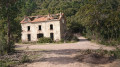
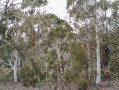
(13) At the right-hand bend, take the path down to the left and cross the stream in the Vallon de l'Apié de Sigallon. Shortly afterwards, turn right. At the clump of eucalyptus trees, continue along the path that leads downhill. At the left-hand bend, take the short path down to the right to reach the road. Turn right and head to the car park (S/E).

Waypoints

  1. S/E : mi 0 - alt. 46 ft - Car park at the Font du Pommier ford.
  2. 1 : mi 0.25 - alt. 66 ft - Bagnolin Ravine
  3. 2 : mi 0.94 - alt. 302 ft - Junction
  4. 3 : mi 1.05 - alt. 262 ft - Crossroads of five paths
  5. 4 : mi 1.31 - alt. 279 ft - Turn right
  6. 5 : mi 1.57 - alt. 213 ft - Path on the left
  7. 6 : mi 2.47 - alt. 371 ft - Col Aubert (100m)
  8. 7 : mi 2.78 - alt. 541 ft - Col du Baladou (165m)
  9. 8 : mi 3.28 - alt. 636 ft - Col du Perthus (190m)
  10. 9 : mi 4.46 - alt. 302 ft - Col du Mistral (92m)
  11. 10 : mi 4.99 - alt. 194 ft - Junction
  12. 11 : mi 5.9 - alt. 404 ft - Crossroads
  13. 12 : mi 6.23 - alt. 436 ft - Junction
  14. 13 : mi 6.6 - alt. 253 ft - Junction
  15. S/E : mi 7.96 - alt. 49 ft - Car park at the Font du Pommier ford.

Notes

There are no water points or shelters along the route.
Bring plenty of water, especially in hot weather.
Wear sturdy footwear as there are some very stony sections.

(11) You can take the path on the right and make a return trip to the Barre du Roussivau, 450 m away with an elevation gain of 125 m.

Worth a visit

The Ravin du Gratadis lake.
The Pic du Perthus Oriental.
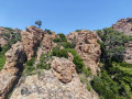
The Barre de Roussivau.

Reviews and comments

4.5 / 5
Based on 4 reviews

Reliability of the description
4.8 / 5
Ease of following the route
4.5 / 5
Route interest
4.3 / 5
lestef
lestef

Overall rating : 4 / 5

Date of your route : Aug 29, 2025
Reliability of the description : ★★★★☆ Good
Ease of following the route : ★★★★☆ Good
Route interest : ★★★★☆ Good
Very busy route : No

A pleasant hike in the hills above Agay.
Access to the starting point is a little complicated due to the closure of the track and then difficulties in reaching the start of the route. As already mentioned, you have to cross the dry riverbed, climb a small embankment and push through the brambles, which for me was . But after that, there were no major difficulties.
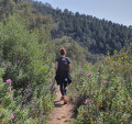
Not very busy at the end of August.

Machine-translated

after
after

Overall rating : 4.3 / 5

Date of your route : Apr 21, 2024
Reliability of the description : ★★★★★ Very good
Ease of following the route : ★★★★☆ Good
Route interest : ★★★★☆ Good
Very busy route : No

In April, the cistus and wild lavender are in bloom; follow the stream and ravines, with a variety of flora; the end of the hike is a gentle descent, which helps you recover.
To reach the start, head up through the forest (absolutely lovely) – it’s not easy to find as the dry bed of the Perthus stream has eroded. Use your GPS (follow the Visorando tracks) and look for a small path that climbs gently 10–20 metres from the edge of the stream’s ravine.
A great start to other hikes.
The estimated time is spot on, allowing you to enjoy the countryside and stop for a few breaks.
Thanks, aisenmann

Machine-translated

cathy asoa
cathy asoa

Overall rating : 4.7 / 5

Date of your route : Feb 04, 2024
Reliability of the description : ★★★★★ Very good
Ease of following the route : ★★★★★ Very good
Route interest : ★★★★☆ Good
Very busy route : No

A lovely walk 🥾, before the rain sets in. The short round trip mentioned in the description is well worth doing for the views of the Dramont and the Bay of Fréjus. There are also lovely views towards the Rocher de Roquebrune.

Machine-translated

Virginie83
Virginie83

Overall rating : 5 / 5

Date of your route : Nov 05, 2023
Reliability of the description : ★★★★★ Very good
Ease of following the route : ★★★★★ Very good
Route interest : ★★★★★ Very good
Very busy route : No

A lovely walk!!
Varied scenery and a well-marked route
For your information, the return trip to the Roussivau bar is 1.4km there and back with a 230m climb; the detour is definitely worth it, with magnificent sea views and panoramic scenery!!
Thanks to the author for sharing this

Machine-translated

Other walks in the area

For more walks, use our search engine .

The GPS track and description are the property of this route's author. Please do not copy them without permission.