


Refine your search for walks in Passerelle de Corbassière
Passerelle de Corbassière walks


 A circular route to the Panossière Hut starting from the Cabane Brunet car park
 Visorando Member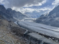
 9.99 mi
 +3,497 ft
 -3,484 ft
 7h 40
7h 40
 Difficult
 Departure from Bagnes (Valais)
A magnificent route in the heart of the Val de Bagnes, with breathtaking views of the Combins massif and its glaciers. The route starts at the Brunet hut, continues to the Corbassière footbridge and then climbs to the Panossière hut. It largely follows the Bec de Sery circular trail, ascending the Col des Avouillons on the way out and continuing the circuit via La Maille on the way back.
Walks near Passerelle de Corbassière
Panossière Hut - Chanrion Hut
 9.72 mi
+3,921 ft
-4,501 ft
7h 55
9.72 mi
+3,921 ft
-4,501 ft
7h 55
 Very difficult
Departure from Bagnes (Valais)
Very difficult
Departure from Bagnes (Valais)
This is a fairly long stage but set against a magnificent backdrop. The Mauvoisin dam is impressive, as are all the waterfalls along the right bank of the lake. The route passes through the easy and beautiful Tsofeiret Pass.
Brunet Hut - Panossière Hut
 4.16 mi
+2,815 ft
-1,070 ft
4h 20
4.16 mi
+2,815 ft
-1,070 ft
4h 20
 Moderate
Departure from Bagnes (Valais)
Moderate
Departure from Bagnes (Valais)
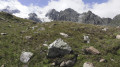
The route passes through the Col des Avouillons before descending to the rest of the Corbassière glacier, which is crossed via a spectacular 200 m long footbridge over a 70 m drop. The high mountains reveal themselves after the pass in a grandiose setting.
Brunet Hut - Louvie Hut
 5.46 mi
+3,333 ft
-2,930 ft
5h 25
Difficult
Departure from Bagnes (Valais)
5.46 mi
+3,333 ft
-2,930 ft
5h 25
Difficult
Departure from Bagnes (Valais)
This fifth stage crosses the Val de Bagnes. To the right of the Cabane Brunet, follow the path that descends directly to Fionnay. Be careful, this very steep path with countless tree roots can be slippery and dangerous in wet weather. Cross the road that leads to Fionnay. The path to the Louvie Hut is signposted in the centre of the village, on the right bank of the torrent. The trail is well marked all the way to the hut. Ibex often come close to the hut. A little further on, it is possible to see chamois.
Fionay - Cabane de Louvie
 2.01 mi
+2,592 ft
-177 ft
3h 10
Moderate
Departure from Bagnes (Valais)
2.01 mi
+2,592 ft
-177 ft
3h 10
Moderate
Departure from Bagnes (Valais)
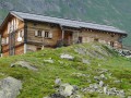
First stage of the trek linking the village of Fionay to Saas Fee. A pleasant stage to reach the Cabane de Louvie, built on the edge of the lake of the same name.
Trek from Fionay to Saas-Fee
 63.00 mi
+27,582 ft
-26,322 ft
7 days
Very difficult
Departure from Bagnes (Valais)
63.00 mi
+27,582 ft
-26,322 ft
7 days
Very difficult
Departure from Bagnes (Valais)
In the Swiss valley, this particularly pleasant hike allows you to explore the many 4000 m peaks that surround the route.
N.B. this route is outlined on Openmap which doesn't have the details of our fine IGN maps. Before being able to get your hands on a Swiss map, which are more precise, the route and GPS layouts will be handy for this pleasant trek.
Louvie Hut - Prafleuri Hut
 7.26 mi
+4,019 ft
-2,654 ft
6h 50
Difficult
Departure from Bagnes (Valais)
7.26 mi
+4,019 ft
-2,654 ft
6h 50
Difficult
Departure from Bagnes (Valais)
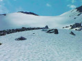
This sixth stage takes place in the high mountains and, depending on the season, may involve crossing snowfields.From Lake Louvie, climb up to Col Termin and rejoin the balcony path that comes from the Montfort Hut. Continue to Col de Louvie (possibility of snowfields). After descending Col de Louvie, the path passes at the foot of the Grand Désert Glacier. The trail then crosses scree; look out for the red and white markings and follow the signs for Prafleuri. Climb Col de Prafleuri. Descend to Torrent de Prafleuri (small bridge); on the left, a trail leads to the Prafleuri Hut.
Louvie Hut - Prafleuri Hut
 6.32 mi
+3,501 ft
-2,103 ft
8 hrs
Very difficult
Departure from Bagnes (Valais)
6.32 mi
+3,501 ft
-2,103 ft
8 hrs
Very difficult
Departure from Bagnes (Valais)
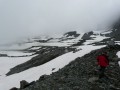
The second stage of the route involves crossing two passes, the Louvie and the Prafleuri, both of which were snow-covered.
Cabane de Mille - Cabane Brunet
 4.53 mi
+686 ft
-1,909 ft
2h 40
Moderate
Departure from Liddes (Valais)
4.53 mi
+686 ft
-1,909 ft
2h 40
Moderate
Departure from Liddes (Valais)
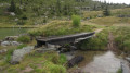
This stage was shortened due to bad weather. The plan was to go via Mont Rogneux. This is a short stage that allows you to avoid Mont Rogneux when it is in thick fog. However, if the weather improves in the afternoon, it is possible to climb from the Cabane Brunet to the Goli des Otanes. You will then walk alongside pastures where Herens cows graze.
Cabane de Mille - FXB Panossière hut
 8.78 mi
+3,245 ft
-2,762 ft
6h 50
Difficult
Departure from Liddes (Valais)
8.78 mi
+3,245 ft
-2,762 ft
6h 50
Difficult
Departure from Liddes (Valais)
Between Mont Blanc and Monte Rosa, the Grand Combin stands out from everywhere. Forming the border between Switzerland and Italy, and the boundary between the Grand Saint-Bernard valley and the Val de Bagne, it rises to 4,314 m. The tour takes seven days; I added an extra day to visit the Fenêtres lakes, the icing on the cake. Each stage offers alpine accommodation.
Liddes - Cabane Brunet
 8.55 mi
+4,462 ft
-1,932 ft
7h 50
Very difficult
Departure from Liddes (Valais)
8.55 mi
+4,462 ft
-1,932 ft
7h 50
Very difficult
Departure from Liddes (Valais)
This fourth stage offers various views of the Combin massif. At the top of the village, head towards the Col and Cabane de Mille. After a pleasant walk through the forest, the path gradually opens up to reach Erra. The terrace of the Cabane de Mille offers a magnificent panorama of the Mont Blanc range, the Aiguilles de Chamonix and the Combin massif. At Servay (a small sheepfold after a small lake), head towards Cabane Brunet. The end of the route crosses a rather chaotic area before taking the small road that climbs up to Cabane Brunet. Superb view of the Combin mountains just behind the hut.