Country:

 City:
City:


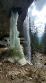
Head to Thorens-Glières, then turn right onto the D2 towards Les Glières. Pass through Usillon, then continue to the Pont de Pierre, at the foot of the Roc waterfall: there is a car park before and after the bridge.
(S/E) Turn right at Nant des Brassets and follow the path as it winds its way uphill in wide hairpin bends.
(1) Turn right onto a downhill path offering a glimpse of the waterfall, then turn back.
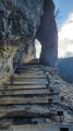
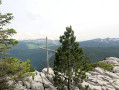
(1) Continue uphill, climb the numerous steps of the Pas du Roc, then, two footbridges further on, reach the viewpoint.
(2) Carry on towards Champ Laitier and the Col de l’Ébat. You’ll reach a junction with a sign for ‘la Source’, with no direction indicated.
(3) Turn right and carry on until you reach a footbridge over the Nant des Brassets:watch out for broken planks.
(4) Cross the footbridge and head slightly to the right towards the forest, following the visible markings. You’ll reach an area of decaying vegetation, a chaotic jumble of trees.
(5) From here, it is easy to lose the path: follow the orange signposts. The path continues uphill, then turns left and remains more or less level. Ignore a path on the right leading to the Plateau des Glières and its monument, and continue for about 200 m to reach another junction.
(6) Turn left here towards Champ Laitier and head down into the valley. Cross the footbridge: there is an information display about the peat bog.
(7) Turn left towards Champ Laitier Sud – Pont de Pierre and head for a junction of paths.
(8) Continue to the left and return to the starting point of the circular route at the ‘la Source’ sign.
(3) Go straight on, passing the viewpoint and the Pas du Roc once more, then complete the route and return to the car park (S/E).


 Visorando Member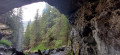

 Very difficult
 Difficult
  Easy
Easy