


Refine your search for walks in Pas de la Cavale
Pas de la Cavale walks


 Vallouise - Pré de la Chaumette Mountain Hut
 Visorando Member
 13.54 mi
 +5,381 ft
 -3,255 ft
 10 hrs
 Very difficult
 Departure from Vallouise (Hautes-Alpes)
The Col de l'Aup Martin and the Pas de la Cavale from the Onde Valley, leading into the Champoléon Valley.
The Aup Martin – what a pass!
Note: This route is a stage of the Tour de l'Oisans but it is very challenging, particularly in early summer when there is still snow on the Col de l'Aup Martin. For this reason, a diversion has been put in place starting from Vallouise, passing through Puy Saint-Vincent, the Col de la Pousterle and the Fournel valley. You then join the Pas de la Cavale (GR®54A).
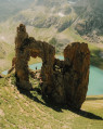
A 13-day grand tour of the Parc des Ecrins via the GR® 54
 105.16 mi
+37,625 ft
-39,075 ft
13 days
Very difficult
Departure from La Chapelle-en-Valgaudemar (Hautes-Alpes)
105.16 mi
+37,625 ft
-39,075 ft
13 days
Very difficult
Departure from La Chapelle-en-Valgaudemar (Hautes-Alpes)
A very challenging 180 km route with 12,000 metres of elevation gain, requiring excellent physical fitness. Stages offering spectacular scenery, steep mountains, passes, wildlife, flora and colours. The most beautifulGR® route we have ever done. We completed the route in August, the ideal time to tackle the most difficult passes, which are likely to be snow-covered early in the season, such as La Muzelle, l’Aup Martin, the Pas de la Cavale, de la Valette, Vallonpierre and de La Vaurze.
Wild crossing of the Écrins
 73.32 mi
+28,494 ft
-29,314 ft
7 days
Very difficult
Departure from L'Argentière-la-Bessée (Hautes-Alpes)
73.32 mi
+28,494 ft
-29,314 ft
7 days
Very difficult
Departure from L'Argentière-la-Bessée (Hautes-Alpes)
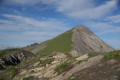
This 7-day trek is for hikers who are used to camping in tents.Although there are a few refuges along the route, the stages are designed for those who wish to sleep in the heart of nature.The circuit crosses the Écrins massif and offers total immersion in the alpine landscape, where you can encounter local flora and fauna.Ideal for walkers who are used to the mountains, it is a complete adventure that will challenge you with its significant elevation changes and occasional technical or unmarked sections.
Ravin des Serres - Vallonpierre refuge
 10.03 mi
+5,138 ft
-5,220 ft
9h 05
10.03 mi
+5,138 ft
-5,220 ft
9h 05
 Difficult
Departure from L'Argentière-la-Bessée (Hautes-Alpes)
Difficult
Departure from L'Argentière-la-Bessée (Hautes-Alpes)
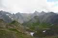
The hike begins with the ascent of the Pas de la Cavale, which rises to an altitude of 2,735 metres. After this climb, you will reach the Pré de la Chaumette refuge. From there, another climb will take you along the imposing Sirac, passing through the Vallette, Gouiran and Vallonpierre passes. The route ends at the Vallonpierre refuge.
Vallouise - Pré de la Chaumette Mountain Hut
 9.83 mi
+3,852 ft
-3,228 ft
8 hrs
Very difficult
Departure from Vallouise (Hautes-Alpes)
9.83 mi
+3,852 ft
-3,228 ft
8 hrs
Very difficult
Departure from Vallouise (Hautes-Alpes)
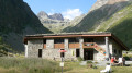
Stage11 of this route. One of the most beautiful and challenging stages of the route, featuring the Aup Martin pass at 2,700 metres and the Pas de la Cavale, the highest point ofthe GR® 54. This stage demands the utmost vigilance and experience of high-mountain hiking. The views are absolutely stunning and incredibly wild. We took the shuttle bus to avoid the 8 km of tarmac road to the car park at Entre-les-Aigues.
Walks near Pas de la Cavale
Pré de la Chaumette Mountain Hut - Vallonpierre Mountain Hut
 6.50 mi
+3,783 ft
-2,215 ft
6h 15
Difficult
Departure from Champoléon (Hautes-Alpes)
6.50 mi
+3,783 ft
-2,215 ft
6h 15
Difficult
Departure from Champoléon (Hautes-Alpes)
The12th stage of this route features three passes to cross, the last of which is particularly technical and difficult.
The panoramic views remain as exceptional as ever, with vistas of the majestic Chaillol, the Sirac and the Champoléon valley. The refuge is set in lush greenery at the bottom of a cirque at the foot of the Sirac and on the shores of the magnificent Lac de Vallonpierre. A campsite in a beautiful meadow at the foot of the Sirac, with a splendid view of the lake.
From Roche Rousse to Prapic via the lakes of Orcières and Les Pisses
 7.85 mi
+978 ft
-3,373 ft
4h 30
7.85 mi
+978 ft
-3,373 ft
4h 30
 Moderate
Departure from Orcières (Hautes-Alpes)
Moderate
Departure from Orcières (Hautes-Alpes)
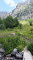
A magnificent hike taking you to discover the lakes of Orcières, Lac des Pisses and the pretty village of Prapic
The six lakes of Orcières-Merlette, including Les Estaris
 4.13 mi
+299 ft
-1,447 ft
2h 10
4.13 mi
+299 ft
-1,447 ft
2h 10
 Easy
Departure from Orcières (Hautes-Alpes)
Easy
Departure from Orcières (Hautes-Alpes)
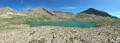
This hike has been suitable for all ages since 2020. Using the chairlifts (Drouvet 1 and 2 for the outward journey and Roche Rousse for the return journey) makes it easy. The six large lakes are visited on the way down. A variant towards the Col de Freissinières is possible. The landscapes are magnificent, especially at the starting point at the top of Drouvet. The lakes are all very beautiful and diverse.
Vallonpierre Refuge - La Chapelle-en-Valgaudemar
 8.45 mi
+112 ft
-3,999 ft
4h 00
Moderate
Departure from La Chapelle-en-Valgaudemar (Hautes-Alpes)
8.45 mi
+112 ft
-3,999 ft
4h 00
Moderate
Departure from La Chapelle-en-Valgaudemar (Hautes-Alpes)
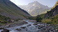
Here we are at the final stage of this 13-day route around the magnificent Écrins National Park. A downhill stage that takes you to La Chapelle-en-Valgaudemar, where this journey began 13 days earlier. A splendid start to the stage, all the way down to the glacial torrents. The panorama is breathtaking, surrounded by the most beautiful peaks of the southern part of the Écrins, already leaving us with a sense of nostalgia for the past 13 days. A route with no technical difficulty.
Vallonpierre refuge - Sebeyras lakes
 14.23 mi
+4,291 ft
-4,255 ft
10h 15
Very difficult
Departure from La Chapelle-en-Valgaudemar (Hautes-Alpes)
14.23 mi
+4,291 ft
-4,255 ft
10h 15
Very difficult
Departure from La Chapelle-en-Valgaudemar (Hautes-Alpes)
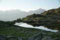
From the Vallonpierre refuge, the hike takes you to the Rif du Sap chapel, then to the charming village of La Chapelle-en-Valgaudémar, where you can stop for refreshments at a local grocery store. The route then crosses the Valgaudémar National Forest before reaching the magnificent lakes of Pétarel and Sebeyras.
Fressinières Pass (Col)
 13.19 mi
+4,482 ft
-4,911 ft
10h 00
Difficult
Departure from Orcières (Hautes-Alpes)
13.19 mi
+4,482 ft
-4,911 ft
10h 00
Difficult
Departure from Orcières (Hautes-Alpes)
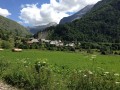
From Prapic to Dormillouse via the Fressinières Pass.
Please note: the height difference is only 1200 m.
Lac des Sirènes, starting from Prapic
 6.38 mi
+2,884 ft
-1,864 ft
5h 25
Difficult
Departure from Orcières (Hautes-Alpes)
6.38 mi
+2,884 ft
-1,864 ft
5h 25
Difficult
Departure from Orcières (Hautes-Alpes)
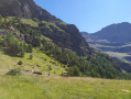
A walk with almost no descent thanks to the Télémix and the car left beforehand at the Orcières Merlette resort.The Diolon Valley is beautiful and little-known. It takes you from Prapic to Lac des Sirènes. From there, it’s easy to reach Roche Rousse.This hike should only be undertaken when the Merlette resort is open in summer (July and August) so you can return via the Roche Rousse Télémix. (The descent is much shorter as it includes the ride down on the Télémix!)
The Col des Terres Blanches
11.81 mi
+4,259 ft
-3,822 ft
9h 10
Difficult
Departure from Freissinières (Hautes-Alpes)
From Dormillouse to Prapic via the Col des Terres Blanches.
From Rif du Sap to Navette via Le Chapeau
 7.39 mi
+4,045 ft
-4,301 ft
6h 55
Very difficult
Departure from La Chapelle-en-Valgaudemar (Hautes-Alpes)
7.39 mi
+4,045 ft
-4,301 ft
6h 55
Very difficult
Departure from La Chapelle-en-Valgaudemar (Hautes-Alpes)
A beautiful and challenging hike in the hills, varied with some unexpected sections. Stunning views. Be careful, there are many tricky and slippery sections. Avoid in wet weather.
Chalet du Gioberney – Vallonpierre Mountain Hut
 6.84 mi
+3,442 ft
-1,358 ft
6h 10
Difficult
Departure from La Chapelle-en-Valgaudemar (Hautes-Alpes)
6.84 mi
+3,442 ft
-1,358 ft
6h 10
Difficult
Departure from La Chapelle-en-Valgaudemar (Hautes-Alpes)
The sixth stage is a fairly easy climb up to the Vallonpierre Refuge.
This allows you to arrive at the refuge early and, if you wish, carry on to the Col des Chevrettes, where marmots are guaranteed.