No Outray, Lac Noir and Lac de la Girotte

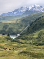
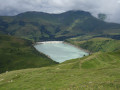
A lovely day’s hike to admire the view from the Pas d’Outray and then Lac de la Girotte with its distinctive colour.

Details

n°3855276
Creation:
Last update:
Last review:
  • Walking
    Activity: Walking
  • ↔
    Distance: 10.77 mi
  • ◔
    Average duration: 8h 00 
  • ▲
    Difficulty: Difficult

  • ⚐
    Back to start: Yes
  • ↗
    Ascent: + 3,504 ft
  • ↘
    Descent: - 3,510 ft

  • ▲
    Highest point: 7,251 ft
  • ▼
    Lowest point: 5,315 ft

Photos

Description of the walk

The “Parking du Sapin” car park is, in essence, a spot where the road is wide enough to accommodate a few cars (but don’t expect anything more). Take care if you’re driving a low-slung car.

(S/E) Set off south-west towards the Pas d’Outray, following the forest track.

(1) When you reach a bend in the road, a sign points to the track on your left. The climb up to the Pas d’Outray begins here.

(2) At an elevation of 1,806, continue along the track, which is a bit steep but the climb is manageable.
You’ll reach the Pas d’Outray at an elevation of 2181.

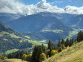
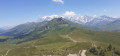
(3) Once at the top, take in the splendid 270° view of the Beaufortain.
Continue along the path heading south-east.

(4) As you approach the Chalets d’Outray, at around 2,100 m, you have two options:
- either you can choose to go left, following the route description and the GPX track, to reach Lac de Crêt.
- or you can head right up to the pass.

(5) Reach the Col du Sallestet at an elevation of 2,111 metres.

(6) At the pass, head north-east towards Lac Noir.

(7) A short break is in order in front of this mysterious-looking body of water. Continue towards Lac de la Girotte.

(8) At the junction, at an elevation of 2,056 metres, turn right to walk round the lake in an anti-clockwise direction.
NB: the path may be a little damp at the start, but from the technical installations onwards, it widens into a track suitable for vehicles. Follow the track to the dam.

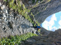
(9) You cannot cross the dam; you must pass at the foot of the enormous arches.
After the dam, take the path opposite which heads due south between the two small buildings towards Plan de la Mouille. Pass a hut on your left.

(10) At the fork, at elevation 1869, continue due south and head for the Plan de la Mouille.

(11) At the crossroads, turn right, heading due west, and cross a rocky area.

(12) Shortly afterwards, turn left into the forest for a fairly steep descent to the ford at elevation 1700.

(13) Continue straight ahead, heading due west, along the wide path, which you should follow to the car park (S/E).

Waypoints

  1. S/E : mi 0 - alt. 5,322 ft - Parking du Sapin
  2. 1 : mi 0.66 - alt. 5,535 ft - End of the road
  3. 2 : mi 1.03 - alt. 5,909 ft - Start of the climb
  4. 3 : mi 2.04 - alt. 7,149 ft - No Outray
  5. 4 : mi 2.61 - alt. 6,886 ft - Path on the left towards the - Lac du Bout de Crêt
  6. 5 : mi 3.31 - alt. 7,133 ft - Lac du Bout de Crêt
  7. 6 : mi 3.69 - alt. 6,923 ft - Col du Sallestet
  8. 7 : mi 4.54 - alt. 7,205 ft - Lac Noir (Beaufortain)
  9. 8 : mi 5.15 - alt. 6,739 ft - At the junction (elevation 2056), turn right
  10. 9 : mi 7.25 - alt. 5,676 ft - Dam at - Lac de la Girotte
  11. 10 : mi 8.11 - alt. 6,142 ft - Junction (elevation 186)
  12. 11 : mi 8.72 - alt. 6,388 ft - Map of La Mouille
  13. 12 : mi 9.24 - alt. 5,981 ft - Join the forest track
  14. 13 : mi 9.62 - alt. 5,577 ft - Ford
  15. S/E : mi 10.77 - alt. 5,318 ft - Parking du Sapin

Notes

The starting point is the Parking du Sapin car park (listed on Google Maps); the climb from Hauteluce is tough on the car but is manageable with any mini SUV.

Worth a visit

Panoramic view of the Beaufortain, Lac Noir and Lac de la Girotte.

Reviews and comments

5 / 5
Based on 1 review

Reliability of the description
5 / 5
Ease of following the route
5 / 5
Route interest
5 / 5
sylvie.vilette
sylvie.vilette

Overall rating : 5 / 5

Date of your route : Sep 10, 2022
Reliability of the description : ★★★★★ Very good
Ease of following the route : ★★★★★ Very good
Route interest : ★★★★★ Very good
Very busy route : No

Stunning scenery. No technical difficulties, just a long route, but it can be shortened if necessary.
Please note that the ‘Les Sapins’ car park is not easily accessible for low-clearance vehicles. The track is unpaved.
If you can’t get through, you can start the walk further down by leaving your car on the track, as the GR trail begins at the start of this track.

Machine-translated

Other walks in the area

For more walks, use our search engine .

The GPS track and description are the property of this route's author. Please do not copy them without permission.