Country:
 City:


Montgon is 20 km north of Vouziers via the D25 and D977. Recommended car park: Place de la Mairie in Montgon
Yellow mountain bike signposting
(S/E) Starting from the Place de la Mairie in Montgon, head towards the hamlet of Décharge Faux by turning right at the start sign. Once you reach the sign, continue straight on until you reach a road. Watch out for the drainage channels crossing the dirt track.
(1) At a place called Les Carrières, turn left and follow the small road along the old Roman road until you reach a T-junction.
(2) Turn right to join the departmental road towards Le Chesne, taking care as you do so. Walk past a farm on your right and, before reaching the village of Le Chesne, look for the start of a grassy path on the left by a small stream (marked by two blue and white striped markers).
(3) Leave the departmental road and take the path on the left. Enter Le Chesne and continue straight on until you reach the fork at the war memorial.
(4) Turn left towards Poix Terron (D991), cross over the Canal des Ardennes and carry on straight ahead, passing the Place du Parlement on your right.
(5) Turn left onto the D30, towards Lametz. Continue to the junction at the hamlet of Longwé (Moulin de Longwé on the map).
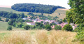
(6) At the edge of the Bois des Moines and just before a bridge on a right-hand bend, take the unpaved track on the left (Danger sign, railway tracks, speed limit 10 km/h and vehicles under 3.5 tonnes). Pass through Montardré, then enjoy the view of Montgon as you descend to the Canal des Ardennes.
(7) Head into the Vallée des Écluses by turning right.
(8) At Lock No. 14 in Montgon, turn left, cross the canal and ride on to Montgon, then head back up towards the village centre via a winding climb.

 Local authority
 Difficult

 Easy
 Visorando Member