Bruailles Route

Bruailles boasts a well-preserved heritage: the bishop’s house, the vicarage, the church and the bread oven. The latter was once used by the villagers to bake their bread. Situated in the heart of the village and close to the town hall, it is currently brought back to life several times a year during various village events, providing opportunities for socialising.
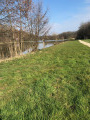
Two rivers wind their way not far from the village, flowing through floodplains and wooded countryside: the Vallière and the Solnan.

Details

n°4651334
Creation:
Last update:
Last review:
  • Walking
    Activity: Walking
  • ↔
    Distance: 6.40 mi
  • ◔
    Average duration: 3h 05 
  • ▲
    Difficulty: Moderate

  • ⚐
    Back to start: Yes
  • ↗
    Ascent: + 167 ft
  • ↘
    Descent: - 167 ft

  • ▲
    Highest point: 673 ft
  • ▼
    Lowest point: 597 ft
  • ⚐ Country: France
  • ⚐ City: Bruailles (71500)
  • ⚑
    Start/End: N 46.59559° / E 5.23526°
  • ❏
    IGN map(s): Ref. 3127E
  • Hour-by-hour weather

Photos

Description of the walk

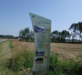
Park at Place du 8 Mai 1945. A large sign showing the two ‘Balades Vertes’ routes in the town marks the starting point of the walk. Thefirst information board recounts the history of the Bishop’s House as well as the process of making bricks and tiles in the region’s many tile works during the 19th and 20th centuries.

(S/E) From Place du 8 Mai 1945, take the Route du Bourg and walk down to the Church of the Assumption.

(1) There are two information boards: one about the vicarage grounds and the other about the church and its stained-glass windows.
Continue along Route du Bourg and cross the railway line: please be careful, as trains run regularly on this line.

(2) Turn onto Route de Culey,the first right after the railway line. Continue along this road until you reach the junction with Route de Sainte-Croix (D996).

(3) Cross with care and continue straight ahead onto Route de l’Argillet. Turn left at thefirst road, Route de la Communauté, and join Route de Cuiseaux (D972).

(4) Cross with care and continue straight ahead along the gravel track until you reach a fork at the edge of the woodland.

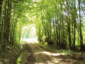
(5) Turn right near the heritage orchard, which you can visit to learn more about old varieties of fruit trees, and walk through both woods until you reach the road running at right angles, Route de la Chichevière.

Efirst information board takes you back to 28 November 1980 and recounts the history of the pipeline. A little further on, asecond information board provides details about local agriculture.

(6) Turn left and continue along Route de la Chichevière until the next crossroads, Route de Marcilly.

(7) Turn left and follow this road for approximately 1.3 km.

(8) Turn onto thefirst path on the left towards the Plan d’Eau de la Galette and carry on to the car park.

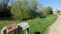
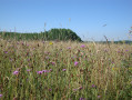
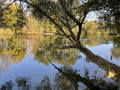
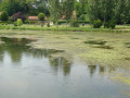
(9) Turn right across the car park to walk round the lake. An information board about the lake and its fish is located near a picnic area. At the end of the lake, take the path on the right, walking alongside the field on your right and the woodland on your left.

(5) Turn right and continue to Route de Cuiseaux (D972).

(4) Cross with care and take the road opposite, Route de la Communauté, as far as Route de l’Argillet. Turn right.

(3) Cross the D996 to reach the road opposite, Route de Culey. Continue along this road, following the railway line.

(2) At the junction with Route du Bourg, turn left and cross the railway line. Please note that trains run regularly on this line: take great care when crossing.

(1) Walk past the Church of the Assumption and head up to the town hall, the starting point (S/E).

Waypoints

  1. S/E : mi 0 - alt. 669 ft - Place du 8 Mai 1945
  2. 1 : mi 0.17 - alt. 604 ft - Église de l'Assomption (Bruailles)
  3. 2 : mi 0.35 - alt. 633 ft - Culey
  4. 3 : mi 0.98 - alt. 669 ft - D996 road
  5. 4 : mi 1.64 - alt. 666 ft - Route de Cuiseaux
  6. 5 : mi 1.9 - alt. 656 ft - Conservation orchard
  7. 6 : mi 2.61 - alt. 620 ft - Chichevière
  8. 7 : mi 2.87 - alt. 600 ft - Chivevière
  9. 8 : mi 3.68 - alt. 666 ft - Path on the left
  10. 9 : mi 3.97 - alt. 623 ft - La Galette lake
  11. S/E : mi 6.4 - alt. 669 ft - Place du 8 Mai 1945

Notes

Starting point: Place du 8 Mai 1945: free parking available.
Toilets and picnic tables are available at the Galette lake.
Trainers or light walking shoes are sufficient.
Take care when crossing the Route de Cuiseaux, as it is a fairly busy road; and when crossing the railway line, please note that trains run daily on this line.
This trail is signposted with directional signs (BRU1) and yellow painted markings.

Worth a visit

This themed route takes you through the village, where you can discover beautiful traditional Bresse houses, the village lake and lovely wooded areas. It is dotted with information boards detailing the village’s history and heritage. You’ll pass by the lake, where you can have a picnic, use the fitness trail or go fishing with a day permit.

Reviews and comments

4.7 / 5
Based on 1 review

Reliability of the description
5 / 5
Ease of following the route
5 / 5
Route interest
4 / 5
OT Bresse Bourguignonne

Hello Charly

Thank you for taking the time to leave a review; we hope your feet didn’t suffer too much on the tarmac sections. We’re delighted that you enjoyed the walk all the same, judging by your comment.

Have a lovely day

Mélise
Bresse Bourguignonne Tourist Office

Machine-translated

Meyer Charly
Meyer Charly

Overall rating : 4.7 / 5

Date of your route : Mar 09, 2021
Reliability of the description : ★★★★★ Very good
Ease of following the route : ★★★★★ Very good
Route interest : ★★★★☆ Good
Very busy route : No

Hello, a lovely walk. Despite the many sections on tarmac, it took us 2 hours and 10 minutes to complete the route (4.4 km/h)
Have a good day, Charly

Machine-translated

Other walks in the area

For more walks, use our search engine .

The GPS track and description are the property of this route's author. Please do not copy them without permission.