Country:

 City:


Public transport
Train: Riom-Châtel-Guyon SNCF station, then bus route P62 – Riom-Saint-Gervais – Saint-Gervais Mairie stop
https://www.laregionvoustransporte.fr/li...
Car
Parking spaces are available on Rue du Castel in Saint-Gervais-d’Auvergne. Further spaces are also available in Place Raymond Gauvin and Place de la Mairie.
(S/E) Head towards the Castel Hotel and follow Rue du Castel until you reach the junction
(1) Turn right towards Sauret-Besserve onto Rue de la Croix Bideau. Continue along Rue de la Combraille until you reach the junction with the D227, near a wayside cross.
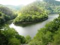
(2) Cross the road carefully to reach the opposite side, then immediately take the small road on the left towards Les Sagnes and La Chassignole. On the way to Les Sagnes, at the top of the first hill, take a moment to admire the magnificent panoramic view ahead of you over the Chaîne des Puys and the Monts Dore, and, looking back, the church of Saint-Gervais-d’Auvergne.
(3) When you reach the hamlet of Les Sagnes, at the cross, take the road on the left.
(4) Just before the entrance to the hamlet of Les Arbres, turn left. After a few hundred metres, the road joins the D531, which you follow in the same direction. Just before the junction with the D227, you’ll notice on the right the few houses of the Cité EDF, built in the 1960s to house the workers employed on the construction of the Fades dam.
(6) Cross back over the D227 and follow Rue Achille Michel opposite. Cross Rue Fontaine de la Ville (D534) and take Rue des Paulines opposite (with the old washhouse on the right). Follow this street straight on until you reach the fortified church of Saint-Gervais-d’Auvergne.
(6) Turn left towards the post office, then head right up to the central square. Then turn left onto Rue Mercière.
(1) Take Rue du Castel again to return to the car park (S/E).

 Visorando Member

 Moderate
 Tourist office