Along the Becdal

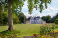
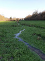
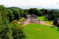
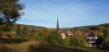
This walk will allow you to discover Acquigny’s rich heritage, the lapping of the water along the Becdal and the picturesque charm of the manor house beside it. You’re sure to come across a few animals along the way.

Details

1667335
Creation:
Last update:
Last review:
  • Walking
    Activity: Walking
  • ↔
    Distance: 8.09 mi
  • ◔
    Average duration: 4h 10 
  • ▲
    Difficulty: Moderate

  • ⚐
    Back to start: Yes
  • ↗
    Ascent: + 466 ft
  • ↘
    Descent: - 446 ft

  • ▲
    Highest point: 440 ft
  • ▼
    Lowest point: 59 ft
  • ⚐ Country: France
  • ⚐ City: Acquigny (27400)
  • ⚑
    Start/End: N 49.169975° / E 1.184925°
  • ❏
    IGN map(s): Ref. 1913SB, 2012OT
  • Hour-by-hour weather

Photos

Description of the walk

Starting point: Car park, Rue Saint-Mauxe, 27400 Acquigny

Yellow signposting

(S/E) From the car park, head north-west along Rue du Moulin Potel until you reach the municipal stadium.

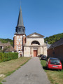
(1) Keep to the right and turn right at the Stop sign. Cross the small bridge to reach the church.

(2) Opposite the church, turn left, then left again onto Rue Aristide Briand. Walk through the village. Continue to the traffic lights and go straight on, then cross the bridge over the N154.

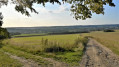
(3) Turn immediately right onto the track. Continue between the dual carriageway and the fields. The track veers to the left and leads to the Becdal manor house.

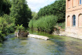
(4) Turn left onto the track, then left again. Cross the Becdal ford and head right. Leave the forest. Further on, turn left and head towards the fields. Turn left to join the D82.

GRP Châteaux de l’Eure

(5) Turn left (take care), then right onto the path. At the next junction, turn right, keep left at the Fork in the road and continue straight on until you reach the main road in the hamlet of La Mare Hermier.

GRP Châteaux de l’Eure +GR®222

(6) At Rue de la Métairie (D 112), turn right. At the wayside cross, turn left onto the path leading to the pond. Go round it on the left.

(7) Take the Chemin des Pommiers, then the new Chemin des Pommiers on the left. Head up Rue de la Métairie on the left, then take the first right onto the Chemin des Écoliers (take care). Carry on straight ahead, carry on straight ahead and head down into the forest until you reach a cemetery.

End ofGR® andGRP® signposting

(8) Turn left until you reach the D112 (take care on the bend).

(9) Turn left, then, at thesecond street, turn right until you reach the D61 and Chemin des Perrais.

(10) Turn left immediately and follow the road to the railway line.

(11) Turn right and follow the track until you reach the D71.

(12) Cross (take care) to reach the right-hand side (before the safety barriers) and go under the motorway. Follow the D71 to the junction.

(13) Turn right, then immediately left, onto the road leading back towards Acquigny.

(14) At the junction, turn left and then right to return to the starting point. (S/E)

Waypoints

  1. S/E : mi 0 - alt. 62 ft - Car park near the - L'Iton
  2. 1 : mi 0.06 - alt. 62 ft - Acquigny Municipal Stadium. Near the - Eure (rivière)
  3. 2 : mi 0.25 - alt. 66 ft - Eglise Sainte Cécile
  4. 3 : mi 1.05 - alt. 154 ft - N54, path between the dual carriageway and the fields
  5. 4 : mi 2.04 - alt. 66 ft - Le Manoir du Becdal
  6. 5 : mi 3.98 - alt. 436 ft - Path through the fields
  7. 6 : mi 4.75 - alt. 430 ft - Crossroads near a wayside cross
  8. 7 : mi 4.88 - alt. 427 ft - Passing by the Mare Hermier
  9. 8 : mi 5.64 - alt. 164 ft - Passage past the cemetery
  10. 9 : mi 5.85 - alt. 92 ft - Junction
  11. 10 : mi 6.34 - alt. 79 ft - Chemin des Perrais
  12. 11 : mi 6.74 - alt. 72 ft - Railway line
  13. 12 : mi 7.3 - alt. 66 ft - D71
  14. 13 : mi 7.53 - alt. 69 ft - Crossroads
  15. 14 : mi 7.82 - alt. 59 ft - Junction
  16. S/E : mi 8.09 - alt. 62 ft - Car park

Notes

Be careful at the ford; make sure you wear waterproof shoes.

Check with the local council or visit onf.fr for information on hunting seasons from September to the end of February

Worth a visit

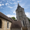
  • Sainte-Cécile Church, listed as a historic monument in 1975, is a Rococo church with a Neoclassical façade. It was built in the16th century and subsequently extended in the18th century by Roux d’Esneval. It features magnificent wood panelling in the Louis XV and Louis XVI styles, as well as a painting by Charles Le Brun, court painter to Louis XIV, and by Jean-Baptiste Nuet.
  • The park and gardens of the Château d’Acquigny, designed in the late18th century and designated a ‘remarkable garden’, this 16-hectare romantic park serves as a setting for a Renaissance château built around the theme of love.
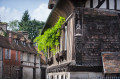
  • ‘Le Vieux Logis’ house, a half-timbered building featuring an ‘essentage’ (a façade clad in wooden tiles) and a carved wooden statue.
  • Manoir du Becdal, built in the early16th century. It was listed as a historic monument in 1978.

Always be cautious and plan ahead when you're outdoors. Visorando and the author of this route cannot be held responsible for any accidents occurring on this route.

The GR® and PR® markings are the intellectual property of the Fédération Française de Randonnée Pédestre.

Reviews and comments

4.3 / 5
Based on 3 reviews

Reliability of the description
4.5 / 5
Ease of following the route
4.7 / 5
Route interest
3.7 / 5
Office de Tourisme Seine-Eure

Hello,

Thank you for your comment. More prominent signage is planned for the Mare Hermier area in the near future.
Kind regards,

The Tourist Office team

Machine-translated

ealet
ealet

Overall rating : 3.7 / 5

Date of your route : Oct 16, 2025
Reliability of the description : ★★★★☆ Good
Ease of following the route : ★★★★☆ Good
Route interest : ★★★☆☆ Average
Very busy route : No

Overall, a pleasant hike, except for two places (point 3 when walking along the motorway and point 12 when following the D71). In addition, the route at Mare Hermier is tricky (the description seems too brief to me)
you walk through beautiful woodland and it's lovely to cross the fields in the morning sunshine. At the end of the hike, it's worth visiting Acquigny Castle, which is well worth a detour
thanks to the author for sharing this

Machine-translated

Office de Tourisme Seine-Eure

Hello,

Thank you for your feedback on this hike.

It's true that the section along the A154 is not very pleasant. We are working to make this section more enjoyable, but it is the only way to complete this hike, which has many interesting features.
The "muddy section" is a ford, which is indicated in the description and allows you to discover Becdal, a key point of interest on this hike. Good hiking boots are therefore recommended.
Feel free to explore our other trails.

The Seine-Eure Tourist Office team

Machine-translated

jijiday
jijiday

Overall rating : 4 / 5

Date of your route : Sep 08, 2025
Reliability of the description : Not used / Not applicable
Ease of following the route : ★★★★★ Very good
Route interest : ★★★☆☆ Average
Very busy route : No

This hike includes sections through forests, towns and fields. Part of the route runs alongside a noisy motorway. The section along the Becdal is muddy. Overall, it is a fairly average hike, neither unpleasant nor exciting.

Machine-translated

Office de Tourisme Seine-Eure

Hello,

We’d like to thank you for your comment and look forward to seeing you on our walking trails.

Kind regards,

The Seine-Eure Tourist Office team

Machine-translated

benoitrando
benoitrando

Overall rating : 5 / 5

Date of your route : Mar 24, 2025
Reliability of the description : ★★★★★ Very good
Ease of following the route : ★★★★★ Very good
Route interest : ★★★★★ Very good
Very busy route : Yes

Thank you to the Seine-Eure Tourist Office for this lovely route.

Machine-translated

Other walks in the area

For more walks, use our search engine .

The GPS track and description are the property of this route's author. Please do not copy them without permission.