


Refine your search for walks in Oudenburg
Oudenburg walks
 Circular route between De Haan and Oudenburg
 Visorando Member
 25.16 mi
 +36 ft
 -39 ft
 2 hrs
2 hrs
 Moderate
 Departure from De Haan (Flandre-Occidentale)
An easy route, passing through Plassendale in the Flemish Polders and following a canal. Well-maintained cycle paths. Passes through the lovely little town of Oudenburg. Returns via Stalhillebrug and Vlissegem.
 Bruges celebrates Christmas
 7.12 mi
+30 ft
-30 ft
3h 20
Moderate
Departure from Flandre-Occidentale
7.12 mi
+30 ft
-30 ft
3h 20
Moderate
Departure from Flandre-Occidentale
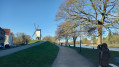
Bruges becomes an enchanted setting during the Christmas market: chalets, the smell of hot chocolate, lights and golden reflections on the canals. Stroll through cobbled streets, medieval houses and illuminated bridges.Nicknamed the "Venice of the North", the city combines historic charm and peaceful corners, perfect for a stroll through its old town and green spaces.Bruges also has its stories: legends of haunted alleys, tales of guilds and small courtyards hidden behind façades.Despite the winter, swans, ducks and moorhens enliven the canals, while the Minnewater and the Beguinage offer havens of nature.With superb views from the bridges, local crafts, carousels and a magical atmosphere, this walk promises a unique blend of heritage, festive magic and culinary delights.
Veurne and Beauvoorde circular loop in the Flemish region
 11.67 mi
+30 ft
-30 ft
5h 25
Moderate
Departure from Veurne (Flandre-Occidentale)
11.67 mi
+30 ft
-30 ft
5h 25
Moderate
Departure from Veurne (Flandre-Occidentale)
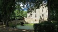
Just a few kilometres from the French-Belgian border, a walk in Flanders, in the heart of the ‘flat country’. This walk will take you from the charming and picturesque town of Veurne (Furnes in French) to Beauvoorde Castle. Before setting off, do take a stroll around the town to admire the many Renaissance houses and perhaps visit the town hall, St Walburga’s Church or the bakery museum.
Passendale through the Passchendaele battlefield
9.07 mi
+128 ft
-125 ft
4h 15
Moderate
Departure from Zonnebeke (Flandre-Occidentale)
Departing from the car park of Passchendaele Church, this walk takes you across the Passchendaele battlefield along the junction points. The phrase "across the Passchendaele battlefield along the junction points" refers to the Sunflower Walk, created in 2024 on the sites of the former battles in Passchendaele, Belgium. This route guides you through the historic battlefield by following junction points (or connection points), linking major places of interest such as Tyne Cot Cemetery and other First World War heritage memorial sites.
Boezinge Dekemelelaan via Hagebos
9.27 mi
+66 ft
-69 ft
4h 20
Moderate
Departure from Langemark-Poelkapelle (Flandre-Occidentale)
Departure from the car park at Dekemelelaan 31 in Boezinge via Hagebos. Boezinge was devastated during the First World War and became a ghost village. Nothing remained of the buildings; the church was also completely destroyed. It was not until the summer of 1919 that the first inhabitants of Boezinge returned.
The coastal path from Bray-Dunes to Étaples
 105.81 mi
+2,001 ft
-1,978 ft
8 days
105.81 mi
+2,001 ft
-1,978 ft
8 days
 Difficult
Departure from Bray-Dunes (Nord)
Difficult
Departure from Bray-Dunes (Nord)
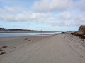
This beautiful route allows you to discover a varied coastline with vast sandy beaches, pebble beaches and a long stretch of cliffs between Calais and Boulogne. It also offers short detours away from the coast into dune nature reserves.This multi-day hike will appeal not only to lovers of remarkable natural sites, but also to enthusiasts of architectural heritage and birdwatchers (during migration periods).
Boezinge and the Kermiswandeling of 2025
9.74 mi
+26 ft
-26 ft
4h 30
Moderate
Departure from Ieper (Flandre-Occidentale)
Start and finish at the car park of Boezinge church, with a walk along the canal that connects the Lys to the Yser. Boezinge was devastated during the First World War
The town became a ghost town. Nothing remained of the buildings; the church was also completely destroyed. It was not until the summer of 1919 that the first inhabitants of Boezinge returned
 Zwinroute from Cadzand-Bad
23.50 mi
+33 ft
-33 ft
4 hrs
Moderate
Departure from Belgium
A wide canal, the Zwin, runs through the dunes between the Netherlands and Belgium. Marshes, mudflats and sandy expanses punctuate this 39 km route. Not to mention the typical Flemish border villages.
In the 12th century, the Zwin stretched as far as Bruges, then a seaport. The route silted up and soon became impassable. Streams, ravines and mudflats took its place. Today, it is a dynamic region where the tides fluctuate.
Along the way, enjoy the bustle of border towns such as Sluis, interspersed with peaceful villages such as Sint Anna ter Muiden. In Cadzand-Bad, the boulevard gently transforms into a cycle path beyond the dyke, offering breathtaking views of the Western Scheldt.
Westvleteren, Sint-Sixtus Abbey via the Dozinghembos
9.56 mi
+105 ft
-102 ft
4h 30
Moderate
Departure from Vleteren (Flandre-Occidentale)
Departure from the car park of Sint-Sixtus Abbey in Westvleteren. Pass through the Dozinghembos, along anunpaved path in the Dozinghembos and partly between fields. Then into the forest that is part of the Sixtusbossen.Following this route, you will encounter several beautiful forests in this part of the province of West Flanders. You will also enjoy wide views of the agricultural landscape.
Dadizele Pompeschitter, Ter Hand and Panemolen 16
9.96 mi
+112 ft
-105 ft
4h 40
Moderate
Departure from Moorslede (Flandre-Occidentale)
A circular walking route starting from the car park at the Basilica of Notre-Dame de Dadizele. This route takes in country lanes, green fields, chapels and local farms.
Geluveld, Polygonbos, Nonnebossen and The Brothers in Arms Memorial
9.64 mi
+302 ft
-308 ft
4h 40
Moderate
Departure from Zonnebeke (Flandre-Occidentale)
A circular walking route starting from the car park at Geluveld Church, via the Polygoonbos, the Nonnebossen, the ‘The Brothers in Arms’ memorial and the Buttes New British Cemetery in Polygon Wood.
Geluveld, Polygoonbos, Nonnebossen and The Brothers In Arms Memorial
6.27 mi
+115 ft
-102 ft
3h 00
Moderate
Departure from Zonnebeke (Flandre-Occidentale)
A circular walking route starting from the car park at Geluveld Church, via the Polygoonbos (one of Belgium’s oldest state-owned forests), the Nonnebossen and the Brothers In Arms Memorial
Circular from Zillebeke and the 't Riet cultural centre
9.53 mi
+276 ft
-262 ft
4h 35
Moderate
Departure from Ieper (Flandre-Occidentale)
Departure and arrival at the car park of the cultural centre in 't Riet in Zillebeke.
Passing through the woods of Zwarte Leen, Mont Sorrel, Zandvoorde, Sanctuary Wood, and the provincial domain of Vierlingen
Palingbeek and Hill 62 starting from Zillebeke
9.34 mi
+348 ft
-331 ft
4h 35
Moderate
Departure from Ieper (Flandre-Occidentale)
Walk along part of the First World War front line: the area between Hill 60 and Hill 62. You will also pass one of the most remarkable and interesting war museums in Belgium: the Sanctuary Wood Museum. A must-see. You can also have a drink there.Departure from the in 't Riet cultural centre via the visitor centre of the Palingbeek provincial estate and the Canadian site Hill 62.
Hill 60, Mont Sorrel and Zwarte Leen from Zillebeke
9.51 mi
+295 ft
-295 ft
4h 40
Moderate
Departure from Ieper (Flandre-Occidentale)
Departure from Zillebeke, at the in 't Riet cultural centre, via the provincial estate of Palingbeek, the Caterpillar crater, Hill 60, Zwarte Leen, Mont Sorrel and Hill 62.
Zillebeke, Hooge Crater, Bellewaerde, Mont Sorrel and Palingbeek
9.66 mi
+417 ft
-417 ft
4h 50
Moderate
Departure from Ieper (Flandre-Occidentale)
A circular walking route starting from Zillebeke Church via the Hooge Crater: the fourth-largest Commonwealth military cemetery in Europe, with 5,923 graves. Nearby are Bellewaerde amusement park, Mont Sorrel and the Palingbeek Estate nature reserve.
Zillebeke, Hooge Crater Cemetery, Bellewaerde and Mont Sorrel
9.45 mi
+213 ft
-200 ft
4h 30
Moderate
Departure from Ieper (Flandre-Occidentale)
A circular walking route starting from Zillebeke Church and passing through the fourth-largest Commonwealth military cemetery in Europe, with 5,923 graves: Hooge Crater Cemetery. The walk passes by Bellewaerde Park, Mont Sorrel, Zwarte Leen and Palingbeek.
Mount Sorrel, Hill 60, Caterpillar Crater starting from Zandvoord
9.45 mi
+272 ft
-266 ft
4h 35
Moderate
Departure from Zonnebeke (Flandre-Occidentale)
Departure from the car park on Kleine Leperstraat in Zandvoorde via Mount Sorrel, Hill 60, Caterpillar Crater, and the provincial domain of Palingbeek.
Zillebeke Zwarteleenstraat via Palingbeek and the Caterpillar crater
9.47 mi
+246 ft
-220 ft
4h 35
Moderate
Departure from Zonnebeke (Flandre-Occidentale)
Departure and arrival at the car park on Zwarteleenstraat in Zillebeke or at the following car parks: Kleine Ieperstraat in Zandvoorde, the Palingbeek estate in Hollebeke or Hill 60: Zwarteleenstraat 40 in Zillebeke
Caterpillar Crater Circular Loop
7.89 mi
+285 ft
-276 ft
3h 55
Moderate
Departure from Ieper (Flandre-Occidentale)
This 12.1 km circular walk starting from Hill 60, near Ypres, offers an immersion in nature and the memory of the First World War. Accessible and of moderate difficulty, it begins along the Ypres-Komen canal before crossing the open landscapes and ponds of the Palingbeek estate. The route alternates between paths, forest trails and wooden footbridges, with a few flights of steps.
Zillebeke via Mont Sorrel and Zandvoordebos
6.63 mi
+144 ft
-148 ft
3h 10
Moderate
Departure from Ieper (Flandre-Occidentale)
Departure from the car park on Zwarteleenstraat in Zillebeke via Mont Sorrel and Zandvoordebos. Crossing the woods of Zandvoorde and the provincial domain of West Flanders. Passing through Mont Sorrel.
The Gasthuisbossen from Ypres
6.00 mi
+144 ft
-144 ft
2h 55
 Easy
Departure from Ieper (Flandre-Occidentale)
Easy
Departure from Ieper (Flandre-Occidentale)
A very pleasant hike: lots of woodland, very few small roads and some beautiful clearings.
A good half-day in the great outdoors.
This hike can be combined with a stroll through the Palingbeek Estate for a route of about 22 km (connecting route between Palingbeek and Gasthuisbossen).
Zillebeke Palingbeek Vaartstraat via Zwarte Leen and Mont Sorrel
9.43 mi
+240 ft
-223 ft
4h 35
Moderate
Departure from Ieper (Flandre-Occidentale)
Departure and arrival at the car park of the visitor centre of the provincial domain of Palingbeek, Vaartstraat 7 in Zillebeke. Other departure and arrival points are possible at the Hill 60 car park on Zwarteleenstraat in Zillebeke or at the car park on Zwarteleenstraat 7 in Zillebeke via Mont Sorrel.
A stroll through the Palingbeek estate
 6.69 mi
+295 ft
-289 ft
3h 20
Moderate
Departure from Ieper (Flandre-Occidentale)
6.69 mi
+295 ft
-289 ft
3h 20
Moderate
Departure from Ieper (Flandre-Occidentale)
A lovely cool walk when it’s hot in the Palingbeek Estate, which is remarkably well-maintained considering we’re in Belgium.There are numerous paths on the site; I recommend using the app.For history buffs, there are plenty of information boards (in multiple languages!).
Please note, it gets very busy at weekends.
This walk can be combined with the Gasthuisbossen for a route of around 22 km (connecting route between Palingbeek and the Gasthuisbossen)
Circular Zillebeke Palingbeek Vaartstraat
6.74 mi
+240 ft
-240 ft
3h 20
Moderate
Departure from Ieper (Flandre-Occidentale)
Departure from the car park at the visitor centre of the Palingbeek provincial estate on Vaarstraat.
Dikkebus Pond, the Dickebusch Military Cemetery and the hamlet of Klijte
9.66 mi
+144 ft
-135 ft
4h 35
Easy
Departure from Ieper (Flandre-Occidentale)
A circular walking route starting from the car park at Zillebeke Pond, passing through the Dickebusch Old Military Cemetery, the hamlet of De Klijte and the British Military Cemetery ‘The Huts’ in Ypres
Circular via Voormezele starting from Dikkebus Pond
9.62 mi
+108 ft
-95 ft
4h 30
Moderate
Departure from Ieper (Flandre-Occidentale)
Start and finish at the Dikkebus pond car park. The route crosses a meadow where, in summer, you may encounter cows grazing on the grass.
The ponds near Ypres
 15.91 mi
+207 ft
-210 ft
7h 30
Difficult
Departure from Ieper (Flandre-Occidentale)
15.91 mi
+207 ft
-210 ft
7h 30
Difficult
Departure from Ieper (Flandre-Occidentale)
A long walk in Belgium, a little flat, but the length makes up for it. It will allow you to discover beautiful lakes, the Palingbeek estate and part of the ramparts of Ypres.
It may be a little monotonous, but it is sometimes pleasant to hike on well-maintained trails with good signposting. Our Pas-de-Calais has some progress to make in this area. The signposting system is the same as for the Mont Kemmel and Mont Rouge walks.
Comines, Ten Brielen and Moulin Soete
9.35 mi
+85 ft
-85 ft
4h 20
Moderate
Departure from Comines-Warneton (Hainaut)
Departure and arrival at the Moulin Soete car park in Comines-Ten-Brielen via the countryside of Kruiseke in Wervik and Houthem
Passing by the Ravenstein vineyard in Wervik-Kruiseke and the Ferme Bleue vineyard.
Houthem, Ten-Brielen, Zandvoorde and Hollebeke
9.45 mi
+62 ft
-66 ft
4h 25
Moderate
Departure from Comines-Warneton (Hainaut)
A circular walking route starting at Houthem Church, via the Ferme Bleue vineyard, the countryside around Ten Brielen, Kruiseke, Zandvoorde and Hollebeke, the Ypres–Comines Canal and La Cortewilde
Houthem, its church, the Comines–Ypres Canal and the countryside around Hollebeke
6.30 mi
+95 ft
-95 ft
3h 00
Moderate
Departure from Comines-Warneton (Hainaut)
A circular walking route starting at Houthem Church, passing by the old Comines–Ypres Canal, the La Cortewilde neighbourhood, the countryside around Hollebeke and Wijtschate, and the Clarebout vineyard in Houthem.
Wijtschate church via the Wulvergem countryside and the Kampagnebos woods
6.23 mi
+338 ft
-338 ft
3h 10
Moderate
Departure from Heuvelland (Flandre-Occidentale)
Departure and arrival at the car park near the Church of Saint Médard in Wijtschate via the Wulvergem countryside and the Kampagnebos woods
This hike partly follows the route called Craters and Mines
Wijtschate and St Médard Church via the Spanbroekmolen Krater
6.24 mi
+233 ft
-220 ft
3h 05
Moderate
Departure from Heuvelland (Flandre-Occidentale)
Departure and arrival near the Church of Saint-Médard in Wijtschate via the Spanbroekmolen Krater.
This is part of the Crater and Mine route, which passes through key battle sites from the 1914-1918 war, including the historic site of the British military cemetery and its crater: Spanbroekmolen.
The route also passes close to the British military cemeteries of Lone Tree, Irish House and Wijtschaete Cemetery.
Wijtschate centre via Hollebeke and the Palingbeek estate
9.44 mi
+210 ft
-213 ft
4h 30
Easy
Departure from Heuvelland (Flandre-Occidentale)
Departure and arrival at the car park in front of the church in Wijtschate. Pass through the countryside of Houthem and Hollebeke, along the Kortrijk-Poperinge railway line and along the southern flank of the Palingbeek estate.
De Klijte and the countryside around Reningelst and Dikkebus
9.58 mi
+141 ft
-138 ft
4h 30
Moderate
Departure from Heuvelland (Flandre-Occidentale)
A circular walking route starting at the church in the hamlet of De Klijte in Reningelst, through the countryside around Reningelst and Dikkebus, and past the Klein-Vierstraat British Military Cemetery
De Klijte via Scherpenberg and Mont Rouge
9.42 mi
+610 ft
-604 ft
4h 50
Moderate
Departure from Heuvelland (Flandre-Occidentale)
Departure from the car park at De Klijte church. Crossing Scherpenberg and the Hellebeek nature reserve. Passing close to the vineyards of Mont Kemmel, Mont Rouge and Mont Noir.
From De Klijte via Lettenberg, Kemmelberg, Monteberg and Scherpenberg
9.68 mi
+577 ft
-574 ft
4h 55
Moderate
Departure from Heuvelland (Flandre-Occidentale)
Departure and arrival in De Klijte via Lettenberg, Kemmelberg, Monteberg and Scherpenberg. Crossing Scherpenberg and the Hellebeek nature reserve. Passing close to the vineyards of Mont Kemmel, Mont Rouge and Mont Noir.
Loker, Scherpenberg, Mont Rouge and Sulferberg starting from De Klijte
9.73 mi
+768 ft
-794 ft
5h 10
Moderate
Departure from Heuvelland (Flandre-Occidentale)
Departure from the car park of De Klijte church via Loker, Scherpenberg, Mont Rouge and Sulferberg.
Mont Rouge circular starting from De Klijte
9.48 mi
+797 ft
-794 ft
5h 05
Moderate
Departure from Heuvelland (Flandre-Occidentale)
Departure and arrival at the car parks either at De Klijte church or Loker via Scherpenberg, Sulferberg and the Mont Rouge nature reserve (Hellegatbos, or 'hole in the hill') with its De Kosmos recreation park.
Mont Rouge from Loker
4.70 mi
+325 ft
-322 ft
2h 25
Easy
Departure from Heuvelland (Flandre-Occidentale)
A pleasant short hike near Loker and Le Mont Rouge, with easy-to-use numbered markings.
Around and on Mont Rouge
 10.03 mi
+787 ft
-814 ft
5h 20
Difficult
Departure from Heuvelland (Flandre-Occidentale)
10.03 mi
+787 ft
-814 ft
5h 20
Difficult
Departure from Heuvelland (Flandre-Occidentale)
A long, slightly winding route to enjoy the beautiful Belgian trails, which are well maintained and clearly marked.
Simple signposting: there are posts with numbers and an arrow indicating the number you want to go to (not easy to explain but obvious when you're there).
Difficult route, even very difficult in wet weather.
Roller coaster and maze on the Monts de Flandre
13.66 mi
+1,427 ft
-1,417 ft
7h 30
Difficult
Departure from Heuvelland (Flandre-Occidentale)
This is a route on which I had fun concentrating as many difficulties as possible (more than 400 m of elevation gain). This gives it a somewhat labyrinthine feel, but it allows you to avoid tarmac as much as possible. So you walk from peak to peak on well-marked, clean paths. The use ofthe Visorando app is highly recommended, even though the numbering system is very practical.
Scherpenberg and Rodeberg, mid-season route
 12.37 mi
+942 ft
-938 ft
6h 30
Difficult
Departure from Heuvelland (Flandre-Occidentale)
12.37 mi
+942 ft
-938 ft
6h 30
Difficult
Departure from Heuvelland (Flandre-Occidentale)
When the weather becomes a little wetter, you can still hike on Mont Rouge.
This route alternates between small roads (with little traffic), paths and forest trails, which makes it a little less strenuous.
It is a winding route, so the app is very useful.
There is quite a bit of elevation gain and, in wet weather, the trails are quite slippery. The walk is therefore quite tiring (equivalent to a 25 km route).
The Red and the Black
 10.86 mi
+1,276 ft
-1,270 ft
6h 05
Difficult
Departure from Heuvelland (Flandre-Occidentale)
10.86 mi
+1,276 ft
-1,270 ft
6h 05
Difficult
Departure from Heuvelland (Flandre-Occidentale)
Return to Mont Rouge, passing through the Bois du Mont Noir. Enjoy a beautiful stroll through the woods, ending with a superb (and challenging) staircase.
Be careful, as soon as it gets a little wet, the paths become very difficult and you can sometimes find yourself with mud up to your mid-shoes. This was the case this morning (19 November 2021).
The plain around Mont de Boeschepe
8.42 mi
+531 ft
-538 ft
4h 20
Moderate
Departure from Boeschepe (Nord)
Starting from the typical Auberge du Vermont, a route through the plains of Flanders at the foot of Mont des Cats and its monastery. Pass by the Moulin de l'Ingratitude and the Vierpot estaminet. Pass through the Boeschepe and Kokereel hills. View of Belgium, Bailleul.
Mont des Cats and the Helleketelbos Nature Reserve
 15.05 mi
+774 ft
-784 ft
7h 35
Difficult
Departure from Godewaersvelde (Nord)
15.05 mi
+774 ft
-784 ft
7h 35
Difficult
Departure from Godewaersvelde (Nord)
After passing through Mont des Cats, you head back down to Boeschepe before a short detour into Belgium near Poperinge. As a bonus, there’s a ‘short’ circular route through the Helleketelbos nature reserve – just for the fun of getting your boots muddy.
Around Mont des Cats (Katts Walk)
 3.03 mi
+322 ft
-322 ft
1h 40
Easy
Departure from Godewaersvelde (Nord)
3.03 mi
+322 ft
-322 ft
1h 40
Easy
Departure from Godewaersvelde (Nord)
Walk around the Mont des Cats monastery. Peaceful, natural surroundings and panoramic views guaranteed.
Let’s wander around the mountain
17.41 mi
+1,434 ft
-1,404 ft
7 hrs
 Very difficult
Departure from Godewaersvelde (Nord)
Very difficult
Departure from Godewaersvelde (Nord)
A very long route on and around Mont des Cats, allowing you to explore its southern section. I’ve tried to take as many paths as possible, resulting in a very winding route (hence the name of the walk). Take care on the small roads where visibility isn’t always very good.
Mont Cassel and Mont des Récollets starting from Terdeghem
 10.06 mi
+607 ft
-587 ft
5h 10
Moderate
Departure from Terdeghem (Nord)
10.06 mi
+607 ft
-587 ft
5h 10
Moderate
Departure from Terdeghem (Nord)
This route alternates between small roads and paths.
Explore Cassel via the Chemin des Remparts and enjoy a bite to eat as we’re two-thirds of the way through the walk.
After Cassel, we follow a series of paths to reach Terdeghem.