Country:

 City:
City:


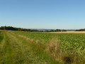
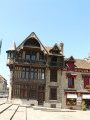
The walk starts on the forecourt of Fontainebleau-Avon station (on the side of platform 2).
(S) With your back to the station, head left and walk down Rue du Viaduc. You’ll reach the first roundabout beneath the viaduct’s piers. Walk alongside it, without crossing it at any point.
(1) At the second roundabout, keep going in the same direction, before naturally heading uphill along Rue des Déportés. At the junction with Rue Gambetta, take the Pont d’Avon bridge over the railway lines.
(2) Leave the road immediately and turn right onto the Chemin de Saint-Aubin, which heads diagonally into the forest (avoid the path furthest to the right, which runs alongside the railway lines again). At the first junction, take the second path on the right heading south-east (unnamed path; do not take the Route de Diane). 200 metres further on, cross the Route forestière du Grand Jarrier, then head due south.
(3) At the next junction, turn left onto the Route du Prince. Follow this track eastwards for about 800 metres, below Mont Andart.
(4) At the crossroads, take the third path on the right, the Route de la Porte Nadon. Continue straight on (south-east) until you reach the Carrefour de la Petite Haie.
(5) Then take the third path on the right (south) to climb up onto the widened railway platform nearby. N.B. Do not attempt to cross the railway line; our route passes underneath it a little further on. Follow this platform eastwards to reach the tarmac road, near the Thomery bus stop.
(6) Pass under the tracks and follow the Route Ronde (tarmac road) for about 150 metres.
(7) Then turn left and rejoin the Route de la Porte Nadon. Follow this lovely forest lane for about 2 km; pass the Fraillons crossroads, then the Pointe d’Irai crossroads, and arrive at the Carrefour des Ventes Nadon.
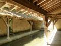
(8) Carry on straight ahead, passing a few houses in a housing estate. Enter the woodland again (the Bois Prieur, which is fenced off as it is currently being regenerated; access is permitted for walkers provided you close the gate properly behind you). On leaving the woodland, cross the Route du Bois Prieur and carry on straight ahead (an old wash house is down to the left).
(9) At the T-junction, turn right then immediately left (zigzag) onto Rue Boris Grinson. At the end of the street, turn left onto the D302 (Avenue de Fontainebleau), heading downhill.
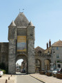
(10) Pass close to Veneux-les-Sablons station (option to return to Fontainebleau) and continue along the D302 on the pavement. Pass under a railway bridge. At the roundabout, turn right onto Avenue Jean Jaurès. Pass the Porte de Paris, which marks the entrance to the town centre of Moret-sur-Loing, and carry on straight ahead.
(11) Pass the Porte de Bourgogne, which marks the exit from the old town. Cross the bridge over the Loing, continue straight on, and cross a second bridge over the canal.
(12) Turn immediately right after the bridge, towards Écuelles. Follow Rue de l’Orvanne.
(13) Pass under the D606 and continue with the canal on your right.
(14) At the roundabout, go straight on along the D218, which is lined with vast quarries. Climb to the top of the road, then descend back down into the valley.
(15) As you come out of the left-hand bend, turn sharply right towards La Fontaine du Dy. After about a hundred metres, take a wide, partly cobbled path on the left.
(16) Follow theGR®11to the left (red and white markings). Head uphill towards Villecerf, pass the cemetery and head back down.
(17) At the foot of the church, turn left. Cross the D21, then pass through a damp area and cross the Ruisseau des Bouillons. At the end of the path, turn right onto a road and pass through the hamlet of La Fondoire.
(18) Cross the D403 and turn left onto the Chemin des Roulis. Climb gently, then descend into the Orvanne valley and its tributaries at Pilliers.
(19) Pass through Pilliers and continue along the road to the hamlet of La Vallée de Dormelles, without attempting to follow theGR®11, which heads off into the fields to the left.
(20) Carry on straight ahead (ignore the short walking trail on the right) and cross the hamlet. At the end, turn right onto the D120E and rejoin theGR®11.
(21) At the crossroads (cross), turn left onto a small road. At the first Fork in the road, turn left towards La Ronce (end of the hedgerow-lined valley floor). At the second Fork in the road, do the same.
(22) Just before the hamlet, directly beneath a power line, leave the road and follow a wide, gradually ascending stony track to the left. Cross the cereal-growing plateau, heading north-east. From the summit, take in the view of Montereau, the Yonne valley and the Bassée (the Seine valley).
(23) Cross the Vanne aqueduct near a small wooded area and head downhill. Cross the D120E1 and continue gradually downhill along theGR®11to the D120.
(24) Then turn left and take the well-marked path to the left of the road.
(25) At the start of a left-hand bend, before the roundabout, cross the D120 to take the path opposite heading north (take care, this section is not secured). Then cross the D606 at the zebra crossings (take care) and take the path opposite, slightly to the right (still heading north).
(26) Turn right onto the D403 (an easier route than theGR®, with good pavements or verges). Continue along this road, ignoring any side roads. Cross Avenue Albert Grave. At the next roundabout, go straight on and pass under the railway lines. Then turn left onto Rue Léo Lagrange, then left again to reach Montereau station (E).

 Visorando Member
 Moderate
 Easy
Easy