Œnorando® Between the Costières and the Camargue from Gallician

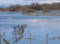
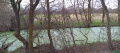
This walk, marked in yellow, invites you to explore the southernmost part of the Costières de Nîmes AOP. On this land of rounded pebbles, the sun, the mistral and the sea breezes combine to create a unique terroir, evident even in the pebble walls of the cellars and estates you’ll come across along the way. Set between the two canals of southern Gard, the vineyard plots of the Costières de Nîmes AOP and a viewpoint overlooking the ponds, this easy walk will transport you through the varied landscapes of the Camargue in the Gard. It’s the perfect opportunity to observe the typical Costières terroir, with its pebbles smoothed over millennia by the Rhône, the wine-growing farmhouses and their imposing gates, whilst keeping an eye out for the Camargue birds that inhabit the banks of the canals.

Details

102614420
Creation:
Last update:
Last review:
  • Walking
    Activity: Walking
  • ↔
    Distance: 6.51 mi
  • ◔
    Average duration: 3h 05 
  • ▲
    Difficulty: Moderate

  • ⚐
    Back to start: Yes
  • ↗
    Ascent: + 112 ft
  • ↘
    Descent: - 98 ft

  • ▲
    Highest point: 105 ft
  • ▼
    Lowest point: 3 ft
  • ⚐ Country: France
  • ⚐ City: Vauvert (30600)
  • ⚑
    Start/End: N 43.641409° / E 4.297772°
  • ❏
    IGN map(s): Ref. 2943OT
  • Hour-by-hour weather

Photos

Description of the walk

You can choose to start from either the car park opposite the Gallician Signature winery or the one at Mas du Notaire.

(S/E) In both cases, opposite the town hall, turn right onto the D779 and follow the green sign for “Œnorando®”

(1) At Gallician marina, before the bridge, turn right towards La Laune, following the riverbank.

(2) At La Laune, cross the wooden footbridge on the right and follow the path lined with a stone wall. Then, turn left towards “Mas Tessier”.

(3) At Mas Tessier, walk behind the farmhouse between two cypress hedges and cross the Costière irrigation canal. Continue straight on between the orchards towards Bas Coquillon along a pebbly path.

(4) Turn right through the vineyards, then, at Bas Coquillon, head down a tarmac road that passes behind the Mas du Petit Bourry with its two red bell towers. Continue for 400 metres.

(5) At the bottom of the descent, at Les Clochettes, turn right towards ‘Haut Coquillon’ onto a dirt track that climbs through the woodland.

(6) At Haut Coquillon, turn right towards Valat de Lagnon onto the Voie Verte, which runs alongside the irrigation canal.

(7) At Valat de Lagnon, head towards Mas Près Gallician along a dirt track that climbs for a few metres, first turn right then left, then descend through the vineyards to the D 779.

(8) At Mas Près Gallician, follow this road to the right (take care!) to return to the starting point, turning left at the end of the street, then right (S/E).

Waypoints

  1. S/E : mi 0 - alt. 7 ft - Mas du Notaire
  2. 1 : mi 0.19 - alt. 3 ft - Marina - Canal du Rhône à Sète
  3. 2 : mi 1.33 - alt. 7 ft - La Laune - Canal du Rhône à Sète
  4. 3 : mi 2.18 - alt. 49 ft - Mas Tessier
  5. 4 : mi 2.77 - alt. 79 ft - Bas Coquillon
  6. 5 : mi 3.92 - alt. 20 ft - Les Clochettes
  7. 6 : mi 4.35 - alt. 66 ft - Haut Coquillon - canal du Bas-Rhône Languedoc ou canal Philippe-Lamour
  8. 7 : mi 5.6 - alt. 72 ft - Valat de Lagnon - canal du Bas-Rhône Languedoc ou canal Philippe-Lamour
  9. 8 : mi 6.17 - alt. 26 ft - Mas Près Gallician
  10. S/E : mi 6.51 - alt. 7 ft - Mas du Notaire

Notes

Free drinking water available at the Gallician boules court.

Worth a visit

This route is certified Œnorando®. It invites you to meet the winemakers at the Gallician Signature winery and the Mas du Notaire, to discover their cultivation and winemaking methods, taste their often award-winning wines and enjoy the activities, events and workshops they offer their visitors.

Other walks in the area

For more walks, use our search engine .

The GPS track and description are the property of this route's author. Please do not copy them without permission.