North of Avize Mountain

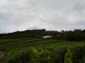
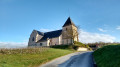
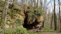
Discover the limestone cliffs of the Avize mountain and, for nature enthusiasts, all the unique features of this ZNIEFF (Natural Area of Ecological, Faunal and Floristic Interest) on the Grauves cliffs.

Details

3481826
Creation:
Last update:
Last review:
  • Walking
    Activity: Walking
  • ↔
    Distance: 6.09 mi
  • ◔
    Average duration: 3h 15 
  • ▲
    Difficulty: Moderate

  • ⚐
    Back to start: Yes
  • ↗
    Ascent: + 558 ft
  • ↘
    Descent: - 561 ft

  • ▲
    Highest point: 797 ft
  • ▼
    Lowest point: 453 ft
  • ⚐ Country: France
  • ⚐ City: Grauves (51190)
  • ⚑
    Start/End: N 48.973672° / E 3.96302°
  • ❏
    IGN map(s): Ref. 2713E
  • Hour-by-hour weather

Photos

Description of the walk

On the main street, park in the town hall car park or, if you miss the entrance, walk back up the street and park in the car park opposite the entrance to the Maison des Associations (as shown on the route).

(S/E) From the car park opposite the entrance to the Maison des Associations, head back towards the main street (Rue d’Épernay), turn left onto it, then take the first right (Rue du Château) – look out for the clay pigeon shooting sign – then the first left (Rue du Buat). A little further on, near the last few houses, continue along the road that climbs to the right and, after 300 m, turn onto the road on the right, towards the cliffs which can be seen from below.

(1) Ignore the path on the right which climbs towards the paragliding/hang-gliding launch site and carry on straight ahead along the vineyard track.

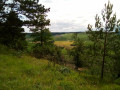
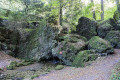
(2) Here, make sure you don’t miss the path branching off to the right into the woodland and follow this path, which runs (albeit at a fair distance) along the base of the limestone cliffs, from where you can see boulders of varying sizes that have broken away from the cliff face. And whilst you’re there, take a moment to admire the view over the valley and the vineyards.

(3) Leave the cliff path and follow the vineyard track for about 200 m before turning right onto the path that climbs; follow this until you reach a good track, which you’ll follow for about 150 m.

(4) You’ll come to a junction where three paths meet; take the middle one and follow it for about 600 metres until you reach a crossroads, where you’ll turn left and continue for about 450 metres.

(5) Leave the path that goes straight down and turn right for about 50 metres before turning left; after about 75 metres, take the path on the right (please note: from here to point 6, this section can be very slippery in wet weather).

(6) When you reach this wide junction, turn right. If the clay pigeon shooting range is in use, you can follow the sound of the shots. After about 500 m, just as the path starts to descend and is blocked on the right (due to the shooting range) by construction tape, turn onto a track that branches off to the left and runs along the hillside.

(7) In reality, the path coming from the left and the two paths mentioned in point 8 are at the same junction. You should therefore ignore the path on the right that goes downhill (and leads straight back to the village of Grauves) and continue straight on until the next junction, which is very close by.

(8) You’ll reach a fork in the road where you should take the left-hand path – which is very slippery in wet weather – for about 450 m (note that there is a discrepancy between the position of point 8 as marked on the actual route during the walk and on the map). At this point, an alternative route via the path on the right will take you directly to the riding centre.

(9) At a left-hand bend with two possible paths: a hairpin bend heading back north and another turning 90° to the left of our current path. Follow the latter path for just under 150 m before taking the path on the right, which descends to the road (D19).

(10) Cross the road carefully to the right.
(User comment dated 15 August 2024: private property with a sign. Another user comment dated 1 April 2025:riding centre; the owner told us it was private property).

(11) Take the path on the right which runs alongside the riding centre and follow it for about 900 m until you come to a good road leading downhill to the left, which takes you to the centre of Grauves; then, following the main street, it takes you back to the car park (S/E).


Waypoints

  1. S/E : mi 0 - alt. 466 ft - Car park opposite the entrance to the Maison des Associations
  2. 1 : mi 0.72 - alt. 666 ft - Straight ahead along the vineyard path
  3. 2 : mi 1.05 - alt. 682 ft - On the right, a path through the woodland
  4. 3 : mi 1.42 - alt. 653 ft - Exit the path at the foot of the cliffs
  5. 4 : mi 2.16 - alt. 778 ft - Passing the beehives
  6. 5 : mi 2.94 - alt. 774 ft - Short series of bends: right, left, right
  7. 6 : mi 3.33 - alt. 791 ft - Major junction
  8. 7 : mi 4.37 - alt. 745 ft - Opposite
  9. 8 : mi 4.4 - alt. 732 ft - Turn left at the fork
  10. 9 : mi 4.7 - alt. 738 ft - 90° junction: take the left-hand path
  11. 10 : mi 4.93 - alt. 719 ft - By road
  12. 11 : mi 5.14 - alt. 640 ft - Turn right towards the vineyard path
  13. S/E : mi 6.09 - alt. 466 ft - Car park opposite the entrance to the Maison des Associations

Notes

- The clay soil in this part of the Avize hills makes some paths very slippery, so wear suitable footwear;
- Despite the damp conditions and clay soil, there are no clearly visible streams, so make sure you bring water with you;
- Do not venture into the designated clay pigeon shooting area;
- Follow the GPS route carefully (on the Visorando app, of course) or the route description, as a few discrepancies between the map and the actual terrain mean it’s easy to take a wrong turn in certain places.

Worth a visit

- Beautiful views over the valley;
- For nature enthusiasts: look out for plants, insects and fossils;
- Take-off area for paragliders and hang-gliders (or for spectators);
- Opportunities to vary, extend or shorten the walk via the various paths and trails throughout the area.

Reviews and comments

4.3 / 5
Based on 2 reviews

Reliability of the description
4 / 5
Ease of following the route
4.5 / 5
Route interest
4.5 / 5
Christian boussin
Christian boussin

Overall rating : 5 / 5

Date of your route : Apr 01, 2025
Reliability of the description : ★★★★★ Very good
Ease of following the route : ★★★★★ Very good
Route interest : ★★★★★ Very good
Very busy route : No

Hello
A group of friends and I have completed your walk, though we took a slightly different route at the start.
In fact, at Bridge 1, we climbed up above the cliffs – the little path at the top is lovely.
One other thing: towards the end, the route takes you through the riding centre, but there the owner asked us where we’d come from in a rather unfriendly tone and told us it was private property and that we had to leave via the main gate.
Apart from that, everything was fine.
Have a nice day
Christian Boussin

Machine-translated

BrunoFlyman
BrunoFlyman
• Edited:

Hello,
As soon as I get back from my trip, I’ll do this walk again and correct the route

Machine-translated

BrunoFlyman
BrunoFlyman
• Edited:

Hello,
It’s true that GPS tracking is sometimes necessary, and unfortunately, plots of land that are freely accessible one day may, some time later, turn out to be on private property.

Machine-translated

scheatt
scheatt

Overall rating : 3.7 / 5

Date of your route : Aug 15, 2024
Reliability of the description : ★★★☆☆ Average
Ease of following the route : ★★★★☆ Good
Route interest : ★★★★☆ Good
Very busy route : No

It’s not easy to follow the descriptions of the various waypoints. There are lots of sections through woodland, and as some of the paths aren’t well-used, they aren’t immediately obvious. Follow the GPS.

As for the section at point 10, perhaps there wasn’t a ‘private property’ sign there the first time we went past. There is one there now. We had to turn back after meeting the owner of the riding centre. Take the road instead.

Machine-translated

Other walks in the area

For more walks, use our search engine .

The GPS track and description are the property of this route's author. Please do not copy them without permission.