Country:
 City:


Our tour begins at Mannheim University Hospital, right by the Friedrich-Ebert Bridge. You can reach the starting point by taking tram lines 15, 2, 4, 4A, 5, 5A or 7 to the ‘Universitätsklinikum’ stop. If you’re coming by car, you can use the University Hospital’s car parks (subject to a charge).
(S/E) Between the Friedrich-Ebert Bridge and the University Hospital, we begin our walk along the Theodor-Kutzer-Ufer through the avenue of plane trees, past the main entrance to the historic hospital building.
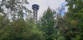
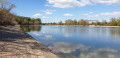
(1) We cross the entrance to the hospital’s visitor car park and stay on the footpath along the Neckardamm, with the River Neckar to our right below us. To our left, we pass the Maruba – the restaurant of the Mannheim Rowing Club Baden. On the right bank of the Neckar, we can see the television tower. Here, the Neckar splits and we can make out the tip of Maulbeerinsel, the highlight of today’s walk. Directly ahead of us, on the horizon, we can make out the hills of the Odenwald, and on a clear day you can see the telecommunications tower on the Weißer Stein, the highest peak in the area. From here on, our route takes us upstream for a few kilometres to the left of the Neckar Canal. At the first fork just after the Maruba, we keep to the right and stay on the tarmac footpath along the embankment. The path curves down to the left and we pass the PSV Schützenhaus on our left.
(2) The path takes us through an underpass; we continue straight on, reach the outlying houses of Feudenheim and walk slightly uphill back to the banks of the Neckar Canal, past the approaches to the Feudenheim lock. The path is now gravelled and continues in a straight line further upstream. To our left are the hockey pitches of the Mannheim hockey clubs. We pass under the Carlo-Schmid Bridge on the B38a and reach the next bridge over the Neckar.
(3) We ignore the steps on the left and follow the path to the right, passing under the bridge and continuing straight on along the Neckar Canal. Our path takes us under the A6 motorway; it is tarmacked for a few metres and then becomes cobbled. Shortly afterwards, we reach the first houses of Ilvesheim. We come to Hebelstraße, which we follow for about 100 metres.
(4) At the Bauer Reisen garage, the road bends to the left and we continue straight on along the footpath, which takes us back to the canal. We pass under Feudenheimer Straße; immediately after the bridge, a steep flight of steps leads up onto the bridge. Here, you could already cross the Neckar Canal and continue the walk downstream on the opposite side. However, we stay on the path. Just after the steps, on the left-hand side, there’s a spot to take a break; there are several shaded table-and-bench sets. We eventually reach Stettiner Straße, which we follow straight ahead, travelling upstream.
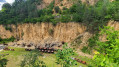
(5) As soon as the road curves to the left, we carry on straight ahead onto the footpath, pass a barrier and continue our walk right alongside the canal. Shortly afterwards, we pass under the next (pedestrian) bridge – here, too, there is the option to continue the walk on the other side of the canal in the opposite direction. However, we stay on the path and continue walking upstream along the Neckar Canal. Shortly after the bridge, we turn right onto a narrow footpath and carry on directly along the bank until we see the first chimneys of the ICL industrial harbour ahead of us. On the horizon, you can now clearly make out the Schriesheim quarry, an insider’s tip for climbers in the region.
(6) The path runs alongside the fence, moving slightly away from the water, and we cross the harbour area via the road. Please take care of the traffic here. We come to a large car park on our right, which we walk alongside until we reach the next junction.
(7) We reach the ‘Ladenburg Kanalbrücke’ bus stop; here, we turn right towards the bridge. After a few metres, the path crosses Ilvesheimer Straße and we follow the footpath and cycle path to the left of the road uphill.
(8) Normally, you can cross Ilvesheimer Straße here and rejoin the riverside path straight away. In autumn 2022, however, this is not possible due to roadworks. We therefore stay on the left-hand side of the road and continue straight ahead along the signposted cycle path.
(9) We reach a flood barrier. From here, the path is impassable during high water; we now walk downstream on the right bank of the renaturalised Neckar.
(10) We come to a second flood barrier. The path climbs slightly for a short distance, and we reach Ladenburger Straße, which we cross here at the pedestrian crossing. We continue straight on along Staarenhöhe, initially following the Riedweg (blue dot sign). At the next junction, we leave the blue dot sign and follow the signs for the multi-purpose hall
and Friedrich-Ebert-Schule
, continuing straight ahead. At the end of the road, just before the school, we follow Mühlenweg to the right.
(11) We ignore the underpass and take the steps to the left of it uphill; at the top, we turn immediately left and, just before the bridge, turn left again, heading down the steps. We have reached the riverside path along the Neckar Canal and are now walking downstream on the other side of the canal. The path is lined with trees and shrubs; on the left, you catch a glimpse of the gardens of the houses, whilst on the right is the Neckar Canal. We pass under Feudenheimer Straße again – which is called Seckenheimer Straße on this side of the canal – and find ourselves on a narrow spit of land separating the Neckar Canal from the River Neckar. We continue along the path, pass under the A6 motorway and finally reach Lauffener Straße, which we follow to the right.
(12) We arrive at the Freudenheim hydroelectric power station. We cross the branch of the Neckar at the weir and are now on Maulbeerinsel. We follow Lauffener Straße until we reach a junction.
(13) At a stone pillar, we turn sharply left, follow the road slightly downhill and spot the German Red Cross (DRK) emblem on the façade of the building ahead of us. In a right-hand bend, we pass the Feudenheim Water Sports Rescue Service buildings on our right, continue straight ahead, cross the car park and reach the paved jetty.
(14) We reach a barrier, turn right and follow the wide footpath towards the Feudenheim lock. We pass under the Carlo-Schmid Bridge on the B38a once more and finally reach the blue bridge of the Riedbahn railway line. We pass under this bridge, go past a flight of steps on the right-hand side and enter the primeval forest of Maulbeerinsel. We follow the narrow path, clamber over fallen tree trunks and admire the old mulberry trees, recognisable by the plaques on their trunks.
(15) We come to a fork in the path that is difficult to make out. The path straight ahead disappears here, so we turn right – be careful, it can be very slippery when wet – and reach the riverside path, which we follow to the left.
(16) We are now at the tip of Maulbeerinsel and can see the Maruba on the right – which we walked past at the start of the tour – and the TV tower and the boathouse on the left. We walk back along the same path we came along, but stay down by the water and walk back here right alongside the jetties, directly next to the water.
(17) At the end of the path, we reach a flight of steps; we go up these, then take the other flight of steps down on the other side, and arrive back at the Riedbahn Bridge, which we pass under once more. Immediately after the bridge pier, we go up the steps and walk across the Neckar on the Riedbahn Bridge.
(18) We come across a signpost and follow the signs for ‘Zentrum’: first we turn left, and at the next fork a few metres further on, the signpost directs us to take a sharp left turn of 180 degrees; we then walk along the tarmac path on the Josef-Braun-Ufer, parallel to the tram line, downstream back towards Mannheim city centre. The path takes us past the boathouse and the Mannheim TV tower, through the nearby Luisenpark, all the way to Theresenkrankenhaus.
(19) We reach the underpass at the Friedrich-Ebert-Brücke, take the stairs on the right up onto the bridge, keep to the right, cross the Neckar one last time and enjoy the view of Maulbeerinsel once more.
(S/E) After a few metres, we reach Theodor-Kutzer-Ufer. We have now returned to our starting point at the University Hospital.

 Visorando Member

 Difficult
 Moderate