Country:
 City:
City:


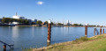
We start at the Alter Messplatz in Mannheim. Take RNV line 1 or 3 to the “Alte Feuerwache” stop. Travelling by car is not recommended, though there is a multi-storey car park at the “Alte Feuerwache” at Schafweide 17, or you might be lucky enough to find a parking space on Dammstraße. The Neuer Messplatz, which is signposted, offers further and better parking options. From there, it’s about a 5-minute walk to the Alte Feuerwache.
(S/E) We walk across the Alter Messplatz directly to the banks of the Neckar – with the “Alte Feuerwache”, now used as a concert hall, on our left – cross Dammstraße and, just before the Kurpfalzbrücke, descend the steps to the Neckar. On the tarmac path, we turn right and walk straight ahead for a while. To our left is the River Neckar; to our right, slightly higher up, are the rows of houses on Dammstraße. We pass under several bridges and eventually reach a fork in the path.
(1) We follow the signposts to the left towards Sandhofen, walk a few metres along the Neckar cycle path and keep to the left at the next fork, so that we continue walking below the cycle path along the Neckar meadows.
(2) Our path rejoins the wider cycle path and curves to the right. To our left is the Old Rhine, which flows into the Neckar here. To our right is the former lock keeper’s house (number 13), now a beautiful property in a rather idyllic setting.
(3) As soon as we reach the road (Inselstraße), we turn left and cross the Old Rhine at the Kammerschleuse lock. Immediately after the bridge, we turn left, towards the ‘Zur Insel’ restaurant, into the street ‘An der Kammerschleuse’.
(4) We follow the signposts for the Neckar Cycle Route and the Rhine Cycle Route and continue straight on – from here, do not follow the signpost to the restaurant any further. The tarmac path takes us straight on, always within sight of the Neckar.
(5) Passing the confluence of the Neckar and the Rhine, the tarmac path leads us straight on; on the opposite bank of the Rhine lies the industrially romantic backdrop of BASF, whilst on our side there are numerous jetties for container ships.
(6) At the Mekan restaurant, we carry on straight ahead along the now gravelly path, following the curved blue ‘N’ on a white background – the Neckarweg – until we reach the edge of the forest.
(7) Here we turn right into the woods – a short, idyllic stretch – until we reach the tarmac road again and pass the animal shelter on our right.
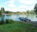
(8) Shortly afterwards, we reach the landing stage for the Old Rhine ferry and cross the Old Rhine by the Dehus restaurant; as we do so, we can already catch a glimpse of the Old Rhine Bridge, which we will cross a little later. We follow the path uphill, with an industrial building on our left.
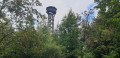
(9) At the junction just beyond, we turn right onto a private road with very little traffic and follow the road (Riedspitze). We cross an inconspicuous former industrial canal, through which the process water from the Waldhof pulp mill was once channelled into the Rhine. A short while later, we pass the Canoe Racing Centre on our right and can already see the tower of the Old Rhine Bridge ahead of us.
(10) At the bridge tower, the path leads uphill and then turns right across the Old Rhine. We have a magnificent view of the Old Rhine bank to our left and the Old Rhine ferry to our right. At the end of the bridge, we follow the tarmac path downhill.
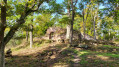
(11) At the junction, we turn right towards the water onto the gravel path, walk under the Old Rhine Bridge and enter the woodland. Here we enjoy the tranquillity and continue straight ahead along the unpaved woodland path. Time and again, small paths on the left lead down to the water.
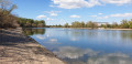
(12) We reach a fork in the path, where it’s worth taking a break on the pebble beach by the water. We continue along the path until we reach a gravel car park.
(13) We walk straight ahead, passing under the pipes, head down to the water’s edge and enjoy the view across the Old Rhine towards Sandhofen and the newly built luxury flats with their own moorings. There is also a lovely spot on the beach here to take a break. The path leads us to the right, back under the pipes and onto a tarmac road, which we follow as far as the main road. We turn left into Rudolf-Diesel-Straße, but not before glancing to the right, where we can admire a new building with a green façade.
(14) At the junction, we turn left into Diffenéstraße, stay on our side of the road and head back towards the water.
(15) Just before the large Diffené drawbridge, we reach our first information board on the Industrial Heritage Trail. From now on, we need to keep a close eye out so as not to miss any of the stops. We cross the bridge and, at the first pedestrian traffic lights, cross Diffenéstraße and turn right into Industriestraße. We take the pavement on the right-hand side of the road. Right on the corner by the warehouse, we find another information board. There are numerous information boards along Industriestraße (see link below). We walk along Industriestraße to the end, cross Helmholtzstraße and rejoin the Neckar Cycle Path, which we had already walked along in the opposite direction at the start of the tour. We now turn left, retracing the same route we came along. Anyone wishing to immerse themselves in Mannheim’s multicultural world and discover a traditional Mannheim café should follow this GPX track and the description.
(16) A narrow passageway through a wall allows us to cross Dammstraße. We pass the church and walk along Lutherstraße, across Neumarkt (a large square with a playground) and finally reach Mittelstraße, which we follow to the right.
(17) We pass Café Möhrenköpfle on our right, turn right at the next junction, cross Am Messplatz at the pizzeria and return to the starting point (S/E).
 Visorando Member
 Difficult
 Moderate