The Neck of Belvezet

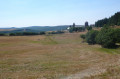
This figure-of-eight walk takes in a geological feature dating back 9 million years. To reach it, you follow an old drovers' road and return via good paths through the pastures.

Details

n°3125270
Creation:
Last update:
Last review:
  • Walking
    Activity: Walking
  • ↔
    Distance: 5.61 mi
  • ◔
    Average duration: 3h 10 
  • ▲
    Difficulty: Moderate

  • ⚐
    Back to start: Yes
  • ↗
    Ascent: + 679 ft
  • ↘
    Descent: - 663 ft

  • ▲
    Highest point: 4,285 ft
  • ▼
    Lowest point: 3,596 ft

Description of the walk

Start at the Croix du Triadou. Park in the small car park on the side of the D987, on the right-hand side when coming from the village of Aubrac.

No signposting

(S/E) Return to the road and follow it to the left (east) towards Aubrac. Follow this road as it climbs gently and steadily for about 2.3 km (take care; the road is not very busy but there is some traffic).

(1) As you come out of a left-hand bend, leave the road and turn onto a path on the right at an acute angle.

Red and white markings

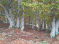
You’ll soon come out onto theGR®65; follow it to the right. Walk down this stony path through the shade. Continue across open ground and ignore all side paths.

(2) At a junction (cross), carry on straight ahead (south-west) and you’ll soon reach another junction.

(3) Carry on straight ahead (south-south-west). Take several sharp bends and you’ll reach a crossroads at the edge of a meadow.

No signposting

(4) Head straight ahead into the meadow and easily climb the clearly visible Neck de Blevezet.

(5) Retrace your steps back to the crossroads.

Red and white markings

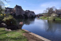
(4) Follow theGR® again, turning left (west), and head down to the village of Belvezet.

Yellow markings

(6) Head up a small road on the right.

(7) After about 800 m, leave the road and take a track on the right. Walk along the undulating path through the pastures until you reach a junction you passed on the way out.

Red and white markings

(3) Join theGR®65again and follow it to the left for about a hundred metres.

Red and yellow markings

(2) At the next junction (cross), turn left. Climb gently, heading north-north-west. At the end of the track, rejoin the D987 road, follow it to the left and you will soon reach the car park where you started (take care when crossing the road) (S/E).

Waypoints

  1. S/E : mi 0 - alt. 4,045 ft - Croix du Triadou
  2. 1 : mi 1.43 - alt. 4,285 ft - Start of the trail
  3. 2 : mi 2.78 - alt. 3,921 ft - Junction of the circular loop
  4. 3 : mi 2.84 - alt. 3,901 ft - Junction of the short circular loop
  5. 4 : mi 3.35 - alt. 3,671 ft - Crossroads
  6. 5 : mi 3.38 - alt. 3,698 ft - Château de Belvezet
  7. 6 : mi 3.55 - alt. 3,599 ft - Belvezet
  8. 7 : mi 4.07 - alt. 3,770 ft - Junction
  9. S/E : mi 5.61 - alt. 4,045 ft - Croix du Triadou

Notes

Hiking boots recommended.

No water sources were identified along the route. There is a bar and restaurant in the village of Aubrac.

A detailed map is useful (at the very least the one accompanying this description).

Hike undertaken by the author on 27 August 1993.

Worth a visit

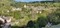
The Neck de Belvezet is in itself a geological curiosity well worth a visit (an ancient volcanic vent exposed by erosion). From its summit, where traces of an ancient keep can be seen, there is a lovely panoramic view, including a bird’s-eye view of the village of Belvezet.

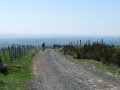
Between (1) and (6), theGR®65follows an old drovers' road (a transhumance track).

The return journey between (7) and (S/E) takes you along a pleasant path through the pastures of the Aubrac plateau, where, from May to October, the cows of the same name graze.

Nearby, the small village of Aubrac is well worth a visit, with the historic buildings of the Dômerie d’Aubrac and the Tour des Anglais (14th century), a former keep converted into a stopover lodge.

Always be cautious and plan ahead when you're outdoors. Visorando and the author of this route cannot be held responsible for any accidents occurring on this route.

The GR® and PR® markings are the intellectual property of the Fédération Française de Randonnée Pédestre.

Reviews and comments

3.8 / 5
Based on 4 reviews

Reliability of the description
4 / 5
Ease of following the route
3.8 / 5
Route interest
3.5 / 5
Vincent M8.
Vincent M8.
• Edited:

Overall rating : 4.7 / 5

Date of your route : Sep 28, 2026
Reliability of the description : ★★★★★ Very good
Ease of following the route : ★★★★☆ Good
Route interest : ★★★★★ Very good
Very busy route : No

-

Machine-translated

Seranne4321
Seranne4321

Overall rating : 4 / 5

Date of your route : Aug 17, 2026
Reliability of the description : ★★★★☆ Good
Ease of following the route : ★★★★☆ Good
Route interest : ★★★★☆ Good
Very busy route : Yes

Beautiful and varied scenery, despite the hike starting with a rather long stretch along the road.
Oh dear, we had to climb up to the foot of the pass, which is off-limits to hikers.

Machine-translated

NADDIE
NADDIE

Overall rating : 4.7 / 5

Date of your route : Jul 31, 2022
Reliability of the description : ★★★★★ Very good
Ease of following the route : ★★★★★ Very good
Route interest : ★★★★☆ Good
Very busy route : No

A lovely route, well signposted, often running along a ridge. It’s a shame about the bit where you have to follow the road.

Machine-translated

Dominique BEX
Dominique BEX

Overall rating : 1.7 / 5

Date of your route : Jun 27, 2020
Reliability of the description : ★★☆☆☆ Disappointing
Ease of following the route : ★★☆☆☆ Disappointing
Route interest : ★☆☆☆☆ Very disappointing
Very busy route : No

I wasn’t particularly keen on this walk, with half the route along the road and the other half down in a valley. The starting point was hard to find.

Machine-translated

Other walks in the area

For more walks, use our search engine .

The GPS track and description are the property of this route's author. Please do not copy them without permission.