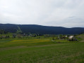
Le Mûrier

A short mountain bike route (3/4 road) on the outskirts of Grenoble. The descent through the woods is very pleasant.

Details

n°653
Creation:
Last update:
Last review:
  • Mountain biking
    Activity: Mountain biking
  • ↔
    Distance: 3.37 mi
  • ◔
    Duration according to the author: 30 mins 
  • ▲
    Difficulty: Easy

  • ⚐
    Back to start: Yes
  • ↗
    Ascent: + 712 ft
  • ↘
    Descent: - 712 ft

  • ▲
    Highest point: 1,414 ft
  • ▼
    Lowest point: 702 ft
  • ⚐ Country: France
  • ⚐
    Areas: Alps, Dauphiné
  • ⚐ City: Saint-Martin-d'Hères (38400)
  • ⚑
    Start/End: N 45.177984° / E 5.775976°
  • ❏
    IGN map(s): Ref. 3334OT, 3334OTR, 3335OT, 3335OTR

  • ◶
    Type of surface: Not specified
  • ⇧
    Bike carrying: Not specified
  • ▲
    Difficulty: Not specified
  • Hour-by-hour weather

Description of the route

Park your car on Avenue Jean-Jaurès near the municipal workshops (no. 71).

(S/E) Take Avenue Jean-Jaurès towards Gières. Take the second right onto Route des Maquis until you reach the next junction.

(1) Turn right towards Le Mûrier. Follow the road almost all the way to Fort du Mûrier.

(2) Just before the fort, turn left onto the path that continues from the bend (Chemin des Batteries Basses).
Turn left immediately and follow the path downhill opposite (Chemin du Château).

(3) At the bottom, after the reservoirs, turn left again (Rue du Repos) until you reach the D112, which you took at the start.

(1) Return to the starting point via the same route (S/E)

Waypoints

  1. S/E : mi 0 - alt. 702 ft - No. 71 Avenue Jean-Jaurès
  2. 1 : mi 0.34 - alt. 725 ft - D112 junction
  3. 2 : mi 2.01 - alt. 1,414 ft - On the left, in front of the fort
  4. 3 : mi 2.69 - alt. 768 ft - On the left: Rue du Repos
  5. S/E : mi 3.37 - alt. 702 ft - No. 71 Avenue Jean-Jaurès

Reviews and comments

4.7 / 5
Based on 1 review

Reliability of the description
5 / 5
Ease of following the route
5 / 5
Route interest
4 / 5
re_sampa
re_sampa

Overall rating : 4.7 / 5

Date of your route : Sep 12, 2014
Reliability of the description : ★★★★★ Very good
Ease of following the route : ★★★★★ Very good
Route interest : ★★★★☆ Good

I’ve got a point to make. On the way down, after passing a large house on the right, you need to turn left and not take the path straight ahead. There’s a small ‘X’ carved into a tree – you need to watch out for it.

Machine-translated

peu308sw
peu308sw

Hello
Actually, I was mistaken – it isn’t the mulberry tree, which was indeed
but rather the Combe de la Gouderie route and the Plateau du Peuil.

The message is as follows

Unable to open C:\Downloads\30_combe_de_la_gouderie.gpx

Same goes for the Plateau du Peuil

jc

Machine-translated

Nono
Nono ★

Hello,

what is the error message?

Arnaud

Machine-translated

peu308sw
peu308sw

Hello, I’ve downloaded the GPS track for Le Murier as a GPX file, but I can’t open it in Carto Explorer or Google Earth – I get an error message when I try to import it, and this isn’t the only file that’s causing me problems
on your website – a problem I don’t encounter on TraceGPS.
Do you have a solution?
That said, I find your website very interesting.

Kind regards

Machine-translated

Other walks in the area

For more walks, use our search engine .

The GPS track and description are the property of this route's author. Please do not copy them without permission.