Lans-en-Vercors – Saint-Nizier-du-Moucherotte circular route via the Via VTT Vercors

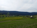
A mountain bike ride partly along the beautiful “Via Vercors”, on cycle paths and forest tracks. Lovely views over the northern Vercors plateau, the Molière massif and Lans-en-Vercors.

Details

n°33856397
Creation:
Last update:
–
Last review:
  • Mountain biking
    Activity: Mountain biking
  • ↔
    Distance: 10.72 mi
  • ◔
    Duration according to the author: 2 hrs 
  • ▲
    Difficulty: Moderate

  • ⚐
    Back to start: Yes
  • ↗
    Ascent: + 1,496 ft
  • ↘
    Descent: - 1,483 ft

  • ▲
    Highest point: 4,262 ft
  • ▼
    Lowest point: 3,209 ft
  • ⚐ Country: France
  • ⚐
  • ⚐ City: Lans-en-Vercors (38250)
  • ⚑
    Start/End: N 45.131139° / E 5.58842°
  • ❏
    IGN map(s): Ref. 3235OT, 3334OT, 3334OTR, 3335OT, 3335OTR

  • ◶
    Type of surface:
  •  
     
    ■ 40% Road ■ 60% Byway
  • ⇧
    Bike carrying: Not specified
  • ▲
    Difficulty: Moderate
  • Hour-by-hour weather

Photos

Description of the route

For those arriving by car, the starting point is at the dirt car park next to the football pitch in Lans-en-Vercors. This makes it easy to find a space (and leaves the other car parks free for visitors to Lans).
For those without a car, you can take the coach to Lans-en-Vercors (from Grenoble coach station, take the T64 or T65) and get off at the Lans-en-Vercors tourist office. You can attach your mountain bike to the back of the coach… From there, make your way to the starting car park.

(S/E) From the car park, take the Chemin des Drevet (tarmac) northwards until you reach thefirst junction.

(1) Turn left onto the Chemin des Falcons (tarmac) and continue until you reach a crossroads.

(2) Stay on the path on the left and continue to the next junction.

(3) Cross the Chemin de Charbonneau and continue straight ahead to the Croix de Lichou.

(4) Take the road on the right and immediately continue downhill along the track to the left of the road (Chemin des Donnets) until you reach the Fork in the road.

(5) Turn right to follow the road and cross over the Bruyant.

(6) Carry on straight ahead to reach the hamlet of Pierregraine.

(7) Cycle along the road for about 100 metres, then take Chemin des Volants on the left. Continue, staying below the main road, and pass the hamlet of La Tour. The track joins the main road.

(8) Take this to reach Saint-Niziers-du-Moucherotte.

(9) Immediately turn right onto the Route du Télécabine (D106f) and follow it for about 1 km until you reach thesecond junction.

(10) Turn left onto Chemin de la Roche, then turn sharply right at the next junction.

(11) Pass the car park (this car park is the starting point for a walk to the summit of Moucherotte).
Follow the forest track for about 2.5 km, enjoying the view of Saint-Niziers-du-Moucherotte and the Molière plateau opposite, until you reach a fork in the road at the 1268-metre mark.

(12) Stay on the forest track on the right and continue along the mountainside until you reach the 1150 mark at the start of the descent.

(13) Continue with caution__ (lots of loose stones) as you descend. At the bottom, there’s a lovely view of Lans-en-Vercors (photo). Cross the road (D106) at La Chenevarie and follow the Chemin de Prenay.

(14) At the three-way junction, turn left onto the Chemin de Charbonneau and return to the original junction.

(3) Turn left and, following the path in the opposite direction to the way out, rejoin the Via Vercors VTT.
Follow it to the left and head back to the car park (S/E).


Waypoints

  1. S/E : mi 0 - alt. 3,212 ft - Car park next to the football pitch - Bourne (rivière)
  2. 1 : mi 0.17 - alt. 3,281 ft - Common junction (out and back)
  3. 2 : mi 0.6 - alt. 3,323 ft - Via Vercors. Common junction (out and back) - Église Saint-Barthélémy (Lans-en-Vercors)
  4. 3 : mi 0.83 - alt. 3,369 ft - Junction of the circular loop
  5. 4 : mi 1.74 - alt. 3,642 ft - Croix de Lichou (Lons-en-Vercors)
  6. 5 : mi 1.96 - alt. 3,550 ft - Fork in the road
  7. 6 : mi 2.52 - alt. 3,415 ft - Bruyant - Cascade du Bruyant
  8. 7 : mi 3.33 - alt. 3,727 ft - Pierregraine hamlet
  9. 8 : mi 4.59 - alt. 3,812 ft - Junction
  10. 9 : mi 4.86 - alt. 3,835 ft - Saint-Nizier-du-Moucherotte
  11. 10 : mi 5.29 - alt. 3,950 ft - Chemin de la Roche
  12. 11 : mi 5.67 - alt. 4,029 ft - Car park
  13. 12 : mi 7.24 - alt. 4,199 ft - Bois des Mûres. Fork in the road
  14. 13 : mi 9.19 - alt. 3,819 ft - Start of the descent
  15. 14 : mi 9.77 - alt. 3,406 ft - Chemin des Charbonneau. Junction
  16. S/E : mi 10.72 - alt. 3,212 ft - Car park next to the football pitch - Furon (rivière)

Notes

For e-MTB enthusiasts, this route is ideal.
There are no water points along the route.

Worth a visit

Places to visit:
Lans-en-Vercors.
Saint-Nizier-du-Moucherotte.
The ‘3 Pucelles’ site.
The Moulin du Bruyant.

Reviews and comments

4.8 / 5
Based on 2 reviews

Reliability of the description
5 / 5
Ease of following the route
4.5 / 5
Route interest
5 / 5
manubruas
manubruas

Overall rating : 5 / 5

Date of your route : Oct 31, 2026
Reliability of the description : ★★★★★ Very good
Ease of following the route : ★★★★★ Very good
Route interest : ★★★★★ Very good
Very busy route : Yes

A very beautiful route, largely marked as No. 76 locally.
It’s a shame for me that the sky didn’t clear up and the view wasn’t there to be had...
Next time!

Machine-translated

jlleb
jlleb
• Edited:

Overall rating : 4.7 / 5

Date of your route : Aug 07, 2024
Reliability of the description : ★★★★★ Very good
Ease of following the route : ★★★★☆ Good
Route interest : ★★★★★ Very good
Very busy route : No

A very enjoyable mountain bike ride. The difficulty is rated as ‘moderate’, but there’s still a good climb to tackle and the final third of the descent is a bit tricky. For that last bit, I preferred to walk my bike down as, given how tired I was from the ride, I didn’t feel up to taking the risk of a fall. I fully intend to do this circular route regularly as there are some lovely views in places and, all in all, it’s a fairly quick ride.

Machine-translated

Other walks in the area

For more walks, use our search engine .

The GPS track and description are the property of this route's author. Please do not copy them without permission.