Circular route around Autrans-Méaudre via the ViaVercors and the forest

An e-MTB route in the Val Autrans Méaudre, starting and finishing at the car park along the ‘6 February 1968’ road in Autrans, following the ViaVercors via a forest track and a walking path.

Details

n°2376050
Creation:
Last update:
Last review:
  • Mountain biking
    Activity: Mountain biking
  • ↔
    Distance: 14.95 mi
  • ◔
    Duration according to the author: 2.5 hrs 
  • ▲
    Difficulty: Moderate

  • ⚐
    Back to start: Yes
  • ↗
    Ascent: + 1,706 ft
  • ↘
    Descent: - 1,716 ft

  • ▲
    Highest point: 4,416 ft
  • ▼
    Lowest point: 3,169 ft
  • ⚐ Country: France
  • ⚐
  • ⚐ City: Autrans (38880)
  • ⚑
    Start/End: N 45.172993° / E 5.542419°
  • ❏
    IGN map(s): Ref. 3235OT

  • ◶
    Type of surface: Not specified
  • ⇧
    Bike carrying: Not specified
  • ▲
    Difficulty: Not specified
  • Hour-by-hour weather

Photos

Description of the route

Park in the Autrans car park, situated on the RD106, Chemin du 6 Février 1968.

(S/E) Follow the ViaVercors signposts towards the ‘Camping au Joyeux Réveil’, then continue along the Chemin du Cornet leading to the hamlet of Le Truc au Bouchet.

(1) Carry on along the road and pass through the hamlet of Le Bouchet.

(2) At the top of the hamlet, take a path on the left to reach the waterfall, where there is a lovely spot for a rest or a picnic in the shade of the forest (see photos).

(3) Head back down the path towards the hamlet of Le Bouchet.

(2) Turn left to join the newly developed ViaVercors path at the edge of the forest, continuing above the main road linking the Col de la Croix Perrin to the village of Autrans. The path leads above the hamlet of Echarlieres and joins the D106 before the hamlet of La Perrinière.

(4) Caution: this is a dangerous junction for crossing the road here; there is heavy traffic.
Continue along the ViaVercors route towards Méaudre, passing through the hamlets of La Perrinière, Les Griats, Les Arnauds, La Bourrière, Cordet and Les Aguiards in turn, until you reach Les Grangeons.

(5) Walk past the Ferme des Colibris. Reach the top of the Grangeons hill.

(6) Take the path on the left towards La Balme. You’ll come to a crossroads with four perpendicular paths.

(7) Turn right to reach the village of Méaudre.

(8) In Méaudre, opposite the Tourist Office, take Rue des Mateaux towards Les Eymes, passing through the hamlets of Les Farlaix and then Cochet.

(9) At the bus stop at the entrance to the hamlet of Les Eymes, turn right onto the Vachat forest track, which climbs towards Le Trou qui Souffle.

(10) Pass by Le Trou qui Souffle, a geological feature. Shortly afterwards, take the Davière/Montbrand forest track.
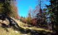
Note: This forest track is closed to motorised vehicles and winds its way up the mountainside through the forest (see photo).
Stay on this track to reach the hamlet of Font de Scellier.

(11) Turn 180° to the right onto the Nave forest track and head for the junction with the Auberge du Banc de l’Ours footpath.

(12) Turn left, then at the next bend, keep left at the junction to reach Bourg de Dessus.

(13) Walk through this hamlet to reach the D106l road and head back down towards the village of Autrans.
Walk past the Tourist Office and then turn left into Rue du Tonkin.
At the wash house, turn right to return to the car park where you started (S/E).

Waypoints

  1. S/E : mi 0 - alt. 3,402 ft - Autrans car park, situated on the RD106
  2. 1 : mi 1.02 - alt. 3,593 ft - Fontaine des Gabets
  3. 2 : mi 1.27 - alt. 3,668 ft - Le Bouchet
  4. 3 : mi 1.43 - alt. 3,701 ft - Waterfall
  5. 4 : mi 2.69 - alt. 3,448 ft - ViaVercors junction – D106C
  6. 5 : mi 3.64 - alt. 3,320 ft - Ferme des Colibris
  7. 6 : mi 4.77 - alt. 3,330 ft - Les Grangeons
  8. 7 : mi 5.22 - alt. 3,232 ft - La Balme crossroads
  9. 8 : mi 5.83 - alt. 3,235 ft - Meaudre Tourist Office
  10. 9 : mi 7.31 - alt. 3,396 ft - Bus stop
  11. 10 : mi 7.78 - alt. 3,537 ft - Le Trou qui Souffle
  12. 11 : mi 12.1 - alt. 4,255 ft - Font de Scellier
  13. 12 : mi 13.19 - alt. 3,668 ft - Auberge du Banc de l’Ours
  14. 13 : mi 13.76 - alt. 3,645 ft - Le Bourg de Dessus
  15. S/E : mi 14.95 - alt. 3,399 ft - Autrans car park, situated on the RD106

Notes

- Shaded picnic area at the Bouchet waterfall.
- The water from the fountains along the route is not safe to drink.
- Shops in the villages of Autrans and Méaudre.
- Tourist Information Offices in the two villages near the route.

Worth a visit

(Between S/E and 1) View of the Olympic ski jumps from the 1968 Winter Olympics.
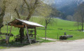
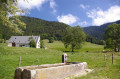
(1) The hamlet of Le Truc: here you’ll find a fountain and a farrier’s workshop (see photos).
(10) ‘Le Trou qui Souffle’ is the entrance to a cave from which very cool air flows; it is situated at the foot of a rocky outcrop next to the road.

Reviews and comments

3.7 / 5
Based on 2 reviews

Reliability of the description
3.5 / 5
Ease of following the route
3.5 / 5
Route interest
4 / 5
Benlam38
Benlam38

Overall rating : 3 / 5

Date of your route : Nov 11, 2024
Reliability of the description : ★★★☆☆ Average
Ease of following the route : ★★★☆☆ Average
Route interest : ★★★☆☆ Average
Very busy route : No

If you’re after the great outdoors and long, challenging bike climbs, you’ll be in your element. The route from Autrans to Meaudre is pleasant – you even pass a bison farm. It was after that, though, that I personally began to lose interest: a long climb with not much to offer in the way of scenery, just trees.I passed by the chasm just before the forest – it looked more like an old crumbling wall with a barrier right next to the road. Apart from the trees, the forest is certainly pleasant, but it’s a constant climb; I did enjoy the descent down to the Autrans treetop adventure park. Here’s a quick snap of Le Claret: the setting sun on the road leading to Autrans town centre.

Machine-translated

Meupat
Meupat

Overall rating : 4.3 / 5

Date of your route : Sep 05, 2022
Reliability of the description : ★★★★☆ Good
Ease of following the route : ★★★★☆ Good
Route interest : ★★★★★ Very good
Very busy route : No

On an e-mountain bike, it’s really enjoyable

Machine-translated

Other walks in the area

For more walks, use our search engine .

The GPS track and description are the property of this route's author. Please do not copy them without permission.