Country:

 City:


Free car park for around twenty cars opposite No. 27 Rue des Grottes.
(S/E) With your back to the car park, turn left, walk past the church entrance and continue along the N86. Cross the bridge over the River Lesse and continue until you reach Rue de la Source.
(1) Turn right and cross over the Ry d’Ave stream. At the Fork in the road, turn left towards the house.
Red Diamond markings
At the end of the fence around the plot on your left, turn left onto the path leading into the forest. Head uphill.
(2) At the top, continue to the left. At the next junction, carry on straight ahead until you reach a Fork in the road.
(3) Take a short detour to the left to a viewpoint. Retrace your steps, ignore the markings and turn left to continue along the path. Head downhill and, at the bottom, keep to your right. Rejoin the Ry d’Ave and follow it to the road. Cross carefully and enter the car park on the left. Cross the car park to reach a forest track on your left in the middle.
GR® signposting
(4) Take this forest track running alongside a private pond. Ignore the paths and tracks on your left and walk to the road. Turn left and walk along the road until you reach the next track on your right.
Follow this track to the edge of the woodland. Before entering the woodland, turn right. Follow the track as it eventually enters the woodland and heads uphill. Stay on the main track until you reach the hamlet known as l’Ermitage.
(5) Turn left and you’ll see the ruins of the Ermitage tower on your left. Carry on and then take the path on your right near the information board, close to the fence and the boundary marker. Cross through the ruins, which also form part of an arboretum, and continue along the forest track beyond the fence. Join another forest track and continue to the left until you reach the hamlet known as Bois de Niau.
(6) Turn right. Walk alongside the Les Pairées Nature Reserve. Ignore theGR® alternative route branching off to your left and carry on straight ahead. At the next junction, keep to the right. Pass through the area known as Pelouses à Genévriers. Carry on straight ahead until you reach the road.
Unmarked
(7) Turn left onto the farm track marked with aGR® cross. Further on, at the gate, take the path on your right. Follow this path downwards; it veers sharply to the right, and walk until you reach the road. Turn left and walk down the road, with a view of the quarry face, until you reach the junction.
(8) Carry on straight ahead and cross the River Lesse. In front of Resteigne Castle, turn left onto the track leading to the quarry. Enter the old quarry on your right and head right towards the walls covered in graffiti. Continue along the track between the walls and head uphill. The path turns left. Ignore the path on your right (private property) and continue uphill to the Fork in the road.
(9) Turn left. Walk to the end of the path, ignoring a junction on your right, but first take in the view from the small hills on your left to discover a superb vantage point. At the end of the path, which bends sharply to the right, enter the Ellinchamps Forest Reserve. Warning: processionary caterpillars are present; do not stray from the paths. Walk for about 500 m, ignoring the less clearly marked paths, until you reach a junction. Continue straight on to the hamlet of Crête d’E. Linchamps.
Red Trail markings
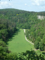
(10) Ignore the path leading down to your left and carry on straight ahead along the ridge. Further on, you’ll come to the Rocher à Pic viewpoint. Continue along the path until you reach a T-junction.
(11) Turn left and head down the wide path. Ignore the path branching off to your right, then, further down, the one branching off to the left. Leave the woods and walk out into the open. Stay on the main path, which curves sharply to the left, and you’ll reach the road. Turn left, enter Belvaux and head down to the junction. (Leave the signposted route for a moment to visit the chapel and the bread oven)
(12) Turn left into Rue du Hambeau to visit the bread oven and Saint Laurent Chapel. Retrace your steps.
(12) Carry on straight ahead along the road towards the bridge. Go past it and continue along Rue du Gouffre. Further on, you’ll pass the Belvaux campsite. Continue along the road for 650 m until you reach the junction with a footpath on your left.
(13) Turn left and go round the barrier. Follow the forest track, ignoring the paths branching off on either side, until you reach a three-way junction.
No signposting
(14) Turn right. Follow the dry Ri d’en Faule (July 2022) for 1 km until you reach a junction.
(15) Turn left and begin a long climb to a junction with a wide forest track. Take the path leading uphill opposite. Continue straight on at the junction (not shown on maps). As you emerge from the woods, turn left until you reach a Fork in the road.
Red Trail markings
(16) Turn right and, at the T-junction, continue to the left. The path turns right and, at a place called Griffaloux, head off to see the viewpoint. Retrace your steps and rejoin the path to the left. Head downhill. Cut across a forest track and continue along the path opposite, slanting slightly to the right. Then, rejoin the forest track and continue downhill to the left until you reach the road.
(17) Turn left. At the junction, carry on straight ahead along the farm track. You’ll come to a road; carry on straight ahead along it. A little further on, join another road on your right and enter Han-sur-Lesse. Ignore the junctions and return to your car park on this street opposite No. 27 (S/E).

 Visorando Member

 Difficult
 Easy