


Refine your search for walks in Montanuy / Montanui
Montanuy / Montanui walks


 Circular route around the lakes and mountain huts starting from the Embalse de Llauset
 Visorando Member
 6.34 mi
 +2,500 ft
 -2,500 ft
 5h 05
5h 05
 Difficult
 Departure from Montanuy / Montanui (Huesca)
One of the most beautiful hikes in the area, featuring a lovely, technical circular route that can be challenging at times due to steep gradients. It’s best to follow the suggested route. There are numerous mountain lakes to explore, magnificent landscapes offering varied views of the surrounding mountain ranges, and a brand-new mountain refuge (where you can enjoy a meal or stop for a picnic).
Cap de Llauset mountain refuge – Plan d’Abaixo
9.05 mi
+2,920 ft
-4,767 ft
6h 40
Difficult
Departure from Montanuy / Montanui (Huesca)
The route starts at the Cap de Llauset mountain hut and ends at Plan d’Abaixo. This stage takes you over the Col d’Ixalenques, which rises to an altitude of 2,812 metres. You’ll enjoy magnificent panoramic views of the surrounding peaks before beginning a long descent to Plan d’Abaixò, in the heart of a wild and unspoilt landscape.
Prados de Llosás – Cap de Llauset mountain hut
3.65 mi
+3,156 ft
-2,257 ft
4h 25
Difficult
Departure from Benasque/Benás (Huesca)
The route runs from Prados de Llosás to the Cap de Llauset mountain hut. This is a day during which you’ll have the chance to climb a peak over 3,000 metres high, the Tuca de Culebres. From there, you’ll be able to enjoy a magnificent view of the Aneto. You’ll then continue on a gentle descent to the mountain hut.
Estanys de Anglios
 6.72 mi
+2,789 ft
-2,756 ft
5h 35
Difficult
Departure from Montanuy / Montanui (Huesca)
6.72 mi
+2,789 ft
-2,756 ft
5h 35
Difficult
Departure from Montanuy / Montanui (Huesca)
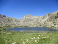
This challenging hike, situated in the Posets-Maladeta Natural Park, takes you to discover the Estanys de Anglios, a magnificent series of high-altitude lakes located off the beaten track of the Aigüestortes National Park’s main routes. The first section, mostly through woodland, follows the GR® 11 and leads to the Estany Gran, an ideal spot for a picnic break. The rest of the route requires a good sense of direction and experience of navigating difficult terrain with few landmarks. Nevertheless, the various lakes you’ll encounter and the beauty of the scenery will easily make you forget these challenges: torrents of all sizes, lakes with crystal-clear waters, enchanting woodland and an exceptional natural cirque.
Estany de Besiberri
 4.98 mi
+1,804 ft
-1,827 ft
3h 50
4.98 mi
+1,804 ft
-1,827 ft
3h 50
 Moderate
Departure from Vielha e Mijaran (Lleida)
Moderate
Departure from Vielha e Mijaran (Lleida)
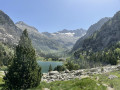
A classic in the Val d'Aran, an ascent to Lake Besiberri via the Val de Besiberri with magnificent views of the Besiberri, the Sèrra del Molar Gran and the Aneto.
Lac Redon, Tuc deth Port de Vielha, Lac de Rius from Espitau de Vielha
 8.65 mi
+4,022 ft
-4,022 ft
7h 30
Difficult
Departure from Vielha e Mijaran (Lleida)
8.65 mi
+4,022 ft
-4,022 ft
7h 30
Difficult
Departure from Vielha e Mijaran (Lleida)
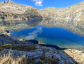
A lovely loop from Espitau de Vielha via Tuc deth port de Vielha (2,606 m), the magnificent Lac Redon (2,230 m), Coret deth Redon (2,454 m) and finally Lac de Rius (2,320 m). It goes up and down, and the slopes are quite steep. Very rocky landscape. Hike done in summer. Lac de Rius, which is pumped in summer and during periods of drought, can see its level drop by several metres, which detracts a little from its charm.
The three waterfalls towards Cerier
4.21 mi
+1,106 ft
-1,099 ft
2h 55
 Easy
Departure from Benasque/Benás (Huesca)
Easy
Departure from Benasque/Benás (Huesca)
A very beautiful hike.
There is a tricky 10-metre section at the waterfall, but there is a safety line to help you.
The outward journey is a little more difficult than the return journey, but it's worth it. And it's good to do it in this direction.
The return route crosses fields.
Val de Boí: Estanys de Llebreta and Llong
 13.16 mi
+2,247 ft
-2,218 ft
8h 00
Difficult
Departure from la Vall de Boí (Lleida)
13.16 mi
+2,247 ft
-2,218 ft
8h 00
Difficult
Departure from la Vall de Boí (Lleida)
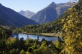
The Val de Boí is particularly well known for its many Romanesque churches, whose original frescoes are preserved at the National Art Museum of Catalonia (MNAC) in Barcelona. This valley is listed as a UNESCO World Heritage Site. But it is also the gateway to the Aigüestortes National Park. The suggested route is a discovery walk, a return trip that can therefore be adapted to suit. The scenery is breathtaking.
Tour of Aneto
24.52 mi
+9,741 ft
-9,744 ft
4 days
Difficult
Departure from Benasque/Benás (Huesca)
The walk starts from Fuente de la Pubiya, which is easily accessible by car and has a car park nearby. This walk allows you to reach your first peak at over 3,000 metres whilst enjoying magnificent high-mountain scenery, including glacial lakes, ridges and panoramic views of the Maladeta massif. However, the route remains challenging due to its length and elevation gain: it is advisable to be reasonably fit and to have experience of mountain walking before attempting it.
Fuente de la Pubiya – Prados de Llosás
5.63 mi
+3,074 ft
-476 ft
5h 15
Difficult
Departure from Benasque/Benás (Huesca)
Starting from Fuente de la Pubiya and ending at Prados de Llosás. The first day covers around 10 km with a climb of nearly 1,000 m. A lovely, gradual climb through the heart of the valley, with superb scenery and a finish in a magnificent setting.
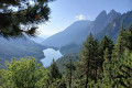
Almost a loop in the Encantats de Cavallers in La Molina
 30.04 mi
+8,868 ft
-10,125 ft
4 days
Difficult
Departure from la Vall de Boí (Lleida)
30.04 mi
+8,868 ft
-10,125 ft
4 days
Difficult
Departure from la Vall de Boí (Lleida)
A very beautiful hike in Spain, south of Vielha. There are numerous lakes: this is the largest concentration of lakes in the Pyrenees. The peaks are around 3,000 metres high and almost all are only accessible by mountaineering. The refuges are pleasant but small, so it is essential to book several months in advance.
Cavallers Pond - Ventosa refuge
 3.19 mi
+2,067 ft
-417 ft
3h 15
Moderate
Departure from la Vall de Boí (Lleida)
3.19 mi
+2,067 ft
-417 ft
3h 15
Moderate
Departure from la Vall de Boí (Lleida)
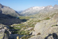
This is the first stage of a four-day circuit in the Encantats. It is the shortest stage and can be completed in an afternoon, but it is best not to arrive too late at the large refuges so that you can choose your bed and not have to wait too long for a shower.
Estos Valley with the Batisielles and Escarpinosa mountain lakes
9.99 mi
+3,497 ft
-3,530 ft
7h 40
Difficult
Departure from Benasque/Benás (Huesca)
Park at the free car park in Estos. Follow the GR® as it climbs gradually, passing close to the Embiase and then the Ana hut. Then turn left towards the Batisielles ibonet. We choose to continue towards the upper lakes: a steep and demanding climb to the Gran de Batisielles ibon, followed by a gentler slope to the Aigüeta ibon. Lunch break by the lake after a short scrambling section. Return via the Ibon d’Escarpinosa: a more technical route with numerous scree slopes, where you must follow the cairns closely and remain vigilant, even in the forest. Once in Escarpinosa, we take a circular route to explore the two ibons, where a few locals are swimming in August. The descent alternates between steep slopes and more gentle trails before rejoining the GR®, the perfect way to round off this beautiful, long day.
Tour du Posets
 27.38 mi
+10,600 ft
-10,584 ft
4 days
Difficult
Departure from Benasque/Benás (Huesca)
27.38 mi
+10,600 ft
-10,584 ft
4 days
Difficult
Departure from Benasque/Benás (Huesca)
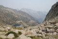
A very scenic circular route with varied landscapes, taking you round the Posets Massif within the Posets-Maladeta Natural Park. A 4-day route starting from the bottom of the Benasque Valley, with 3 nights in mountain huts (Estos / Viados / Angel Orus).
The last two stages feature significant elevation gain and rocky sections, making them longer than the first two.
Estos car park – Estos mountain hut
 5.17 mi
+2,011 ft
-115 ft
4h 10
Moderate
Departure from Benasque/Benás (Huesca)
5.17 mi
+2,011 ft
-115 ft
4h 10
Moderate
Departure from Benasque/Benás (Huesca)
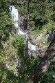
The first day of the Tour des Posets, which offers a gentle start with a steady climb to the Estos Mountain Hut. Initially through woodland, partly alongside the Rio Estos, the path follows the GR®11 route and takes you close to the Gorgues Galantes (waterfalls) before reaching thefirst mountain hut on this tour.
Ibón de Batisielles
9.67 mi
+3,494 ft
-3,461 ft
7h 30
Difficult
Departure from Benasque/Benás (Huesca)
A very pleasant walk that goes as far as the Batisielles tarns and takes in a section of the path to the Estos mountain hut. The walk passes a small hut – the Santa Ana hut – which is very charming. You can make an initial stop at the Batisielles tarn, where you can take the path leading directly to the pass between the two tarns to avoid the following sections. You can also head to the second ibon, the Aigulla de Batisielles, but this adds an extra 100 metres of elevation gain. You can turn back and take a path to avoid the avalanche couloirs. There is also a very difficult and very long section through the middle of the avalanche couloirs and over rocky ground. The rest of the route through the avalanche couloirs continues to feature dangerous sections. To see the paths more clearly, switch the map to OSM Rando. Please stay on the paths and respect the mountain environment.
The abandoned village of Castrocit as seen from Calvera
 Tourism professional
 3.15 mi
+443 ft
-476 ft
1h 50
Easy
Departure from Beranuy (Huesca)
3.15 mi
+443 ft
-476 ft
1h 50
Easy
Departure from Beranuy (Huesca)
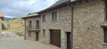
An easy walk of less than 6 km there and back from the Casa Puixico lodge in Calvera. An ideal walk to discover the abandoned village of Castrocit and its church in a wild and peaceful landscape.
From Calvera (Casa Puixico) to Obarra Monastery
 2.67 mi
+810 ft
-794 ft
1h 55
Moderate
Departure from Beranuy (Huesca)
2.67 mi
+810 ft
-794 ft
1h 55
Moderate
Departure from Beranuy (Huesca)
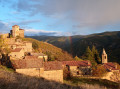
An ideal option for visiting the impressive 11th-century Obarra Monastery, accessible directly on foot from Calvera, without the need for a car. A magnificent route starting from the Casa Puixico lodge.
From Calvera (Casa Puixico) to the Obarra Viewpoint
 2.47 mi
+748 ft
-735 ft
1h 45
Moderate
Departure from Beranuy (Huesca)
2.47 mi
+748 ft
-735 ft
1h 45
Moderate
Departure from Beranuy (Huesca)
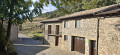
Starting from the peaceful mountain village of Calvera, this round-trip hike leads to the Mirador de Obarra, which overlooks the magnificent Isábena Valley, in one of the least-visited areas of the Aragonese Pyrenees.
Guests staying at Casa Puixico can set off on foot straight away, without needing to use their car. The route passes through unspoilt mountain countryside and leads to a superb viewpoint offering panoramic views of Obarra Monastery, the Isábena Valley and the surrounding peaks.
The tranquillity is one of the great attractions of this walk. Calvera lies at the end of a small mountain road and, outside the mushroom-picking season, it is rare to come across other walkers there. Bearded vultures are frequently seen gliding above the cliffs.
Era Restanca and Lac deth Cap deth Pòrt, starting from the Pontet de Rius
 4.39 mi
+1,926 ft
-1,919 ft
3h 40
Moderate
Departure from Naut Aran (Lleida)
4.39 mi
+1,926 ft
-1,919 ft
3h 40
Moderate
Departure from Naut Aran (Lleida)
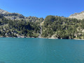
A magnificent hike in the heart of the Pyrenees, a round trip starting from Pont de Rius, allowing you to discover Lake Era Restanca, then the refuge of the same name, and the superb Lac deth Cap dethPòrt. The route offers stunning mountain scenery, taking in forests, torrents, valleys and high-altitude lakes. A challenging and exotic hike, ideal for making the most of the wild beauty of the Val d’Aran.
More walks in Montanuy / Montanui
Select a point of interest below: