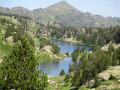
Val de Boí: Estanys de Llebreta and Llong

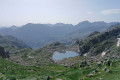
The Val de Boí is particularly well known for its many Romanesque churches, whose original frescoes are preserved at the National Art Museum of Catalonia (MNAC) in Barcelona. This valley is listed as a UNESCO World Heritage Site. But it is also the gateway to the Aigüestortes National Park. The suggested route is a discovery walk, a return trip that can therefore be adapted to suit. The scenery is breathtaking.

Details

386544
Creation:
Last update:
Last review:
  • Walking
    Activity: Walking
  • ↔
    Distance: 13.16 mi
  • ◔
    Average duration: 8h 00 
  • ▲
    Difficulty: Difficult

  • ⚐
    Back to start: Yes
  • ↗
    Ascent: + 2,247 ft
  • ↘
    Descent: - 2,218 ft

  • ▲
    Highest point: 6,617 ft
  • ▼
    Lowest point: 4,570 ft

Photos

Description of the walk

The route starts at the La Molina car park. Beyond this point, private vehicles are not permitted. This is also the final stop for taxis taking passengers to Sant Espérit: see § Practical Information.

(S/E) Take the path that starts about ten metres below the hut. It climbs steadily through the forest. Wide and well signposted, it presents no difficulties. This route is signposted as Planell Aigüestortes (signs). You’ll reach a grassy area and a suspension footbridge to cross the stream.

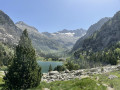
(1) The signposting directs you to take the footbridge: do not follow it, but continue along the path on the left bank without crossing, to avoid the concrete road used by shuttle taxis. A little further on, the slope becomes steeper, through more open terrain. You’ll reach a flat area overlooking the Estany de Llebreta. Walking along this bank offers some wonderful views.

(2) Carry on, cross the bridges and go round the lake to its left along the concrete road.

(3) Leave this road as soon as possible at the far end of the lake by taking a path on the right. Join the yellow-marked trail. The markings are on posts about one metre high. The climb becomes a little steeper; the path is well marked and very visible. You’ll rejoin the road at a hairpin bend.

(4) Head slightly to the right to see the waterfalls, then continue the climb more or less parallel to the road. You’ll reach a developed viewpoint (with guardrails) offering a fine view of the torrent and its potholes.

(5) Continue along the path, which crosses the road twice, leading to the Font de Sant Esprit and a plateau.

(6) Carry on to reach the information centre and the taxi drop-off point: a very busy area in high season.

(7) Turn right to take a detour to the viewpoint and its orientation board: the view is superb.

(7) Return to the wide path and continue by turning right: a circular path has been created for people with reduced mobility arriving by taxi. Reach the Font del Pas del Planell Gran.

(8) Carry on straight ahead; further on, on your right, you’ll pass the path leading to Estany de Dellui (2 hours 30 minutes), and follow the signs for “Refugi d’Estany Llong”, marked as 1 hour away. Cross Planell Gran, a sort of welcoming, open plateau.

(9) You’ll cross the Carros de Foc (a circular mountain route linking the nine refuges in the Aigües Tortes i Estany de Sant Maurici National Park) and follow it to the Estany Llong refuge.

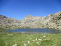
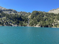
(10) Continue on to the lake.

(11) Retrace your steps along the outward route to return to the car park (S/E).

Waypoints

  1. S/E : mi 0 - alt. 4,570 ft - La Molina car park
  2. 1 : mi 1.11 - alt. 4,875 ft - Suspension footbridge
  3. 2 : mi 2 - alt. 5,390 ft - View of Estany de Llebreta
  4. 3 : mi 2.59 - alt. 5,367 ft - Leave the road, take the footpath on the right
  5. 4 : mi 2.93 - alt. 5,466 ft - Waterfalls
  6. 5 : mi 3.46 - alt. 5,778 ft - Promontory
  7. 6 : mi 3.67 - alt. 5,955 ft - Font de Sant Esprit
  8. 7 : mi 3.85 - alt. 5,974 ft - Sant Esperit Viewpoint
  9. 8 : mi 4.71 - alt. 6,056 ft - Font del Planell Gran
  10. 9 : mi 6.05 - alt. 6,391 ft - Carros de Foc junction
  11. 10 : mi 6.37 - alt. 6,558 ft - Estany Llong Mountain Hut
  12. 11 : mi 6.66 - alt. 6,617 ft - Estany Llong
  13. S/E : mi 13.16 - alt. 4,573 ft - La Molina car park

Notes

Standard mountain kit: preferably high-top boots, sunglasses, a cap, and also gloves and a hat in the late season,
Check the opening times of the mountain huts before setting off, if necessary.
There are several well-signposted and well-maintained water fountains along the route.

From the villages, particularly Boï and Barruera, a transport service is organised (large blue sign) providing access to the mountain range. Here, 9-seater minibuses go up to the ‘7 ’, for a return fare of €10.50 per person.
This may be worth considering for a second hike in the area. It will save you between 3 and 4 hours. It can be a good alternative if you’re travelling with young children, but you’ll miss out on some superb views. You’ll need to book in advance during peak times.

(11) You can return by taxi or walk along certain sections of road, including the ‘official’ route from Estany Llebreta. It’s much easier going, but there are plenty of taxis available, even in the off-season in October.
I’d recommend the footpath: whatever you do, keep your eyes peeled and have your camera to hand.

Worth a visit

The scenery is truly superb, so take as many photos as you like – bear this in mind when planning your timing, as you’ll quickly find yourself captivated.
Make the most of it to spot other routes to explore the Aigüestortes National Park further.

Reviews and comments

4.7 / 5
Based on 1 review

Reliability of the description
5 / 5
Ease of following the route
5 / 5
Route interest
4 / 5
jolo07
jolo07

Overall rating : 4.7 / 5

Date of your route : Aug 20, 2019
Reliability of the description : ★★★★★ Very good
Ease of following the route : ★★★★★ Very good
Route interest : ★★★★☆ Good

A lovely walk to do before the “invasion” of tourists arriving by minibus, so you can enjoy the peace and beauty of the area early in the morning – especially in high season.
The next day, we did a round-trip walk from the Estany de Cavaliers dam (past Caldès de Boï) to the mountain hut and the lakes above: less crowded and more unspoilt!
Worth combining with a ‘Heritage’ day exploring the churches of the Boï Valley.

Machine-translated

Other walks in the area

For more walks, use our search engine .

The GPS track and description are the property of this route's author. Please do not copy them without permission.