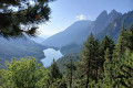
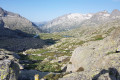
Era Restanca and Lac deth Cap deth Pòrt, starting from the Pontet de Rius

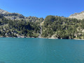
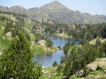
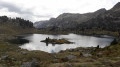
A magnificent hike in the heart of the Pyrenees, a round trip starting from Pont de Rius, allowing you to discover Lake Era Restanca, then the refuge of the same name, and the superb Lac deth Cap dethPòrt. The route offers stunning mountain scenery, taking in forests, torrents, valleys and high-altitude lakes. A challenging and exotic hike, ideal for making the most of the wild beauty of the Val d’Aran.

Details

106123124
Creation:
Last update:
Last review:
  • Walking
    Activity: Walking
  • ↔
    Distance: 4.39 mi
  • ◔
    Average duration: 3h 40 
  • ▲
    Difficulty: Moderate

  • ⚐
    Back to start: Yes
  • ↗
    Ascent: + 1,926 ft
  • ↘
    Descent: - 1,919 ft

  • ▲
    Highest point: 7,352 ft
  • ▼
    Lowest point: 5,427 ft

Photos

Description of the walk

Start from the Pontet de Riuscar park , at the end of a road called Camin de Rius.

(S/E) The path climbs gradually through very pleasant mountain scenery, following the signposts to the Restanca refuge. After a steady climb, you reach the northern tip of Lake Era Restanca.

(1) You walk along the right-hand side of the lake to the refuge, set in a magnificent high-mountain setting.

(2) The route continues south-east towards Lac deth Cap dethPòrt, offering beautiful panoramic views of the surrounding peaks and landscapes.

(3) You go round the lake on the left to reach its south-eastern tip.

(4) The return journey follows the same route in the opposite direction to Pontet de Rius (S/E).

Waypoints

  1. S/E : mi 0 - alt. 5,427 ft - Car park - Pontet de Ruis
  2. 1 : mi 1.09 - alt. 6,568 ft - Northern tip of - Era Restanca
  3. 2 : mi 1.23 - alt. 6,594 ft - Refugi dera Restanca
  4. 3 : mi 1.85 - alt. 7,300 ft - North-western tip of the - Lac deth Cap deth Pòrt
  5. 4 : mi 2.2 - alt. 7,336 ft - South-eastern tip of the - Lac deth Cap deth Pòrt
  6. S/E : mi 4.39 - alt. 5,433 ft - Car park - Pontet de Ruis

Other walks in the area

For more walks, use our search engine .

The GPS track and description are the property of this route's author. Please do not copy them without permission.