Montagne de Sous-Dîne

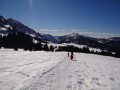
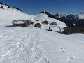
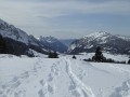
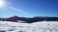
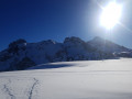
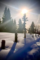
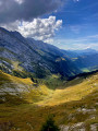
A very lovely snowshoe hike, quite mentally demanding, but well worth the effort once you reach the top. The first section is through woodland with a few steep slopes; the second takes you across the plateau with little elevation gain until you reach the summit. There are several lovely viewpoints overlooking the Aravis range, and at the summit you’ll be rewarded with a 360° view.

Details

n°20363574
Creation:
Last update:
Last review:
  • Snowshoeing
    Activity: Snowshoeing
  • ↔
    Distance: 6.69 mi
  • ◔
    Duration according to the author: 6 hrs 
  • ▲
    Difficulty: Difficult

  • ⚐
    Back to start: Yes
  • ↗
    Ascent: + 3,031 ft
  • ↘
    Descent: - 3,028 ft

  • ▲
    Highest point: 6,545 ft
  • ▼
    Lowest point: 3,586 ft

Description of the walk

Park in the large car park above Les Cheneviers.

(S/E) At the far end of the car park, follow the highest track leading straight ahead.

(1) At the track junction, carry on straight ahead until you reach the next one.

(2) Carry on straight ahead and climb up to the inverted Y-junction.

(3) Turn sharply to the right and head for the viewpoint on the ridge.

(4) Leave the track and take the path to the left after the viewpoint. Continue through the forest, past a picnic table, to reach the panoramic viewpoint.

(5) After the climb leading to a beautiful view of the Aravis range, turn left.

(6) When you reach the hiking signpost, turn right and head uphill.

(7) Carry on straight ahead, via the Montagne de Sous-Dîne, to the summit of Sous-Dîne.

(8) After taking in the views, follow the same route back and head towards Les Chenevriers (S/E).

Waypoints

  1. S/E : mi 0 - alt. 3,586 ft - Les Chenevriers car park
  2. 1 : mi 0.73 - alt. 4,209 ft - Crossroads of trails
  3. 2 : mi 1.1 - alt. 4,554 ft - Crossroads of trails
  4. 3 : mi 1.3 - alt. 4,806 ft - Junction
  5. 4 : mi 1.68 - alt. 5,203 ft - Viewpoint
  6. 5 : mi 2.28 - alt. 5,804 ft - Viewpoint
  7. 6 : mi 2.51 - alt. 6,047 ft - Hiking signpost
  8. 7 : mi 2.68 - alt. 6,250 ft - Montagne de Sous-Dîne (1905m)
  9. 8 : mi 3.35 - alt. 6,444 ft - Sous Dîne
  10. S/E : mi 6.69 - alt. 3,586 ft - Les Chenevriers car park

Notes

Do not venture near the cliffs, especially in snowy conditions.

This route passes through a protected area, which may be subject to special regulations:

Reviews and comments

4.7 / 5
Based on 1 review

Reliability of the description
5 / 5
Ease of following the route
4 / 5
Route interest
5 / 5
LouiseR28
LouiseR28

Overall rating : 4.7 / 5

Date of your route : Jan 30, 2025
Reliability of the description : ★★★★★ Very good
Ease of following the route : ★★★★☆ Good
Route interest : ★★★★★ Very good
Very busy route : No

A wonderful snowshoe hike that I highly recommend. It does involve a significant elevation gain, but there are no technical difficulties.

Machine-translated

Other walks in the area

For more walks, use our search engine .

The GPS track and description are the property of this route's author. Please do not copy them without permission.