Country:

 City:
City:


Park in the car park at the junction of the Route de la Culaz and the Piste des Mouilles, near the small utility building (pumping station).
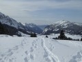
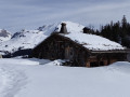
(S/E) Follow the snow-covered road north-eastwards up towards La Culaz (do not head south-west by following the posts marking the signposted snowshoe route). After a few hairpin bends, cut right across the fields to reach the hamlet of La Culaz. In front of the farm, head off towards the south-west to reach the Le Repaire inn (closed in winter). Continue climbing in a south-westerly direction along the path leading to the two old farms, then carry on to the top of the hill to enter some sparse woodland. Cross the woodland along the hillside, maintaining the same direction.
As you emerge from the woods into the Mouilles mountain pasture, continue along the hillside towards the south-south-west to the far end of the pasture, going as far as you can. Enter the woods, keeping a small hill to your left. The track descends gently through the woods. Keep close to the steep hillside on your right until you come to a small, sparsely wooded valley that slopes gently down towards the Chemin des Parchets. This valley is often recognisable by the tracks of other snowshoe walkers who know this secret passage, or of animals that are just as clever.
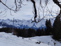
(1) Follow this gully down for 50 metres and, as you emerge from the woods, turn right onto the path towards the large cross, then on to the hamlet of Les Parchets. After the hamlet, walk alongside the forest to the far end of the mountain pasture, keeping the sloping pasture on your left.
(2) At the corner of the field, enter the woods and, before the cliff, turn left (south-east) to head back down into the woods. Continue in this direction until you reach the cross-country ski trail which crosses the mountain pasture on your left, then descends to La Tannaz.
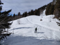
(3) Turn right onto the steeply sloping cross-country ski trail heading west. At the bottom of this, turn left and head due south into a small valley about 30 metres long, which leads you to the hamlet of La Tannaz.
(4) Head due east again and follow the cross-country ski trail for 350 m until you reach a forest track leading down to the right. It is signposted as a mountain bike route.
(5) Head down to the right, heading south-east, along the forest track which winds along a balcony-like path until you reach another track leading up to Sur le Mont.
(6) Turn left as you head northwards and pass behind the alpine chalet (in winter only), then rejoin the track that climbs due north to the pass. It is signposted as a snowshoe route. At the pass, head down to the left and north-east down the steep valley. Cut across the hairpin bends of the footpath. At the Chalet du Bas des Mouilles, follow the ski run north-east to reach the car park where you started (S/E).


 Visorando Member

 Difficult
 Easy
Easy